35,99 €
35,99 €
inkl. MwSt.
Sofort per Download lieferbar
payback
0 °P sammeln
35,99 €
35,99 €
inkl. MwSt.
Sofort per Download lieferbar

Alle Infos zum eBook verschenken
payback
0 °P sammeln
Als Download kaufen
35,99 €
inkl. MwSt.
Sofort per Download lieferbar
payback
0 °P sammeln
Jetzt verschenken
35,99 €
inkl. MwSt.
Sofort per Download lieferbar

Alle Infos zum eBook verschenken
payback
0 °P sammeln
  • Format: ePub

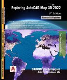
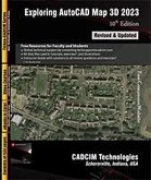
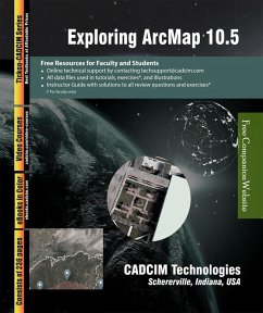
The Exploring ArcMap 10.5 textbook explains the concepts and principles of GIS through practical examples, tutorials, and exercises. The book enables the users to harness the power of GIS with ArcMap for their specific use. In this textbook, the author explains in detail the vector data, raster data, and real world data. In addition, in this textbook, you will learn tools and concepts for creating shapefile, contour, and elevation data. This textbook consists of 7 chapters covering Shapefile Creations, DEM Analysis, Raster Modeling, Vector Modeling, and so on. As you go through this textbook,…mehr

  • Geräte: eReader
  • mit Kopierschutz
  • eBook Hilfe
  • Größe: 11.21MB
  • FamilySharing(5)
Produktbeschreibung
The Exploring ArcMap 10.5 textbook explains the concepts and principles of GIS through practical examples, tutorials, and exercises. The book enables the users to harness the power of GIS with ArcMap for their specific use. In this textbook, the author explains in detail the vector data, raster data, and real world data. In addition, in this textbook, you will learn tools and concepts for creating shapefile, contour, and elevation data. This textbook consists of 7 chapters covering Shapefile Creations, DEM Analysis, Raster Modeling, Vector Modeling, and so on. As you go through this textbook, you will work on tutorials and exercises that can be used to create a complete project. Each concept in this textbook is explained using the detailed description and relevant graphical examples and illustrations. The accompanying tutorials and exercises, which relate to the real world projects, help you understand the usage and abilities of the tools available in ArcMap.


Dieser Download kann aus rechtlichen Gründen nur mit Rechnungsadresse in A, B, CY, CZ, D, DK, EW, E, FIN, F, GR, H, IRL, I, LT, L, LR, M, NL, PL, P, R, S, SLO, SK ausgeliefert werden.

Autorenporträt
Prof. Sham Tickoo is professor of Manufacturing Engineering at Purdue University Northwest, USA where he has taught design, drafting, CAD and other engineering courses for over nineteen years. Before joining Purdue University, Prof. Tickoo has worked as a machinist, quality control engineer, design engineer, engineering consultant, and software developer. He has received a US patent for his invention Self Adjusting Cargo Organizer for Vehicles. Professor Tickoo also leads the team of authors at CADCIM Technologies to develop world-class teaching and learning resources for Computer Aided Design and Manufacturing (CAD/CAM) and related technologies.