113,95 €
113,95 €
inkl. MwSt.
Sofort per Download lieferbar
payback
57 °P sammeln
113,95 €
113,95 €
inkl. MwSt.
Sofort per Download lieferbar

Alle Infos zum eBook verschenken
payback
57 °P sammeln
Als Download kaufen
113,95 €
inkl. MwSt.
Sofort per Download lieferbar
payback
57 °P sammeln
Jetzt verschenken
113,95 €
inkl. MwSt.
Sofort per Download lieferbar

Alle Infos zum eBook verschenken
payback
57 °P sammeln
  • Format: PDF

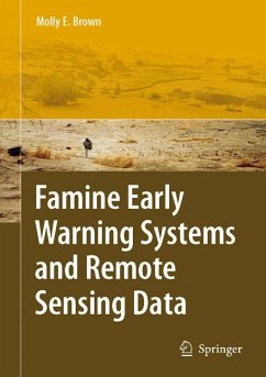
This book describes the interdisciplinary work of USAID's Famine Early Warning System (FEWS NET) and its influence on methodological and development policies in the US. This book describes FEWS NET's systems, methods and presents several illustrative case studies that will demonstrate the integration of both physical and social science disciplines in its work. The aim of this book is to bring the work of USAID's Famine Early warning System Network into the public domain.

  • Geräte: PC
  • ohne Kopierschutz
  • eBook Hilfe
  • Größe: 17.54MB
Produktbeschreibung
This book describes the interdisciplinary work of USAID's Famine Early Warning System (FEWS NET) and its influence on methodological and development policies in the US. This book describes FEWS NET's systems, methods and presents several illustrative case studies that will demonstrate the integration of both physical and social science disciplines in its work. The aim of this book is to bring the work of USAID's Famine Early warning System Network into the public domain.


Dieser Download kann aus rechtlichen Gründen nur mit Rechnungsadresse in A, B, BG, CY, CZ, D, DK, EW, E, FIN, F, GR, HR, H, IRL, I, LT, L, LR, M, NL, PL, P, R, S, SLO, SK ausgeliefert werden.

Autorenporträt
Molly E. Brown received a master's of arts degree in 1998 and a doctor of philosophy in the summer of 2002 from the Department of Geography, University of Maryland at College Park. She has worked with the GIMMS group at NASA's Goddard Space Flight Center since 1997, primarily on developing and using a stable, 25-year, 8km vegetation record from the NOAA-AVHRR series of instruments. Using these satellite data to investigate questions of climate, land use, and human-environmental interaction has been the main focus of her work.