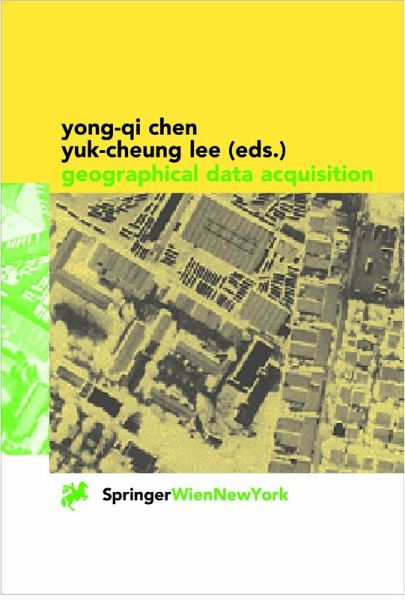
Geographical Data Acquisition (eBook, PDF)
Redaktion: Chen, Yong-Qi; Lee, Yuk-Cheung
73,95 €
73,95 €
inkl. MwSt.
Sofort per Download lieferbar
37 °P sammeln
73,95 €
Als Download kaufen
73,95 €
inkl. MwSt.
Sofort per Download lieferbar
37 °P sammeln
Jetzt verschenken
Alle Infos zum eBook verschenken
73,95 €
inkl. MwSt.
Sofort per Download lieferbar
Alle Infos zum eBook verschenken
37 °P sammeln
Geographical Data Acquisition (eBook, PDF)
Redaktion: Chen, Yong-Qi; Lee, Yuk-Cheung
- Format: PDF
- Merkliste
- Auf die Merkliste
- Bewerten Bewerten
- Teilen
- Produkt teilen
- Produkterinnerung
- Produkterinnerung
Bitte loggen Sie sich zunächst in Ihr Kundenkonto ein oder registrieren Sie sich bei
bücher.de, um das eBook-Abo tolino select nutzen zu können.
Hier können Sie sich einloggen
Sie sind bereits eingeloggt. Klicken Sie auf 2. tolino select Abo, um fortzufahren.
Bitte loggen Sie sich zunächst in Ihr Kundenkonto ein oder registrieren Sie sich bei bücher.de, um das eBook-Abo tolino select nutzen zu können.
This book presents the theory and methodology of geographical data acquisition, providing comprehensive coverage ranging from the definition of geo-referencing systems and transformation between these systems to the acquisition of geographical data using different methods. The material provides readers with a good understanding of the nature of spatial data, the accuracy of spatial data, and the theory behind various data acquisition methodologies.
- Geräte: PC
- ohne Kopierschutz
- eBook Hilfe
- Größe: 25.35MB
Andere Kunden interessierten sich auch für
- Interfacing Geostatstics and GIS (eBook, PDF)113,95 €
- Geospatial Techniques in Urban Hazard and Disaster Analysis (eBook, PDF)113,95 €
- Remote Sensing and GIS Technologies for Monitoring and Prediction of Disasters (eBook, PDF)113,95 €
- Earth Science Satellite Remote Sensing (eBook, PDF)161,95 €
- Landscape Balance and Landscape Assessment (eBook, PDF)113,95 €
- Mario A. GomarascaBasics of Geomatics (eBook, PDF)177,95 €
- Geographic Information and Cartography for Risk and Crisis Management (eBook, PDF)113,95 €
-
-
-
This book presents the theory and methodology of geographical data acquisition, providing comprehensive coverage ranging from the definition of geo-referencing systems and transformation between these systems to the acquisition of geographical data using different methods. The material provides readers with a good understanding of the nature of spatial data, the accuracy of spatial data, and the theory behind various data acquisition methodologies.
Dieser Download kann aus rechtlichen Gründen nur mit Rechnungsadresse in A, B, BG, CY, CZ, D, DK, EW, E, FIN, F, GR, HR, H, IRL, I, LT, L, LR, M, NL, PL, P, R, S, SLO, SK ausgeliefert werden.
Produktdetails
- Produktdetails
- Verlag: Springer Vienna
- Seitenzahl: 265
- Erscheinungstermin: 6. Dezember 2012
- Englisch
- ISBN-13: 9783709161838
- Artikelnr.: 53162228
- Verlag: Springer Vienna
- Seitenzahl: 265
- Erscheinungstermin: 6. Dezember 2012
- Englisch
- ISBN-13: 9783709161838
- Artikelnr.: 53162228
- Herstellerkennzeichnung Die Herstellerinformationen sind derzeit nicht verfügbar.
1 Geographical Data and Its Acquisition.- 1.1 Introduction.- 1.2 The Nature of Geographical Data.- 1.3 Define the Nature and Scope of the Database.- 1.4 Identify the Types of Features.- 1.5 Design the Geographical Database.- 1.6 A Survey of Data Acquisition Methods.- 1.7 Geo-Reference Data.- 1.8 Trends in Spatial Data Acquisition.- 2 Coordinate Systems and Datum.- 2.1 Coordinate Systems.- 2.2 Geoid and Mean Sea Level.- 2.3 Datum.- 2.4 Ellipsoid.- 2.5 Geodetic and Plane Coordinate Systems.- 3 Transformation of Coordinates between Cartesian Systems.- 3.1 Introduction.- 3.2 Basic Concepts of Coordinate Transformations.- 3.3 Models for Coordinate Transformation.- 3.4 Derivation of Transformation Models.- 3.5 Determination of Transformation Parameters.- 4 Map Projections.- 4.1 Introduction.- 4.2 The Shape of the Earth.- 4.3 Map Projections as Mathematical Transformations.- 4.4 Geometric Distortions on Maps.- 4.5 Preserving Some of the Geometric Properties.- 4.6 Minimizing Geometric Distortions for a Project Area.- 4.7 Naming of Map Projections.- 4.8 Rectangular Grid System.- 4.9 The UTM Projection.- 4.10 The UTM Grid.- 4.11 Integrating Maps of Different Projections.- 4.12 Map Projection and Digital Maps.- 4.13 Conclusions.- 5 Geographical Data from Analogue Maps.- 5.1 Introduction.- 5.2 Vector and Raster Models.- 5.3 The Choice between Vector and Raster Models.- 5.4 Vector Digitizing.- 5.5 Raster Scanning.- 5.6 Conclusion.- 6 Ground-Based Positioning Techniques.- 6.1 Introduction.- 6.2 Measurement of Distances and Angles.- 6.3 Measurement of Height.- 6.4 Reduction of Coordinates to Datum.- 6.5 Detail Surveys.- 7 Satellite-Based Positioning.- 7.1 Concept of Satellite Positioning.- 7.2 Absolute and Relative Positioning.- 7.3 Differential GPS (DGPS) Technique.- 7.4 PositioningTechniques for Surveying.- 7.5 Real-Time Kinematic Positioning.- 7.6 Future Developments.- 8 Techniques for Underwater Data Acquisition.- 8.1 Introduction and Overview.- 8.2 Tidal and Other Water Level Changes.- 8.3 Soundings.- 8.4 Survey Preparation and Data Processing.- 8.5 Summary and Outlook on Future Developments.- 9 Image Acquisition.- 9.1 Introduction.- 9.2 Image Types.- 9.3 Imaging Devices.- 9.4 Air Borne Imagery.- 9.5 Space Borne Imagery.- 10 Orthoimage Generation and Measurement from Single Images.- 10.1 Introduction.- 10.2 The Principles for the Generation of Orthoimages.- 10.3 Measurement from Single Image.- 10.4 Procedure for Geo-Referencing Image and Measured Data.- 10.5 Summary.- 11 Geometric Data from Images.- 11.1 Introduction.- 11.2 Stereoscopic Vision.- 11.3 Stereo Photographs.- 11.4 Height from Stereoscopic Parallax.- 11.5 Planimetrie Position from a Stereopair.- 11.6 Analytical Methods.- 11.7 Digital Methodologies.- 12 Thematic Information from Digital Images.- 12.1 Factors to be Considered for Thematic Information Extraction.- 12.2 Feature Identification and Image Interpretation.- 12.3 Image Processing for Thematic Information Extraction.- 12.4 Summary.- Current Trends in Geographical Data Acquisition: An Epilogue.- References.