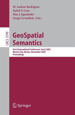
GeoSpatial Semantics (eBook, PDF)
First International Conference, GeoS 2005, Mexico City, Mexico, November 29-30, 2005, Proceedings
Redaktion: Rodriguez, M. Andrea; Levashkin, Sergei; Egenhofer, Max J.; Cruz, Isabel F.
40,95 €
40,95 €
inkl. MwSt.
Sofort per Download lieferbar

20 °P sammeln
40,95 €
Als Download kaufen

40,95 €
inkl. MwSt.
Sofort per Download lieferbar

20 °P sammeln
Jetzt verschenken
Alle Infos zum eBook verschenken
40,95 €
inkl. MwSt.
Sofort per Download lieferbar
Alle Infos zum eBook verschenken

20 °P sammeln
GeoSpatial Semantics (eBook, PDF)
First International Conference, GeoS 2005, Mexico City, Mexico, November 29-30, 2005, Proceedings
Redaktion: Rodriguez, M. Andrea; Levashkin, Sergei; Egenhofer, Max J.; Cruz, Isabel F.
- Format: PDF
- Merkliste
- Auf die Merkliste
- Bewerten Bewerten
- Teilen
- Produkt teilen
- Produkterinnerung
- Produkterinnerung

Bitte loggen Sie sich zunächst in Ihr Kundenkonto ein oder registrieren Sie sich bei
bücher.de, um das eBook-Abo tolino select nutzen zu können.
Hier können Sie sich einloggen
Hier können Sie sich einloggen
Sie sind bereits eingeloggt. Klicken Sie auf 2. tolino select Abo, um fortzufahren.

Bitte loggen Sie sich zunächst in Ihr Kundenkonto ein oder registrieren Sie sich bei bücher.de, um das eBook-Abo tolino select nutzen zu können.
- Geräte: PC
- ohne Kopierschutz
- eBook Hilfe
- Größe: 4.24MB
Andere Kunden interessierten sich auch für
![Geographic Information Science (eBook, PDF) Geographic Information Science (eBook, PDF)]() Geographic Information Science (eBook, PDF)40,95 €
Geographic Information Science (eBook, PDF)40,95 €![Web and Wireless Geographical Information Systems (eBook, PDF) Web and Wireless Geographical Information Systems (eBook, PDF)]() Web and Wireless Geographical Information Systems (eBook, PDF)40,95 €
Web and Wireless Geographical Information Systems (eBook, PDF)40,95 €![Interoperating Geographic Information Systems (eBook, PDF) Interoperating Geographic Information Systems (eBook, PDF)]() Interoperating Geographic Information Systems (eBook, PDF)161,95 €
Interoperating Geographic Information Systems (eBook, PDF)161,95 €![GeoSpatial Semantics (eBook, PDF) GeoSpatial Semantics (eBook, PDF)]() GeoSpatial Semantics (eBook, PDF)40,95 €
GeoSpatial Semantics (eBook, PDF)40,95 €![GeoSpatial Semantics (eBook, PDF) GeoSpatial Semantics (eBook, PDF)]() GeoSpatial Semantics (eBook, PDF)40,95 €
GeoSpatial Semantics (eBook, PDF)40,95 €![Spatial Data on the Web (eBook, PDF) Spatial Data on the Web (eBook, PDF)]() Spatial Data on the Web (eBook, PDF)113,95 €
Spatial Data on the Web (eBook, PDF)113,95 €![Web and Wireless Geographical Information Systems (eBook, PDF) Web and Wireless Geographical Information Systems (eBook, PDF)]() Web and Wireless Geographical Information Systems (eBook, PDF)40,95 €
Web and Wireless Geographical Information Systems (eBook, PDF)40,95 €-
-
-
Produktdetails
- Verlag: Springer Berlin Heidelberg
- Seitenzahl: 260
- Erscheinungstermin: 3. November 2005
- Englisch
- ISBN-13: 9783540322832
- Artikelnr.: 44132747
Dieser Download kann aus rechtlichen Gründen nur mit Rechnungsadresse in A, B, BG, CY, CZ, D, DK, EW, E, FIN, F, GR, HR, H, IRL, I, LT, L, LR, M, NL, PL, P, R, S, SLO, SK ausgeliefert werden.
- Herstellerkennzeichnung Die Herstellerinformationen sind derzeit nicht verfügbar.
M. Andrea Rodriguez, University of Concepción, Chile / Isabel F. Cruz, University of Illinois, Chicago, IL, USA / Max J. Egenhofer, University of Maine, Orono, ME, USA / Sergei Levashkin, Centro de Investigacion en Computacion, Mexico City, Mexico
Theories for the Semantics of Geospatial Information.- Comparing Representations of Geographic Knowledge Expressed as Conceptual Graphs.- Ontology Ontogeny: Understanding How an Ontology Is Created and Developed.- Representing the Meaning of Spatial Behavior by Spatially Grounded Intentional Systems.- Formal Representations for Geospatial Data.- Processes and Events in Dynamic Geo-Networks.- A Qualitative Trajectory Calculus and the Composition of Its Relations.- Modeling Noteworthy Events in a Geospatial Domain.- Similarity Comparison of Spatial Data Sets.- Measuring Semantic Similarity Between Geospatial Conceptual Regions.- Using Semantic Similarity Metrics to Uncover Category and Land Cover Change.- Measuring Arrangement Similarity Between Thematic Raster Databases Using a QuadTree-Based Approach.- Ontology-Based Spatial Information Retrieval.- Extending Semantic Similarity Measurement with Thematic Roles.- Exploiting Geospatial Markers to Explore and Resocialize Localized Documents.- Ontology Matching for Spatial Data Retrieval from Internet Portals.- Geospatial Semantic Web.- Geospatial Semantic Web: Architecture of Ontologies.- Formal Approach to Reconciliation of Individual Ontologies for Personalisation of Geospatial Semantic Web.- Incorporating Update Semantics Within Geographical Ontologies.- Short Papers.- Purpose-Driven Navigation.- Mobile GIS: Attribute Data Presentation Under Time and Space Constraints.- Ontology-Driven Description of Spatial Data for Their Semantic Processing.- An Interstage Change Model for Sandbox Geography.
Theories for the Semantics of Geospatial Information.- Comparing Representations of Geographic Knowledge Expressed as Conceptual Graphs.- Ontology Ontogeny: Understanding How an Ontology Is Created and Developed.- Representing the Meaning of Spatial Behavior by Spatially Grounded Intentional Systems.- Formal Representations for Geospatial Data.- Processes and Events in Dynamic Geo-Networks.- A Qualitative Trajectory Calculus and the Composition of Its Relations.- Modeling Noteworthy Events in a Geospatial Domain.- Similarity Comparison of Spatial Data Sets.- Measuring Semantic Similarity Between Geospatial Conceptual Regions.- Using Semantic Similarity Metrics to Uncover Category and Land Cover Change.- Measuring Arrangement Similarity Between Thematic Raster Databases Using a QuadTree-Based Approach.- Ontology-Based Spatial Information Retrieval.- Extending Semantic Similarity Measurement with Thematic Roles.- Exploiting Geospatial Markers to Explore and Resocialize Localized Documents.- Ontology Matching for Spatial Data Retrieval from Internet Portals.- Geospatial Semantic Web.- Geospatial Semantic Web: Architecture of Ontologies.- Formal Approach to Reconciliation of Individual Ontologies for Personalisation of Geospatial Semantic Web.- Incorporating Update Semantics Within Geographical Ontologies.- Short Papers.- Purpose-Driven Navigation.- Mobile GIS: Attribute Data Presentation Under Time and Space Constraints.- Ontology-Driven Description of Spatial Data for Their Semantic Processing.- An Interstage Change Model for Sandbox Geography.
