50,95 €
50,95 €
inkl. MwSt.
Sofort per Download lieferbar
payback
25 °P sammeln
50,95 €
50,95 €
inkl. MwSt.
Sofort per Download lieferbar

Alle Infos zum eBook verschenken
payback
25 °P sammeln
Als Download kaufen
50,95 €
inkl. MwSt.
Sofort per Download lieferbar
payback
25 °P sammeln
Jetzt verschenken
50,95 €
inkl. MwSt.
Sofort per Download lieferbar

Alle Infos zum eBook verschenken
payback
25 °P sammeln
  • Format: PDF

Land degradation is caused by multiple forces, including extreme weather conditions particularly drought, and human activities that pollute or degrade the quality of soils and land utility negatively affecting food production, livelihoods, and the production and provision of other ecosystem goods and services. This book introduces the basic concepts of GIS and remote sensing and explores the basic aspects of land degradation. It covers mostly the physical and physic-chemical processes of soil loss. It combines different methods and approaches for land degradation monitoring and assessment and…mehr

Produktbeschreibung
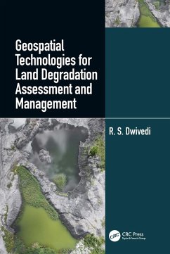
Land degradation is caused by multiple forces, including extreme weather conditions particularly drought, and human activities that pollute or degrade the quality of soils and land utility negatively affecting food production, livelihoods, and the production and provision of other ecosystem goods and services. This book introduces the basic concepts of GIS and remote sensing and explores the basic aspects of land degradation. It covers mostly the physical and physic-chemical processes of soil loss. It combines different methods and approaches for land degradation monitoring and assessment and help readers understand and design sustainable land management strategies.


Dieser Download kann aus rechtlichen Gründen nur mit Rechnungsadresse in A, B, BG, CY, CZ, D, DK, EW, E, FIN, F, GR, HR, H, IRL, I, LT, L, LR, M, NL, PL, P, R, S, SLO, SK ausgeliefert werden.

Autorenporträt
Dr Ravi Shankar Dwivedi is a consultant and guest faculty at Jawaharlal Nehru Technological University Hyderabad, India. He is an expert Land resources management: Soil resources inventory, mapping and monitoring land degradation/ desertification, wastelands and land use/ land cover using a variety of remote sensing data. He has a long experience also in Watershed management- Generation of inputs especially soil resources, land capability and land irrigability maps, surface water bodies maps and drainage maps ; integration of these maps with hydrogeoplogical maps and development of action plan, monitoring and impact assessment using multi-temporal satellite and ancillary data.He holds Awards from Indian Society of Remote Sensing for outstanding contribution in the field of remote sensing and Doreen Mashler Team Award for outstanding contribution to integrated watershed management for sustainable development (as a member of ICRISAT team).