Sie sind bereits eingeloggt. Klicken Sie auf 2. tolino select Abo, um fortzufahren.
Bitte loggen Sie sich zunächst in Ihr Kundenkonto ein oder registrieren Sie sich bei bücher.de, um das eBook-Abo tolino select nutzen zu können.
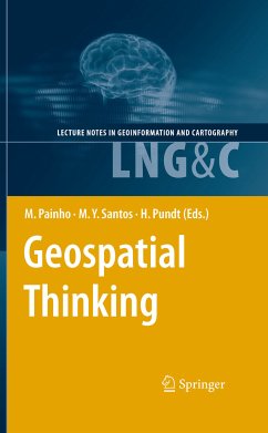
For the fourth consecutive year, the Association of Geographic Infor- tion Laboratories for Europe (AGILE) promoted the edition of a book with the collection of the scientific papers that were submitted as full-papers to the AGILE annual international conference. Those papers went through a th competitive review process. The 13 AGILE conference call for fu- papers of original and unpublished fundamental scientific research resulted in 54 submissions, of which 21 were accepted for publication in this - lume (acceptance rate of 39%). Published in the Springer Lecture Notes in Geoinformation and…mehr
For the fourth consecutive year, the Association of Geographic Infor- tion Laboratories for Europe (AGILE) promoted the edition of a book with the collection of the scientific papers that were submitted as full-papers to the AGILE annual international conference. Those papers went through a th competitive review process. The 13 AGILE conference call for fu- papers of original and unpublished fundamental scientific research resulted in 54 submissions, of which 21 were accepted for publication in this - lume (acceptance rate of 39%). Published in the Springer Lecture Notes in Geoinformation and Car- th graphy, this book is associated to the 13 AGILE Conference on G- graphic Information Science, held in 2010 in Guimarães, Portugal, under the title “Geospatial Thinking”. The efficient use of geospatial information and related technologies assumes the knowledge of concepts that are fundamental components of Geospatial Thinking, which is built on reasoning processes, spatial conc- tualizations, and representation methods. Geospatial Thinking is associated with a set of cognitive skills consisting of several forms of knowledge and cognitive operators used to transform, combine or, in any other way, act on that same knowledge. The scientific papers published in this volume cover an important set of topics within Geoinformation Science, including: Representation and Visualisation of Geographic Phenomena; Spatiotemporal Data Analysis; Geo-Collaboration, Participation, and Decision Support; Semantics of Geoinformation and Knowledge Discovery; Spatiotemporal Modelling and Reasoning; and Web Services, Geospatial Systems and Real-time Appli- tions.
Hardy Pundt, geboren 1964, stammt von der Insel Memmert und verbrachte Kindheit und Jugend in Ostfriesland. Nach über 20 Jahren in Westfalen lebt er heute mit seiner Familie in Schleswig-Holstein. Er ist Hochschuldozent und kann auf zahlreiche wissenschaftliche Veröffentlichungen zurückblicken.
Inhaltsangabe
Intersection of Nonconvex Polygons Using the Alternate Hierarchical Decomposition.- Visual Analytics of Urban Environments using High-Resolution Geographic Data.- A Visual Query Language for Spatial Data Warehouses.- The Impact of Data Quality in the Context of Pedestrian Movement Analysis.- Visit Potential: A Common Vocabulary for the Analysis of Entity-Location Interactions in Mobility Applications.- Pre-School Facilities and Catchment Area Profiling: a Planning Support Method.- A Geo-business Classification for London.- Suggestive Geo-Tagging Assistance for Geo-Collaboration Tools.- A Novel Approach to Mining Travel Sequences Using Collections of Geotagged Photos.- Exposing CSW Catalogues as Linked Data.- Applying Semantic Linkage in the Geospatial Web.- A Machine Learning Approach for Resolving Place References in Text.- Towards a Spatial Semantics to Analyze the Visual Dynamics of the Pedestrian Mobility in the Urban Fabric.- Managing Collapsed Surfaces in Spatial Constraints Validation.- A Spatio-Temporal Model Towards Ad-Hoc Collaborative Decision-Making.- iNav: An Indoor Navigation Model Supporting Length-Dependent Optimal Routing.- MIMEXT: a KML Extension for Georeferencing and Easy Share MIME Type Resources.- Schema Mapping in INSPIRE - Extensible Components for Translating Geospatial Data.- Automated Image-Based Abstraction of Aerial Images.- Geospatial Annotations for 3D Environments and their WFS-based Implementation.- Towards Spatial Data Infrastructures in the Clouds.
Es gelten unsere Allgemeinen Geschäftsbedingungen: www.buecher.de/agb
Impressum
www.buecher.de ist ein Shop der buecher.de GmbH & Co. KG i.I. Bürgermeister-Wegele-Str. 12, 86167 Augsburg Amtsgericht Augsburg HRA 13309