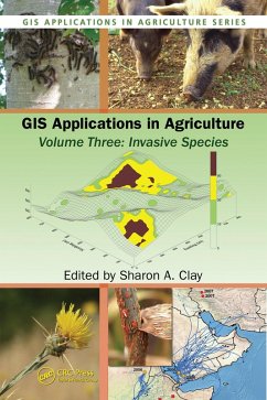
GIS Applications in Agriculture, Volume Three (eBook, PDF)
Invasive Species
Redaktion: Clay, Sharon A.
66,95 €
66,95 €
inkl. MwSt.
Sofort per Download lieferbar

33 °P sammeln
66,95 €
Als Download kaufen

66,95 €
inkl. MwSt.
Sofort per Download lieferbar

33 °P sammeln
Jetzt verschenken
Alle Infos zum eBook verschenken
66,95 €
inkl. MwSt.
Sofort per Download lieferbar
Alle Infos zum eBook verschenken

33 °P sammeln
GIS Applications in Agriculture, Volume Three (eBook, PDF)
Invasive Species
Redaktion: Clay, Sharon A.
- Format: PDF
- Merkliste
- Auf die Merkliste
- Bewerten Bewerten
- Teilen
- Produkt teilen
- Produkterinnerung
- Produkterinnerung

Bitte loggen Sie sich zunächst in Ihr Kundenkonto ein oder registrieren Sie sich bei
bücher.de, um das eBook-Abo tolino select nutzen zu können.
Hier können Sie sich einloggen
Hier können Sie sich einloggen
Sie sind bereits eingeloggt. Klicken Sie auf 2. tolino select Abo, um fortzufahren.

Bitte loggen Sie sich zunächst in Ihr Kundenkonto ein oder registrieren Sie sich bei bücher.de, um das eBook-Abo tolino select nutzen zu können.
This volume focuses on GIS applications in the fight against invasive species, including weeds, insects, disease, and microbes. It offers practical applications for mapping and managing invasives and presents research on GIS applications in monitoring, tracking, modeling, forecasting, and managing, as well as assessing for economic and environme
- Geräte: PC
- mit Kopierschutz
- eBook Hilfe
- Größe: 11.56MB
Andere Kunden interessierten sich auch für
![GIS Applications in Agriculture, Volume Two (eBook, PDF) GIS Applications in Agriculture, Volume Two (eBook, PDF)]() GIS Applications in Agriculture, Volume Two (eBook, PDF)189,95 €
GIS Applications in Agriculture, Volume Two (eBook, PDF)189,95 €![GIS Applications in Agriculture, Volume Four (eBook, PDF) GIS Applications in Agriculture, Volume Four (eBook, PDF)]() GIS Applications in Agriculture, Volume Four (eBook, PDF)48,95 €
GIS Applications in Agriculture, Volume Four (eBook, PDF)48,95 €![Food Security, Food Prices and Climate Variability (eBook, PDF) Food Security, Food Prices and Climate Variability (eBook, PDF)]() Molly BrownFood Security, Food Prices and Climate Variability (eBook, PDF)52,95 €
Molly BrownFood Security, Food Prices and Climate Variability (eBook, PDF)52,95 €![GIS for Water Resource and Watershed Management (eBook, PDF) GIS for Water Resource and Watershed Management (eBook, PDF)]() GIS for Water Resource and Watershed Management (eBook, PDF)55,95 €
GIS for Water Resource and Watershed Management (eBook, PDF)55,95 €![GIS Applications in Agriculture (eBook, PDF) GIS Applications in Agriculture (eBook, PDF)]() GIS Applications in Agriculture (eBook, PDF)183,95 €
GIS Applications in Agriculture (eBook, PDF)183,95 €![Biotechnology, Agriculture, Environment and Energy (eBook, PDF) Biotechnology, Agriculture, Environment and Energy (eBook, PDF)]() Biotechnology, Agriculture, Environment and Energy (eBook, PDF)251,95 €
Biotechnology, Agriculture, Environment and Energy (eBook, PDF)251,95 €![Drones and Geographical Information Technologies in Agroecology and Organic Farming (eBook, PDF) Drones and Geographical Information Technologies in Agroecology and Organic Farming (eBook, PDF)]() Drones and Geographical Information Technologies in Agroecology and Organic Farming (eBook, PDF)0,00 €
Drones and Geographical Information Technologies in Agroecology and Organic Farming (eBook, PDF)0,00 €-
-
-
This volume focuses on GIS applications in the fight against invasive species, including weeds, insects, disease, and microbes. It offers practical applications for mapping and managing invasives and presents research on GIS applications in monitoring, tracking, modeling, forecasting, and managing, as well as assessing for economic and environme
Dieser Download kann aus rechtlichen Gründen nur mit Rechnungsadresse in A, B, BG, CY, CZ, D, DK, EW, E, FIN, F, GR, HR, H, IRL, I, LT, L, LR, M, NL, PL, P, R, S, SLO, SK ausgeliefert werden.
Produktdetails
- Produktdetails
- Verlag: Taylor & Francis eBooks
- Seitenzahl: 448
- Erscheinungstermin: 16. Februar 2011
- Englisch
- ISBN-13: 9781420078817
- Artikelnr.: 38289096
- Verlag: Taylor & Francis eBooks
- Seitenzahl: 448
- Erscheinungstermin: 16. Februar 2011
- Englisch
- ISBN-13: 9781420078817
- Artikelnr.: 38289096
- Herstellerkennzeichnung Die Herstellerinformationen sind derzeit nicht verfügbar.
The Editor: Sharon A. Clay, PhD., is a professor of weed science at South Dakota State University where she has research and teaching responsibilities. She received a B.S. degree in Horticulture from the University of Wisconsin-Madison in 1977, an M.S. degree in Plant Science from the University of Idaho in 1983 examining barley variety sensitivity to various herbicides, and a Ph.D. in Agronomy from the University of Minnesota in 1987 where she examined weed management in wild rice production systems of northern Minnesota. She has conducted weed management studies in range and cropping systems that include corn, soybean, wheat, barley, wild rice, flax, and sunflower, as well as studies in weed physiology and site specific weed management strategies. Dr. Clay has published over 100 scientific articles and has served on the editorial boards for Agronomy Journal, Weed Science, and Site-Specific Management Guidelines. Dr. Clay has served on numerous national committees and review panels and has active memberships in, and has served as president of the SD Chapters of the honorary societies Sigma Xi and Gamma Sigma Delta. She served as the chairperson of the Agricultural Systems division in the American Society of Agronomy, participated in numerous ASA committees, was elected to ASA Fellow in 2009, and has held several positions in the Weed Science Society of America.
Introduction: Remote Sensing and GIS Techniques for the Detection,
Surveillance, and Management of Invasive Species. Obtaining Spatial Data.
Population Ecology Considerations for Monitoring and Managing Biological
Invasions. Integrating GPS, GIS, and Remote Sensing Technologies with
Disease Management Principles to Improve Plant Health. Mapping Actual and
Predicted Distribution of Pest Animals and Weeds in Australia. Use of GIS
Applications to Combat the Threat of Emerging Virulent Wheat Stem Rust
Races. An Online Aerobiology Process Model. Site Specific Management of
Green Peach Aphid, Myzus persicae (Sulzer). Analysis of the 2002 Equine
West Nile Virus Outbreak in South Dakota Using GIS and Spatial Statistics.
Designing a Local-scale Microsimulation of Lesser Grain Borer Population
Dynamics and Movements. Geographic Information Systems in Corn Rootworm
Management,. Improving Surveillance for Invasive Plants: A GIS Toolbox for
Surveillance Decision Support. Tracking Invasive Weed Species in Rangeland
Using Probability Functions to Identify Site Specific Boundaries: A Case
Study Using Yellow Starthistle (Centaurea solstitialis L.). Using GIS to
Map and Manage Weeds in Field Crops. Adapting Geostatistics to Analyze
Spatial and Temporal Trends in Weed Populations. Using GIS to Investigate
Weed Shifts After Two Cycles of a Corn/Soybean Rotation. Creating and Using
Weed Maps for Site-Specific Management.
