Google Earth For Dummies (eBook, PDF)
Alle Infos zum eBook verschenken
Google Earth For Dummies (eBook, PDF)
- Format: PDF
- Merkliste
- Auf die Merkliste
- Bewerten Bewerten
- Teilen
- Produkt teilen
- Produkterinnerung
- Produkterinnerung
Hier können Sie sich einloggen
Bitte loggen Sie sich zunächst in Ihr Kundenkonto ein oder registrieren Sie sich bei bücher.de, um das eBook-Abo tolino select nutzen zu können.
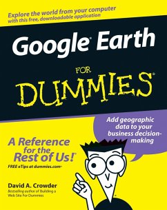
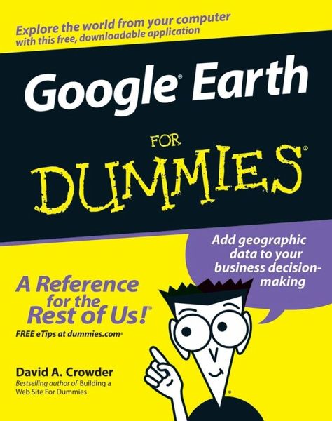
Explore the world from your computer! * This interesting guide covers all aspects of Google Earth, the freely downloadable application from Google that allows users to view satellite images from all points of the globe * Aimed at a diverse audience, including casual users who enjoy air shots of locales as well as geographers, real estate professionals, and GPS developers * Includes valuable tips on various customizations that users can add, advice on setting up scavenger hunts, and guidance on using Google Earth to benefit a business * Explains modifying general options, managing the layer and…mehr
- Geräte: PC
- mit Kopierschutz
- eBook Hilfe
- Größe: 38.97MB
- David A. CrowderGoogle Earth For Dummies (eBook, ePUB)23,99 €
- Ron Hale-EvansMindhacker (eBook, PDF)16,99 €
- Walter J. GoralskiJUNOS OS For Dummies (eBook, PDF)20,99 €
- Woody LeonhardGreen Home Computing For Dummies (eBook, PDF)18,99 €
- Ted CoombsGoogle Power Tools Bible (eBook, PDF)27,30 €
- Kim GilmourSpotify For Dummies (eBook, PDF)15,99 €
- Bart R. McDonoughCyber Smart (eBook, PDF)12,99 €
-
-
-
Dieser Download kann aus rechtlichen Gründen nur mit Rechnungsadresse in A, B, BG, CY, CZ, D, DK, EW, E, FIN, F, GR, HR, H, IRL, I, LT, L, LR, M, NL, PL, P, R, S, SLO, SK ausgeliefert werden.
- Produktdetails
- Verlag: John Wiley & Sons
- Seitenzahl: 368
- Erscheinungstermin: 5. Juli 2007
- Englisch
- ISBN-13: 9780470126981
- Artikelnr.: 37290953
- Verlag: John Wiley & Sons
- Seitenzahl: 368
- Erscheinungstermin: 5. Juli 2007
- Englisch
- ISBN-13: 9780470126981
- Artikelnr.: 37290953
- Herstellerkennzeichnung Die Herstellerinformationen sind derzeit nicht verfügbar.
About This Book 1
How to Use This Book 2
Foolish Assumptions 2
Conventions Used in This Book 2
How This Book Is Organized 3
Part I: Getting to Know Google Earth 4
Part II: Personalizing Google Earth 4
Part III: Becoming a Cybertourist 4
Part IV: Advanced Features 4
Part V: The Part of Tens 4
Part VI: Appendixes 5
Icons Used in This Book 5
Where to Go from Here 5
Part I: Getting to Know Google Earth 7
Chapter 1: The Earth According to Google 9
The View from Google Earth 9
Exploring the Earth Online 11
Google Earth Gives You Options 13
Starting with what's free 14
Looking at Plus and Pro versions 15
So What Can I Really Do with Google Earth? 16
Plenty of personal uses 16
And businesses might want to 17
Joining the Google Earth Community 18
Getting Geekier with GPS, KML, and Overlays 19
Downloading the Program 20
A Note for Mac and Linux Users 22
Chapter 2: Finding Businesses, Places, and Things 23
Flying Down to Rio (Or Anywhere Else) 24
Right on the dot: Understanding latitude and longitude 25
Deciphering geocoding 28
Searching for a Tailor in Tulsa: The Find Businesses Tab 30
Getting Directions 31
Going Global: The Overview Map 32
Surfing with the Integrated Web Browser 35
Chapter 3: Adjusting Your View on the World 39
Rock the World: Dragging and Zooming the Map 39
Gaining a New Perspective: The Direction and Tilt Controls 41
Three-dimensional viewing 43
The compass and status bar 44
The Bigger They Are: Figuring Sizes with the Scale and Ruler 45
Using the Scale Legend 45
Using the Ruler 45
Part II: Personalizing Google Earth 49
Chapter 4: Fine-Tuning the Program 51
Relieve the Pane: Manipulating Screen Areas 51
Setting the Options 56
The 3D View tab 56
The Cache tab 60
The Touring tab 61
The Navigation tab 62
The General tab 63
Chapter 5: Adding Layers and Points of Interest (POIs) 65
Peeling the Onion: A Guide to Layers 65
Built-in points of interest 66
Displaying Layers 68
From School Districts to Earthquakes: Types of Layers 70
The Google Earth Community layer 70
Featured Content 74
Location layers 76
Boundary layers 76
Geographic/geological layers 78
Transportation layers 80
Picking a good place to live 81
Chapter 6: Pinning Down Placemarks 85
Exploring the Built-in Sightseeing Placemarks 86
X Marks the Spot: Creating and Naming Placemarks 88
Editing Placemarks 90
Customizing styles and colors 91
Changing the placemark icon 93
Adjusting the view 96
Setting the altitude 97
Organizing Placemarks 99
Saving files 100
Sorting - by hand! 102
Part III: Becoming a Cybertourist 103
Chapter 7: Going on Tour 105
Real Roads: Getting Route Info 105
Animating placemarks and routes 108
Touring a path 109
Working the Touring Tab 110
Fly-To/Tour settings 110
Driving Directions Tour options 112
Making Custom Tours 113
Planning your tours 113
Constructing the tour 114
Chapter 8: Mingling with the Community 117
Using the Keyhole Forums 117
Joining the Google Earth Community 119
Signing on to the forums 121
Browsing the forums 122
Searching the forums 125
Getting Help 127
Exploring Outside 129
Chapter 9: Importing Data and Images 131
Adding Custom Data to Google Earth 131
Using image overlays 132
Transparency 135
Positioning, rotating, and scaling 136
Precision location 138
Importing from GPS Devices 140
Chapter 10: KML: It's Sorta Like HTML 145
Creating and Saving KML Files 145
Mastering the Syntax 147
Tags and elements 147
Attributes 148
Containers 148
The root element 149
Comments 149
The Most Useful KML Tags 150
Placemarks 150
The Snippet element 158
Altitude and altitudeMode 161
The address element 162
Working with Styles 163
The Style element 164
The styleUrl element 164
LabelStyle 165
IconStyle 169
Radio buttons and check boxes (listStyle) 170
Part IV: Advanced Features 177
Chapter 11: Designing with Google SketchUp 179
The Google SketchUp Interface 181
Touring the toolbars 181
Chapter 12: Designing with Google SketchUp, Part 2 195
Creating a 3-D Model 196
Creating a yard and a house 196
Adding the deck, porch, and patio 199
Adding a swimming pool 204
Allowing entry and light: Adding doors and windows 206
Driveway 211
Stepping stones 212
Moving Your Creation to Google Earth 215
The Google SketchUp Community 217
Chapter 13: Creating Polygons and Other Complex Structures 221
Joining Shapes 222
Designing with the Offset Tool 225
Creating Polygons 228
Making a simple polygon 230
Making an arrowhead 231
Chapter 14: Digging Deeper with Google SketchUp 237
Slicing and Extruding a Stairway 238
Understanding Lines and Faces 241
The Follow Me Tool 245
Lathing a Polygon 248
Setting Leader Text 251
Understanding the Tape Measure and Dimension Tools 253
Part V: The Part of Tens 257
Chapter 15: Ten Great Places to Get Coordinates 259
Aliensview Sightseeing 259
Lat-Long.com 262
fallingrain.com 265
NASA WorldWind 266
World Gazetteer 267
How Far Is It? 269
Heavens Above 270
U.S Gazetteer 271
USGS Geographic Names Information System 272
Maps of World 273
Chapter 16: Ten Reliable Sources for Data Files 275
WebGIS 275
USGS Geographic Data Download 277
DIVA-GIS 278
Clary-Meuser Research Network 279
GIS Data Depot 281
Free GIS Data by Region 282
FreeGIS.org 283
Global Elevation Data 284
NGDC 285
National Atlas Raw Data Download 286
Chapter 17: Ten Cool Tools 289
IrfanView 289
Arc2Earth 290
Juice Analytics Census Files 291
Juice Analytics Geocoding Tool 292
MyFsGoogleEarth - Link Google Earth with Flight Simulator (FS2004, FS9) 293
KML2X3D - Google Earth to Web 3D Converter 294
EarthPlot and EarthPaint 295
Google Earth Hacks Image Overlays 296
GPS Utility 297
GE-Path and GE-Graph 297
Part VI: Appendixes 299
Appendix A: Glossary 301
Appendix B: Default Content of the All Layers Pane 309
Appendix C: Latitudes and Longitudes of Major Landmarks 319
Current Events 319
Historical Conflicts 321
Monuments, Statues, and Historical Addresses 322
Items of Geographic Importance 324
Religious Sites 325
Major Cities 326
Engineering and Architectural Achievements 328
Index 331