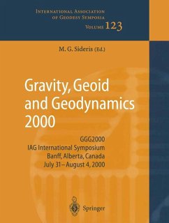
Gravity, Geoid and Geodynamics 2000 (eBook, PDF)
GGG2000 IAG International Symposium Banff, Alberta, Canada July 31 - August 4, 2000
Redaktion: Sideris, Michael G.
161,95 €
161,95 €
inkl. MwSt.
Sofort per Download lieferbar

81 °P sammeln
161,95 €
Als Download kaufen

161,95 €
inkl. MwSt.
Sofort per Download lieferbar

81 °P sammeln
Jetzt verschenken
Alle Infos zum eBook verschenken
161,95 €
inkl. MwSt.
Sofort per Download lieferbar
Alle Infos zum eBook verschenken

81 °P sammeln
Gravity, Geoid and Geodynamics 2000 (eBook, PDF)
GGG2000 IAG International Symposium Banff, Alberta, Canada July 31 - August 4, 2000
Redaktion: Sideris, Michael G.
- Format: PDF
- Merkliste
- Auf die Merkliste
- Bewerten Bewerten
- Teilen
- Produkt teilen
- Produkterinnerung
- Produkterinnerung

Bitte loggen Sie sich zunächst in Ihr Kundenkonto ein oder registrieren Sie sich bei
bücher.de, um das eBook-Abo tolino select nutzen zu können.
Hier können Sie sich einloggen
Hier können Sie sich einloggen
Sie sind bereits eingeloggt. Klicken Sie auf 2. tolino select Abo, um fortzufahren.

Bitte loggen Sie sich zunächst in Ihr Kundenkonto ein oder registrieren Sie sich bei bücher.de, um das eBook-Abo tolino select nutzen zu können.
- Geräte: PC
- ohne Kopierschutz
- eBook Hilfe
- Größe: 56.95MB
Andere Kunden interessierten sich auch für
![Global Gravity Field and Its Temporal Variations (eBook, PDF) Global Gravity Field and Its Temporal Variations (eBook, PDF)]() Global Gravity Field and Its Temporal Variations (eBook, PDF)73,95 €
Global Gravity Field and Its Temporal Variations (eBook, PDF)73,95 €![Geodesy and Physics of the Earth (eBook, PDF) Geodesy and Physics of the Earth (eBook, PDF)]() Geodesy and Physics of the Earth (eBook, PDF)73,95 €
Geodesy and Physics of the Earth (eBook, PDF)73,95 €![Recent Geodetic and Gravimetric Research in Latin America (eBook, PDF) Recent Geodetic and Gravimetric Research in Latin America (eBook, PDF)]() Recent Geodetic and Gravimetric Research in Latin America (eBook, PDF)73,95 €
Recent Geodetic and Gravimetric Research in Latin America (eBook, PDF)73,95 €![Vistas for Geodesy in the New Millennium (eBook, PDF) Vistas for Geodesy in the New Millennium (eBook, PDF)]() Vistas for Geodesy in the New Millennium (eBook, PDF)233,95 €
Vistas for Geodesy in the New Millennium (eBook, PDF)233,95 €![IV Hotine-Marussi Symposium on Mathematical Geodesy (eBook, PDF) IV Hotine-Marussi Symposium on Mathematical Geodesy (eBook, PDF)]() IV Hotine-Marussi Symposium on Mathematical Geodesy (eBook, PDF)161,95 €
IV Hotine-Marussi Symposium on Mathematical Geodesy (eBook, PDF)161,95 €![V Hotine-Marussi Symposium on Mathematical Geodesy (eBook, PDF) V Hotine-Marussi Symposium on Mathematical Geodesy (eBook, PDF)]() V Hotine-Marussi Symposium on Mathematical Geodesy (eBook, PDF)161,95 €
V Hotine-Marussi Symposium on Mathematical Geodesy (eBook, PDF)161,95 €![GPS Trends in Precise Terrestrial, Airborne, and Spaceborne Applications (eBook, PDF) GPS Trends in Precise Terrestrial, Airborne, and Spaceborne Applications (eBook, PDF)]() GPS Trends in Precise Terrestrial, Airborne, and Spaceborne Applications (eBook, PDF)73,95 €
GPS Trends in Precise Terrestrial, Airborne, and Spaceborne Applications (eBook, PDF)73,95 €-
-
-
Produktdetails
- Verlag: Springer Berlin Heidelberg
- Seitenzahl: 398
- Erscheinungstermin: 29. Juni 2013
- Englisch
- ISBN-13: 9783662048276
- Artikelnr.: 53396174
Dieser Download kann aus rechtlichen Gründen nur mit Rechnungsadresse in A, B, BG, CY, CZ, D, DK, EW, E, FIN, F, GR, HR, H, IRL, I, LT, L, LR, M, NL, PL, P, R, S, SLO, SK ausgeliefert werden.
- Herstellerkennzeichnung Die Herstellerinformationen sind derzeit nicht verfügbar.
Time Variable Gravity: An Emerging Frontier in Interdisciplinary Geodesy.- Earth Physics and Global Glacial Isostasy: from Paleo-Geodesy to Space-Geodesy.- Global Unification of Height Systems and GOCE.- A Discussion of Fundamental Constants in View of Geodetic Reference Systems.- A Study of the Transfer of the ITRF Datum to a GPS Network in Antarctica.- Establishing Global Reference Frames. Nonlinear, Temporal, Geophysical and Stochastic Aspects.- Aliasing Error Modeling in Single-Input Single-Output Linear Estimation Systems.- Integrating Heterogeneous Data Sets with Partial Inconsistences.- Optimization of Computations in Spherical Geopotential Field Applications.- TcLight: a New Technique for Fast RTC Computation.- A Fast, Spatial Domain Technique for Terrain Corrections in Gravity Field Modeling.- Some Considerations on Fuzzy Least-Squares.- A Wavelet Solution to 1D Non-Stationary Collocation With an Extension to 2D Case.- A Wavelet Based Gravity Model with an Application to the Evaluation of Stokes' Integral.- Satellite Gravity Anomaly Recovery Using Multigrid Methods.- Inverting Land Uplift near Vatnajökull, Iceland, in Terms of Lithosphere Thickness and Viscosity Stratification.- Error Analysis of the Gravity Recovery and Climate Experiment (GRACE) Mission.- GOCE Gravity Field Recovery Using Massive Parallel Computing.- Regularization for the Gravity Field Recovery from GOCE Observations.- Local Geoid Determination with in situ Geopotential Data Obtained from Satellite-to-Satellite Tracking.- Energy Relations for the Motion of two Satellites within the Gravity Field of the Earth.- Dynamic Satellite Geodesy on the Torus: Block-Diagonality from a Semi-Analytical Approach.- Evaluation of Temporal Variations on the Gravity Field Caused by Geophysical Fluids andTheir Possible Detection by GRACE.- GRIM5-C1: Combination Solution of the Global Gravity Field to Degree and Order 120.- High Resolution Gravity Field Modeling with Full Variance-Covariance Matrices.- Gravity, Oceanic Angular Momentum, and the Earth's Rotation.- Ocean Tide Effects on Grace Gravimetry.- Principal Component Analysis on Temporal-Spatial Variations of Sea Level Anomalies from T/P Satellite Altimetry Data over the Northwest Pacific.- Application of GPS-Buoy Water Level Instrument for Radar Altimeter Calibration.- Methodological Investigation of the Processing of Absolute Gravity Data.- Determination of Atmospheric Influence on High-Accuracy Gravity Measurements with Elastic Earth Models.- Postglacial Rebound in Fennoscandia: New Results from Estonian Tide Gauges.- Time Stability of Gravity at Different Sites in France.- The Gravitational Signature of Earthquakes.- Experiences with AIRGrav: Results from a New Airborne Gravimeter.- STAR-3i Airborne Gravity and Geoid Mapping System.- Towards a Dynamic Absolute Gravity System.- Impact of BRAGS'99 Airborne Gravimetric Data on Geoid Computation in Australia, and Possibilities of Utilization of Bathymetric Information.- Airborne Gravity Survey of the North Greenland Continental Shelf.- Accuracy and Resolution of the Local Geoid Determined from Airborne Gravity Data.- Great Barrier Reef Airborne Gravity Survey (BRAGS'99). A Gravity Survey Piggybacked on an Airborne Bathymetry Mission.- Gravity Anomalies from Airborne Measurements-Experiments Using a Low Cost IMU Device.- Mean Vertical Gradient of Gravity.- Absolute Accounting for Vertical Gravity Gradient in Absolute Gravimeters.- The 1-cm geoid after GOCE.- Density Modeling for Geoid Determination.- Variational Methods in the Recovery of the gravity Field- Galerkin's Matrix for an Ellipsoidal Domain.- Recent Investigations Toward Achieving a One Centimeter Geoid.- Quasi-Geoid Estimations in South America.- A Gravimetric Geoid for Egypt Derived by FFT Technique - EGGG2000.- High Resolution Regional Geoid Computation.- Gravimetric Geoid Computation for Austria Using Seismic Moho Data.- Development of Improved Gravity Field Models Around Japan.- Truncation of Poisson's Integral in Upward and Downward Continuations of the Earth's Gravity.- A New Geoid Model for Japan, JGEOID2000.- First Results of Using Digital Density Data in gravimetric Geoid Computation in Australia.- GPS Leveling and the Second Geodetic Boundary Value Problem.- A High-Resolution Geoid for the Establishment of the Gavdos Multi-Satellite Calibration Site.- Changes in Ice-Mass Balance Inferred from Time Variations of the Geopotential Observed Through SLR and Doris Tracking.- Temporal Geoid of a Rebounding Antarctica and Potential Measurement by the GRACE and GOCE Satellites.- Determination of Mass Balance of Polar Ice from Gravity.- First Absolute Gravity Measurements at the French Station Dumont d'Urville (Antarctica).- VLNDEF Project: Geodetic Contribution to Geodynamics Study of Victoria Island, Antarctica.- Gravity and GPS Observations in the Inland, Antarctica.- Arctic Gravity Project - a Status.
Time Variable Gravity: An Emerging Frontier in Interdisciplinary Geodesy.- Earth Physics and Global Glacial Isostasy: from Paleo-Geodesy to Space-Geodesy.- Global Unification of Height Systems and GOCE.- A Discussion of Fundamental Constants in View of Geodetic Reference Systems.- A Study of the Transfer of the ITRF Datum to a GPS Network in Antarctica.- Establishing Global Reference Frames. Nonlinear, Temporal, Geophysical and Stochastic Aspects.- Aliasing Error Modeling in Single-Input Single-Output Linear Estimation Systems.- Integrating Heterogeneous Data Sets with Partial Inconsistences.- Optimization of Computations in Spherical Geopotential Field Applications.- TcLight: a New Technique for Fast RTC Computation.- A Fast, Spatial Domain Technique for Terrain Corrections in Gravity Field Modeling.- Some Considerations on Fuzzy Least-Squares.- A Wavelet Solution to 1D Non-Stationary Collocation With an Extension to 2D Case.- A Wavelet Based Gravity Model with an Application to the Evaluation of Stokes' Integral.- Satellite Gravity Anomaly Recovery Using Multigrid Methods.- Inverting Land Uplift near Vatnajökull, Iceland, in Terms of Lithosphere Thickness and Viscosity Stratification.- Error Analysis of the Gravity Recovery and Climate Experiment (GRACE) Mission.- GOCE Gravity Field Recovery Using Massive Parallel Computing.- Regularization for the Gravity Field Recovery from GOCE Observations.- Local Geoid Determination with in situ Geopotential Data Obtained from Satellite-to-Satellite Tracking.- Energy Relations for the Motion of two Satellites within the Gravity Field of the Earth.- Dynamic Satellite Geodesy on the Torus: Block-Diagonality from a Semi-Analytical Approach.- Evaluation of Temporal Variations on the Gravity Field Caused by Geophysical Fluids andTheir Possible Detection by GRACE.- GRIM5-C1: Combination Solution of the Global Gravity Field to Degree and Order 120.- High Resolution Gravity Field Modeling with Full Variance-Covariance Matrices.- Gravity, Oceanic Angular Momentum, and the Earth's Rotation.- Ocean Tide Effects on Grace Gravimetry.- Principal Component Analysis on Temporal-Spatial Variations of Sea Level Anomalies from T/P Satellite Altimetry Data over the Northwest Pacific.- Application of GPS-Buoy Water Level Instrument for Radar Altimeter Calibration.- Methodological Investigation of the Processing of Absolute Gravity Data.- Determination of Atmospheric Influence on High-Accuracy Gravity Measurements with Elastic Earth Models.- Postglacial Rebound in Fennoscandia: New Results from Estonian Tide Gauges.- Time Stability of Gravity at Different Sites in France.- The Gravitational Signature of Earthquakes.- Experiences with AIRGrav: Results from a New Airborne Gravimeter.- STAR-3i Airborne Gravity and Geoid Mapping System.- Towards a Dynamic Absolute Gravity System.- Impact of BRAGS'99 Airborne Gravimetric Data on Geoid Computation in Australia, and Possibilities of Utilization of Bathymetric Information.- Airborne Gravity Survey of the North Greenland Continental Shelf.- Accuracy and Resolution of the Local Geoid Determined from Airborne Gravity Data.- Great Barrier Reef Airborne Gravity Survey (BRAGS'99). A Gravity Survey Piggybacked on an Airborne Bathymetry Mission.- Gravity Anomalies from Airborne Measurements-Experiments Using a Low Cost IMU Device.- Mean Vertical Gradient of Gravity.- Absolute Accounting for Vertical Gravity Gradient in Absolute Gravimeters.- The 1-cm geoid after GOCE.- Density Modeling for Geoid Determination.- Variational Methods in the Recovery of the gravity Field- Galerkin's Matrix for an Ellipsoidal Domain.- Recent Investigations Toward Achieving a One Centimeter Geoid.- Quasi-Geoid Estimations in South America.- A Gravimetric Geoid for Egypt Derived by FFT Technique - EGGG2000.- High Resolution Regional Geoid Computation.- Gravimetric Geoid Computation for Austria Using Seismic Moho Data.- Development of Improved Gravity Field Models Around Japan.- Truncation of Poisson's Integral in Upward and Downward Continuations of the Earth's Gravity.- A New Geoid Model for Japan, JGEOID2000.- First Results of Using Digital Density Data in gravimetric Geoid Computation in Australia.- GPS Leveling and the Second Geodetic Boundary Value Problem.- A High-Resolution Geoid for the Establishment of the Gavdos Multi-Satellite Calibration Site.- Changes in Ice-Mass Balance Inferred from Time Variations of the Geopotential Observed Through SLR and Doris Tracking.- Temporal Geoid of a Rebounding Antarctica and Potential Measurement by the GRACE and GOCE Satellites.- Determination of Mass Balance of Polar Ice from Gravity.- First Absolute Gravity Measurements at the French Station Dumont d'Urville (Antarctica).- VLNDEF Project: Geodetic Contribution to Geodynamics Study of Victoria Island, Antarctica.- Gravity and GPS Observations in the Inland, Antarctica.- Arctic Gravity Project - a Status.
