Handbook of Geospatial Approaches to Sustainable Cities (eBook, PDF)
Redaktion: Weng, Qihao
173,95 €
173,95 €
inkl. MwSt.
Sofort per Download lieferbar

87 °P sammeln
173,95 €
Als Download kaufen

173,95 €
inkl. MwSt.
Sofort per Download lieferbar

87 °P sammeln
Jetzt verschenken
Alle Infos zum eBook verschenken
173,95 €
inkl. MwSt.
Sofort per Download lieferbar
Alle Infos zum eBook verschenken

87 °P sammeln
Handbook of Geospatial Approaches to Sustainable Cities (eBook, PDF)
Redaktion: Weng, Qihao
- Format: PDF
- Merkliste
- Auf die Merkliste
- Bewerten Bewerten
- Teilen
- Produkt teilen
- Produkterinnerung
- Produkterinnerung

Bitte loggen Sie sich zunächst in Ihr Kundenkonto ein oder registrieren Sie sich bei
bücher.de, um das eBook-Abo tolino select nutzen zu können.
Hier können Sie sich einloggen
Hier können Sie sich einloggen
Sie sind bereits eingeloggt. Klicken Sie auf 2. tolino select Abo, um fortzufahren.

Bitte loggen Sie sich zunächst in Ihr Kundenkonto ein oder registrieren Sie sich bei bücher.de, um das eBook-Abo tolino select nutzen zu können.
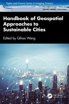
This comprehensive handbook presents the current state of knowledge on geospatial technologies, techniques, and methods that are imperative for providing solutions to sustainable cities. It addresses the role of geospatial big data and AI techniques and how they are applied when analyzing the sustainability of urban development.
- Geräte: PC
- mit Kopierschutz
- eBook Hilfe
Andere Kunden interessierten sich auch für
![Handbook of Geospatial Approaches to Sustainable Cities (eBook, ePUB) Handbook of Geospatial Approaches to Sustainable Cities (eBook, ePUB)]() Handbook of Geospatial Approaches to Sustainable Cities (eBook, ePUB)173,95 €
Handbook of Geospatial Approaches to Sustainable Cities (eBook, ePUB)173,95 €![Practical Handbook of Remote Sensing (eBook, PDF) Practical Handbook of Remote Sensing (eBook, PDF)]() Samantha LavenderPractical Handbook of Remote Sensing (eBook, PDF)50,95 €
Samantha LavenderPractical Handbook of Remote Sensing (eBook, PDF)50,95 €![Computational Methods and GIS Applications in Social Science - Lab Manual (eBook, PDF) Computational Methods and GIS Applications in Social Science - Lab Manual (eBook, PDF)]() Lingbo LiuComputational Methods and GIS Applications in Social Science - Lab Manual (eBook, PDF)52,95 €
Lingbo LiuComputational Methods and GIS Applications in Social Science - Lab Manual (eBook, PDF)52,95 €![Geospatial Science for Smart Land Management (eBook, PDF) Geospatial Science for Smart Land Management (eBook, PDF)]() Geospatial Science for Smart Land Management (eBook, PDF)170,95 €
Geospatial Science for Smart Land Management (eBook, PDF)170,95 €![Computational Methods and GIS Applications in Social Science (eBook, PDF) Computational Methods and GIS Applications in Social Science (eBook, PDF)]() Fahui WangComputational Methods and GIS Applications in Social Science (eBook, PDF)118,95 €
Fahui WangComputational Methods and GIS Applications in Social Science (eBook, PDF)118,95 €![Understanding GIS through Sustainable Development Goals (eBook, PDF) Understanding GIS through Sustainable Development Goals (eBook, PDF)]() Paul HollowayUnderstanding GIS through Sustainable Development Goals (eBook, PDF)105,95 €
Paul HollowayUnderstanding GIS through Sustainable Development Goals (eBook, PDF)105,95 €![Geoinformatics for Sustainable Urban Development (eBook, PDF) Geoinformatics for Sustainable Urban Development (eBook, PDF)]() Geoinformatics for Sustainable Urban Development (eBook, PDF)52,95 €
Geoinformatics for Sustainable Urban Development (eBook, PDF)52,95 €-
-
-
This comprehensive handbook presents the current state of knowledge on geospatial technologies, techniques, and methods that are imperative for providing solutions to sustainable cities. It addresses the role of geospatial big data and AI techniques and how they are applied when analyzing the sustainability of urban development.
Dieser Download kann aus rechtlichen Gründen nur mit Rechnungsadresse in A, B, BG, CY, CZ, D, DK, EW, E, FIN, F, GR, HR, H, IRL, I, LT, L, LR, M, NL, PL, P, R, S, SLO, SK ausgeliefert werden.
Produktdetails
- Produktdetails
- Verlag: Taylor & Francis eBooks
- Seitenzahl: 372
- Erscheinungstermin: 16. April 2024
- Englisch
- ISBN-13: 9781040027493
- Artikelnr.: 70215539
- Verlag: Taylor & Francis eBooks
- Seitenzahl: 372
- Erscheinungstermin: 16. April 2024
- Englisch
- ISBN-13: 9781040027493
- Artikelnr.: 70215539
- Herstellerkennzeichnung Die Herstellerinformationen sind derzeit nicht verfügbar.
Qihao Weng, a Foreign Member of The Academy of Europe (Academia Europaea) and a Fellow of IEEE, AAAS, AAG, ASPRS, and AAIA, is currently a Chair Professor at the Hong Kong Polytechnic University and has worked as the Director of the Center for Urban and Environmental Change and a Professor of Geography at Indiana State University, 2001-2021, and a Senior Fellow at the National Aeronautics and Space Administration from 2008 to 2009. He received his Ph.D. in geography from the University of Georgia in 1999. Weng is the Lead of GEO Global Urban Observation and Information Initiative, 2012-2022, and an Editor-in-Chief of ISPRS Journal of Photogrammetry and Remote Sensing. Additionally, he serves as the Series Editor of Taylor & Francis Series in Remote Sensing Applications, and Taylor & Francis Series in Imaging Science. Weng has been the Organizer and Program Committee Chair of the biennial IEEE/ISPRS/GEO sponsored International Workshop on Earth Observation and Remote Sensing Applications conference series since 2008; a National Director of American Society for Photogrammetry and Remote Sensing from 2007 to 2010; and a panelist of U.S. DOE's Cool Roofs Roadmap and Strategy in 2010. Cheolhee Yoo is currently a Research Assistant Professor at the Hong Kong Polytechnic University. He earned his Bachelor of Engineering and Ph.D. from the Department of Urban and Environmental Engineering at the Ulsan National Institute of Science and Technology (UNIST), South Korea, in 2017 and 2022, respectively. In 2019, he further expanded his research experience as a research intern at the RIKEN Center for Advanced Intelligence Project (AIP) in Japan. Following the completion of his doctoral studies, Dr. Yoo served as a Postdoctoral Fellow at the Hong Kong Polytechnic University from April to September 2022. He is currently an Editorial Board Member of the ISPRS Journal of Photogrammetry and Remote Sensing and GIScience & Remote Sensing.
Part 1: Artificial Intelligence and Big Data Analytics: Needs and
Requirements. 1. Sensing Urban Physical Environment with GeoAI and
Street-level Imagery. 2. Geospatial Big Data for Urban Sustainability
Science. 3. Urban Flooding Monitoring and Management in Geospatial
Perspective: Data, Techniques, and Platforms. Part 2: Geospatial Techniques
for Renewable Cities. 4. Assessing Sustainability in China's Resource-Based
Cities: Leveraging Remote Sensing Techniques for Evaluating
Environment-related SDG Progress. 5. Urban Green Space Maps Based on GeoAI.
6. Contrasting Pattern of Urban Expansion and Urban Land-use
Intensification of Global Megacities Using Nighttime Light Time Series
Data. 7. The Potential of Nature-Based Solutions in Urban Heat Mitigation
and Building Energy Savings. Part 3: Geospatial Techniques for Resilient
Cities. 8. GeoAI for High-Resolution Urban Air Temperature Estimation and
Urban Heat Island Monitoring. 9. Satellite-based Assessment of Urban
Thermal Environments. 10. Urban Air Pollution Mitigation for Sustainable
Cities: Observation, Modelling, and Control Strategies. 11. Geospatial
Analysis of Emerging Drought Risk in a Warming Climate. 12. Urban Summer
Air Temperature Forecasting through a Fusion of a Numerical Weather
Prediction Model with Machine Learning. Part 4: Digital Cities. 13.
GIS-based Modeling for Estimating Urban Carbon Emissions. 14. The
Relationship Between Visual Space and Elders' Mental Health Within
15-minute Life Circles Using SVIs-A Case Study Of Beijing. 15. Comparisons
of Deep Learning Models for Dynamic Local Climate Zone Mapping. 16. The
Potential Diffusion and Economic Impacts of Private Autonomous Vehicles: A
Spatial Agent-based Model
