40,95 €
40,95 €
inkl. MwSt.
Sofort per Download lieferbar
payback
20 °P sammeln
40,95 €
40,95 €
inkl. MwSt.
Sofort per Download lieferbar

Alle Infos zum eBook verschenken
payback
20 °P sammeln
Als Download kaufen
40,95 €
inkl. MwSt.
Sofort per Download lieferbar
payback
20 °P sammeln
Jetzt verschenken
40,95 €
inkl. MwSt.
Sofort per Download lieferbar

Alle Infos zum eBook verschenken
payback
20 °P sammeln
  • Format: PDF

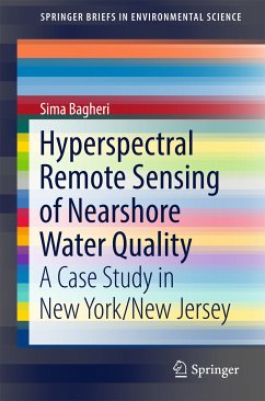
This book provides details on of the utility of hyperspectral remote sensing - NASA/AVIRIS in nearshore water quality issues of NY/NJ. It demonstrates the use of bio optical modeling and retrieval techniques to derive the concentrations of important water quality parameters (chlorophyll, color dissolved organic matter and suspended sediments) in the study area. The case study focuses on the nearshore waters of NY/NJ considered as a valued ecological, economic and recreational resource within the New York metropolitan area. During field campaigns (1998-2001) measurements were made to establish…mehr

Produktbeschreibung
This book provides details on of the utility of hyperspectral remote sensing - NASA/AVIRIS in nearshore water quality issues of NY/NJ. It demonstrates the use of bio optical modeling and retrieval techniques to derive the concentrations of important water quality parameters (chlorophyll, color dissolved organic matter and suspended sediments) in the study area. The case study focuses on the nearshore waters of NY/NJ considered as a valued ecological, economic and recreational resource within the New York metropolitan area. During field campaigns (1998-2001) measurements were made to establish hydrological optical properties of the NY/NJ nearshore waters with concurrent NASA/AVIRIS overflights. The field measurements included: 1) concurrent above and below surface spectral reflectance; 2) shipboard sampling for determination of inherent optical properties (IOP); and 3) concentrations of optically important water quality parameters. Understanding the relationship between reflectance, absorption and scattering is essential for developing the analytical algorithm necessary to use remote sensing as a monitoring /management tool in the nearshore environment.

Dieser Download kann aus rechtlichen Gründen nur mit Rechnungsadresse in A, B, BG, CY, CZ, D, DK, EW, E, FIN, F, GR, HR, H, IRL, I, LT, L, LR, M, NL, PL, P, R, S, SLO, SK ausgeliefert werden.

Autorenporträt
Sima Bagheri is professor of civil and environmental engineering at University Heights, New Jersey Institute of Technology, with research focus on establishing remote sensing as an operational management tool in assessing the quality of New Jersey's nearshore waters. She has been recommended as an author and editor by Prof. Klemas, Marine Studies, University of Delaware, and SWS member. He also reviewed her proposal.