Masanobu Shimada
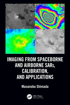
Imaging from Spaceborne and Airborne SARs, Calibration, and Applications (eBook, ePUB)
48,95 €
48,95 €
inkl. MwSt.
Sofort per Download lieferbar

24 °P sammeln
48,95 €
Als Download kaufen

48,95 €
inkl. MwSt.
Sofort per Download lieferbar

24 °P sammeln
Jetzt verschenken
Alle Infos zum eBook verschenken
48,95 €
inkl. MwSt.
Sofort per Download lieferbar
Alle Infos zum eBook verschenken

24 °P sammeln
Masanobu Shimada
Imaging from Spaceborne and Airborne SARs, Calibration, and Applications (eBook, ePUB)
- Format: ePub
- Merkliste
- Auf die Merkliste
- Bewerten Bewerten
- Teilen
- Produkt teilen
- Produkterinnerung
- Produkterinnerung

Bitte loggen Sie sich zunächst in Ihr Kundenkonto ein oder registrieren Sie sich bei
bücher.de, um das eBook-Abo tolino select nutzen zu können.
Hier können Sie sich einloggen
Hier können Sie sich einloggen
Sie sind bereits eingeloggt. Klicken Sie auf 2. tolino select Abo, um fortzufahren.

Bitte loggen Sie sich zunächst in Ihr Kundenkonto ein oder registrieren Sie sich bei bücher.de, um das eBook-Abo tolino select nutzen zu können.
Synthetic Aperture Radar is a topic of great interest all over the world.
- Geräte: eReader
- mit Kopierschutz
- eBook Hilfe
- Größe: 31.18MB
Andere Kunden interessierten sich auch für
![Imaging from Spaceborne and Airborne SARs, Calibration, and Applications (eBook, PDF) Imaging from Spaceborne and Airborne SARs, Calibration, and Applications (eBook, PDF)]() Masanobu ShimadaImaging from Spaceborne and Airborne SARs, Calibration, and Applications (eBook, PDF)48,95 €
Masanobu ShimadaImaging from Spaceborne and Airborne SARs, Calibration, and Applications (eBook, PDF)48,95 €![Subpixel Mapping for Remote Sensing Images (eBook, ePUB) Subpixel Mapping for Remote Sensing Images (eBook, ePUB)]() Peng WangSubpixel Mapping for Remote Sensing Images (eBook, ePUB)121,95 €
Peng WangSubpixel Mapping for Remote Sensing Images (eBook, ePUB)121,95 €![Image Analysis, Classification and Change Detection in Remote Sensing (eBook, ePUB) Image Analysis, Classification and Change Detection in Remote Sensing (eBook, ePUB)]() Morton John CantyImage Analysis, Classification and Change Detection in Remote Sensing (eBook, ePUB)46,95 €
Morton John CantyImage Analysis, Classification and Change Detection in Remote Sensing (eBook, ePUB)46,95 €![Multisensor Data Fusion and Machine Learning for Environmental Remote Sensing (eBook, ePUB) Multisensor Data Fusion and Machine Learning for Environmental Remote Sensing (eBook, ePUB)]() Ni-Bin ChangMultisensor Data Fusion and Machine Learning for Environmental Remote Sensing (eBook, ePUB)48,95 €
Ni-Bin ChangMultisensor Data Fusion and Machine Learning for Environmental Remote Sensing (eBook, ePUB)48,95 €![Introduction to Inverse Problems in Imaging (eBook, ePUB) Introduction to Inverse Problems in Imaging (eBook, ePUB)]() M. BerteroIntroduction to Inverse Problems in Imaging (eBook, ePUB)48,95 €
M. BerteroIntroduction to Inverse Problems in Imaging (eBook, ePUB)48,95 €![Integrating Scale in Remote Sensing and GIS (eBook, ePUB) Integrating Scale in Remote Sensing and GIS (eBook, ePUB)]() Integrating Scale in Remote Sensing and GIS (eBook, ePUB)65,95 €
Integrating Scale in Remote Sensing and GIS (eBook, ePUB)65,95 €![Remote Sensing Image Fusion (eBook, ePUB) Remote Sensing Image Fusion (eBook, ePUB)]() Christine PohlRemote Sensing Image Fusion (eBook, ePUB)52,95 €
Christine PohlRemote Sensing Image Fusion (eBook, ePUB)52,95 €-
-
-
Synthetic Aperture Radar is a topic of great interest all over the world.
Dieser Download kann aus rechtlichen Gründen nur mit Rechnungsadresse in A, B, BG, CY, CZ, D, DK, EW, E, FIN, F, GR, HR, H, IRL, I, LT, L, LR, M, NL, PL, P, R, S, SLO, SK ausgeliefert werden.
Produktdetails
- Produktdetails
- Verlag: Taylor & Francis eBooks
- Seitenzahl: 391
- Erscheinungstermin: 26. Oktober 2018
- Englisch
- ISBN-13: 9781315282596
- Artikelnr.: 54535867
- Verlag: Taylor & Francis eBooks
- Seitenzahl: 391
- Erscheinungstermin: 26. Oktober 2018
- Englisch
- ISBN-13: 9781315282596
- Artikelnr.: 54535867
- Herstellerkennzeichnung Die Herstellerinformationen sind derzeit nicht verfügbar.
Masanobu Shimada (M'97-SM'04-F'11) received the BS and MS degrees in aeronautical engineering from Kyoto University in 1977 and 1979, and the PhD degree in electrical engineering from the University of Tokyo in 1999. He joined the National Space Development Agency of Japan (NASDA, former Japan Aerospace Exploration Agency (JAXA)) in 1979 and conducted the research projects for 34 years. During that, he made three achievements: 1) Sensor developments, i.e., Ku-band Scatterometer, Polarimetric Interferometric Airborne L-band SAR 1 and 2, 2) Operational Algorithm developments: SAR imaging, Interferometry, Polarimetry, Calibration, Mosaicking, and applications, 3) lead the science projects: the JERS-1 SAR calibration and validation (1992-1998), the JERS-1 Science project (Global rainforest and boreal forest mapping project and SAR interferometry for detecting the deformation distribution), the ALOS science project and PALSAR CALVAL, and the Kyoto and Carbon Initiative project using the time series PALSAR/PALSAR2 mosaics. His most impacted achievements are the deformation detection of the Hanshinn-Awaji-Earthquake using the JERS-1 SAR Interferometry, generation of world first global SAR mosaics that depicts the annual deforestation change, and experimental near real time deforestation monitoring using the ALOS/PALSAR ScanSAR.
His current research interests are high resolution imaging for spaceborne and airborne SARs (PALSAR-2 and Pi-SAR-L2), calibration and validation, SAR applications including polarimetric SAR interferometry, and MTI using the UAVSAR interferometry.
Since April 1 2015, He is a professor at Tokyo Denki University, an invited researcher of JAXA, and a guest professor of Yamaguchi University, and from 2018, a lecturer at the Nara Women University. At Tokyo Denki University, he brought up the graduation of the 18 students, on-going 6 master students.
1. Introduction 2. Introduction of the SAR System 3. SAR Imaging and
Analysis 4. Radar Equation for SAR Correlation Power-Radiometry 5. ScanSAR
Imaging 6. Polarimetric Calibration 7. SAR Elevation Antenna Pattern-Theory
and Measured Pattern from the Natural Target Data 8.
Geometry/Ortho-Rectification and Slope-Corrections 9.
Calibration-Radiometry and Geometry 10. Defocusing and Image Shift due to
the Moving Target 11. Mosaicking and Multi-Temporal SAR Imaging 12. SAR
Interferometry 13. Irregularities (RFI and Ionosphere) 14. Applications 15.
Forest Map Generation
