Lin Mu, Lizhe Wang, Mingwei Wang
Information Engineering for Ports and Marine Environments (eBook, PDF)
54,95 €
54,95 €
inkl. MwSt.
Sofort per Download lieferbar

27 °P sammeln
54,95 €
Als Download kaufen

54,95 €
inkl. MwSt.
Sofort per Download lieferbar

27 °P sammeln
Jetzt verschenken
Alle Infos zum eBook verschenken
54,95 €
inkl. MwSt.
Sofort per Download lieferbar
Alle Infos zum eBook verschenken

27 °P sammeln
Lin Mu, Lizhe Wang, Mingwei Wang
Information Engineering for Ports and Marine Environments (eBook, PDF)
- Format: PDF
- Merkliste
- Auf die Merkliste
- Bewerten Bewerten
- Teilen
- Produkt teilen
- Produkterinnerung
- Produkterinnerung

Bitte loggen Sie sich zunächst in Ihr Kundenkonto ein oder registrieren Sie sich bei
bücher.de, um das eBook-Abo tolino select nutzen zu können.
Hier können Sie sich einloggen
Hier können Sie sich einloggen
Sie sind bereits eingeloggt. Klicken Sie auf 2. tolino select Abo, um fortzufahren.

Bitte loggen Sie sich zunächst in Ihr Kundenkonto ein oder registrieren Sie sich bei bücher.de, um das eBook-Abo tolino select nutzen zu können.
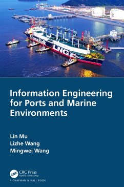
This book describes how to build the ocean dynamics model in information assurance technology for port shipping and ocean environment. It also talkss about the three basic modules necessary for the process of modeling namely atmospheric module, wave module and current module.
- Geräte: PC
- mit Kopierschutz
- eBook Hilfe
Andere Kunden interessierten sich auch für
![Information Engineering for Ports and Marine Environments (eBook, ePUB) Information Engineering for Ports and Marine Environments (eBook, ePUB)]() Lin MuInformation Engineering for Ports and Marine Environments (eBook, ePUB)54,95 €
Lin MuInformation Engineering for Ports and Marine Environments (eBook, ePUB)54,95 €![Systems Engineering (eBook, PDF) Systems Engineering (eBook, PDF)]() Adedeji B. BadiruSystems Engineering (eBook, PDF)79,95 €
Adedeji B. BadiruSystems Engineering (eBook, PDF)79,95 €![Emerging Technologies in Computing (eBook, PDF) Emerging Technologies in Computing (eBook, PDF)]() Emerging Technologies in Computing (eBook, PDF)55,95 €
Emerging Technologies in Computing (eBook, PDF)55,95 €![Optimization of Sustainable Enzymes Production (eBook, PDF) Optimization of Sustainable Enzymes Production (eBook, PDF)]() Optimization of Sustainable Enzymes Production (eBook, PDF)47,95 €
Optimization of Sustainable Enzymes Production (eBook, PDF)47,95 €![GIS (eBook, PDF) GIS (eBook, PDF)]() Matt DuckhamGIS (eBook, PDF)110,95 €
Matt DuckhamGIS (eBook, PDF)110,95 €![Research Software Engineering with Python (eBook, PDF) Research Software Engineering with Python (eBook, PDF)]() Damien IrvingResearch Software Engineering with Python (eBook, PDF)60,95 €
Damien IrvingResearch Software Engineering with Python (eBook, PDF)60,95 €![The Internet as Second Action Space (eBook, PDF) The Internet as Second Action Space (eBook, PDF)]() Aharon KellermanThe Internet as Second Action Space (eBook, PDF)52,95 €
Aharon KellermanThe Internet as Second Action Space (eBook, PDF)52,95 €-
-
-
This book describes how to build the ocean dynamics model in information assurance technology for port shipping and ocean environment. It also talkss about the three basic modules necessary for the process of modeling namely atmospheric module, wave module and current module.
Dieser Download kann aus rechtlichen Gründen nur mit Rechnungsadresse in A, B, BG, CY, CZ, D, DK, EW, E, FIN, F, GR, HR, H, IRL, I, LT, L, LR, M, NL, PL, P, R, S, SLO, SK ausgeliefert werden.
Produktdetails
- Produktdetails
- Verlag: Taylor & Francis eBooks
- Seitenzahl: 254
- Erscheinungstermin: 23. April 2020
- Englisch
- ISBN-13: 9781000051629
- Artikelnr.: 59308163
- Verlag: Taylor & Francis eBooks
- Seitenzahl: 254
- Erscheinungstermin: 23. April 2020
- Englisch
- ISBN-13: 9781000051629
- Artikelnr.: 59308163
- Herstellerkennzeichnung Die Herstellerinformationen sind derzeit nicht verfügbar.
Lin Mu is a professor and doctoral supervisor of College of Life Sciences and Oceanography, Shenzhen University. He was born in 1977, received Ph.D. degree from Ocean University of China and majored in physical oceanography. Dr. Mu has been devoted to the research fields of informational maritime safety support and applied oceanography, and has obtained significant achievements in recent years. He has published 3 monographs and over 50 research papers, 20 of which are covered by Science Citation Index. As the chief scientist, he has been presiding important projects such as National Key Research and Development Program of China, National Natural Science Foundation Project of China and National Science and Technology Support Program of China. In the field of informational maritime safety support, Prof. Mu is specialized in marine oil-spill pollution warning and firstly developed a prediction and warning system of marine oil-spill, search and rescue integration in China, which has been used successfully in a series of accident issues. As an expert in marine search and rescue techniques, he studied, predicted and analyzed the drifting trajectory of the debris of Flight MH370, which provided technical
support for related emergency responses. In the field of applied oceanography, Prof. Mu proposed a real-time tidal level prediction system based on statistics and dynamic model by coupling the real-time monitoring data of meteorology and tidal level, statistical prediction method of tide, atmospheric and marine dynamics model, which conquered the drawbacks of traditional models and brought clear economic benefits.
Lizhe Wang is a "ChuTian" Chair Professor at School of Computer Science, China University of Geosciences (CUG), and a Professor at Institute of Remote Sensing & Digital Earth, Chinese Academy of Sciences (CAS). Prof. Wang received B.E. & M.E from Tsinghua University and Doctor of Engineering from University Karlsruhe (Magna Cum Laude), Germany. Prof. Wang is a Fellow of IET, Fellow of British Computer Society. Prof. Wang serves as an Associate Editor of IEEE TPDS, TCC and TSUSC. His main research interests include HPC, e-Science, and remote sensing image processing.
Mingwei Wang received his Ph.D. degree from Wuhan University, Wuhan, China, in 2018. He obtained the B.S. and M.S. degrees from Hubei Normal University, Huangshi, China, in 2011 and Hubei University of Technology, Wuhan, China, in 2015. He is currently a full-time scientific researcher in School of Geological Survey, China University of Geosciences, Wuhan, China. His major research interests include remote sensing image processing, swarm intelligence and machine learning.
Author Bios. Foreword. Preface. Acknowledgment. Key Issues in Marine
Environment Information Support Technology. Fundamentals of Fluid Mechanics
and Marine Dynamics. Modelling. Forecasting Technology of Tide-bound Water
Level. Key Technology of Oil Spill Early-warning and Forecasting.
Forecasting Technology of Sediment Transport. Research of Integrated Marine
Environment Information Support and Forecast System. Case of Application at
Tianjin Port. Case of Application at Yangshan Port. Bibliography. Index.
