Integrating Scale in Remote Sensing and GIS (eBook, PDF)
Redaktion: Quattrochi, Dale A.; Emerson, Charles W.; Lam, Nina Siu-Ngan; Wentz, Elizabeth
Alle Infos zum eBook verschenken
Integrating Scale in Remote Sensing and GIS (eBook, PDF)
Redaktion: Quattrochi, Dale A.; Emerson, Charles W.; Lam, Nina Siu-Ngan; Wentz, Elizabeth
- Format: PDF
- Merkliste
- Auf die Merkliste
- Bewerten Bewerten
- Teilen
- Produkt teilen
- Produkterinnerung
- Produkterinnerung
Hier können Sie sich einloggen
Bitte loggen Sie sich zunächst in Ihr Kundenkonto ein oder registrieren Sie sich bei bücher.de, um das eBook-Abo tolino select nutzen zu können.
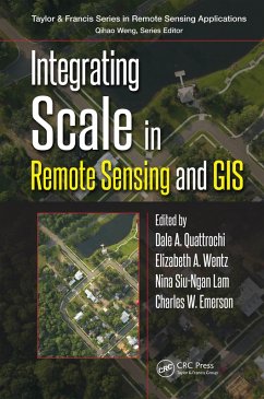
Integrating Scale in Remote Sensing and GIS serves as the most comprehensive documentation of the scientific and methodological advances that have taken place in integrating scale and remote sensing. It demonstrates new developments in the concept of scale within the purview of the "science of scale" for multispatial, multitemporal, and multispectral data. Divided into four thematic groups: scale issues and multiple scaling; physical scale as applied to natural resources; urban scale; and human health/social scale, this book is a vital resource to researchers, instructors, and students alike, seriously involved in the field of GIScience.…mehr
- Geräte: PC
- mit Kopierschutz
- eBook Hilfe
- Größe: 20.03MB
- Remote Sensing and Cognition (eBook, PDF)47,95 €
- Remote Sensing of Impervious Surfaces (eBook, PDF)47,95 €
- Peng WangSubpixel Mapping for Remote Sensing Images (eBook, PDF)118,95 €
- Remote Sensing and Cognition (eBook, ePUB)47,95 €
- Victor RaizerOptical Remote Sensing of Ocean Hydrodynamics (eBook, PDF)49,95 €
- Peng WangSubpixel Mapping for Remote Sensing Images (eBook, ePUB)118,95 €
- Morton John CantyImage Analysis, Classification and Change Detection in Remote Sensing (eBook, PDF)45,95 €
-
-
-
Dieser Download kann aus rechtlichen Gründen nur mit Rechnungsadresse in A, B, BG, CY, CZ, D, DK, EW, E, FIN, F, GR, HR, H, IRL, I, LT, L, LR, M, NL, PL, P, R, S, SLO, SK ausgeliefert werden.
- Produktdetails
- Verlag: Taylor & Francis
- Seitenzahl: 440
- Erscheinungstermin: 6. Januar 2017
- Englisch
- ISBN-13: 9781482218275
- Artikelnr.: 47509565
- Verlag: Taylor & Francis
- Seitenzahl: 440
- Erscheinungstermin: 6. Januar 2017
- Englisch
- ISBN-13: 9781482218275
- Artikelnr.: 47509565
- Herstellerkennzeichnung Die Herstellerinformationen sind derzeit nicht verfügbar.
Integration. Scale and Remote Sensing and GIS Integration: A Revisit of the
Issues. Remote Sensing: Advances in Sensors and Data. Integration of
Multispatial, Multitemporal, and Multispectral Remote Sensing Data in GIS:
Progress and Challenges. Theory, Methods, and Techniques for Multiscale
Data Integration. Computational and Technological Issues. Implementation of
Multiscale Approaches: Methods and Examples. Modeling Methods for GIS
Integration of Multiscaled Remote Sensing Data. Multiscaled Data Fusion for
GIS Integration. Uncertainty and Error Analysis in Remote Sensing Data
Integration with GIS. Geographic Object-Based Image Analysis. Temporal
Analysis for Remote Sensing/GIS Integration. Applications of Multiscaled
Remote Sensing and GIS. Approaches to Land Use/Land Change with Multiscaled
Remote Sensing Data. Multiscaled Remote Sensing Data for Analysis of
Landscape Heterogeneity. Environmental Modeling with Multiscaled Data. Use
of Hyperspectral Data Remote Sensing Data in GIS. Analysis of Multiscaled
Thermal Remote Sensing Data. Multiscaled Remote Sensing Data and GIS for
Modeling Land Surface Processes. GIS, Multiscaled Remote Sensing Data for
Climate Change Analysis. Integration of GPS, GIS, and Multiscaled Remote
Sensing Data. Real Time Data and GIS Integration Applications. Multiscaled
Remote Sensing Data, GIS Integration, and the Future. Summary. Epilogue.