The most up to date and extensive survey of GIS in the secondary education landscape, covering both principles and practice.Professor David Maguire, Pro-Vice-Chancellor, Birmingham City University, UK
International Perspectives on Teaching andLearning With GIS in Secondary Schools is a highly relevant, critically important, reflective contribution to the literature, providing strong arguments supporting the inclusion for spatial studies for all in secondary school education. Karl Donert, President, EUROGEO
This is an invaluable and inspirational examination of innovation in geospatial technologies in secondary schools around the world. Each chapter contains practical models for how to integrate powerful tools for spatial analysis into a range of subjects. It will be useful to classroom teachers and administrators seeking pathways to implementation and teacher educators considering how to prepare the next generation to use geospatial technologies. Sarah Witham Bednarz, Department of Geography, Texas A&M University, College Station, TX, USA
Dieser Download kann aus rechtlichen Gründen nur mit Rechnungsadresse in A, B, BG, CY, CZ, D, DK, EW, E, FIN, F, GR, HR, H, IRL, I, LT, L, LR, M, NL, PL, P, R, S, SLO, SK ausgeliefert werden.
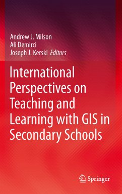
"The most up to date and extensive survey of GIS in the secondary education landscape, covering both principles and practice." -- Professor David Maguire, Pro-Vice-Chancellor, Birmingham City University, UK
"International Perspectives on Teaching and Learning With GIS in Secondary Schools is a highly relevant, critically important, reflective contribution to the literature, providing strong arguments supporting the inclusion for spatial studies for all in secondary school education." -- Karl Donert, President, EUROGEO
"What do China, Finland, India, Norway, South Africa, Taiwan, Turkey and the UK have in common? GIS in the curriculum! Imagine comparing the national curricula of 33 countries spanning every populated continent, and "zooming in" to specific applications of GIS in each country. This book is a significant contribution to the field and the "known world" of GIS education in K-12 settings and beyond, providing the big picture, global insights and recommendations for the future." -- Marsha Alibrandi, Fairfield University
"This is an invaluable and inspirational examination of innovation in geospatial technologies in secondary schools around the world. Each chapter contains practical models for how to integrate powerful tools for spatial analysis into a range of subjects. It will be useful to classroom teachers and administrators seeking pathways to implementation and teacher educators considering how to prepare the next generation to use geospatial technologies." -- Sarah Witham Bednarz, Department of Geography, Texas A&M University
From the reviews:
"An eagerly awaited volume editied by three GIS scholars, the new International Perspectives on Teaching and Learning with GIS in Secondary Schools is a comprehensive guide to the current state of Geographic Information Systems (GIS) in education globally. This is no small task, and its value to the GIS in education community is as broad as the book's scope. For educators, policy-makers, Geography and Teacher educators, this collection of 67 international contributors, with a foreword by Roger Tomlinson, Canadian "father" of GIS, the book commands an important niche on the library shelf of all geography educators. ... this volume is one that certainly deserves to belong on the shelves of geography teachers and teacher educators, science teachers and teacher educators, and instructional technologies teachers and teacher educators. It would be most instructive to school administrators and policy-makers in any state, province, nation or district. With the teaching and learning of GIS in schools now fully in its third decade, an international comparative study such as this is immensely important for the future of geographic education. This compilation is a vital work and should be read by individuals in each school district today as we enter a new landscape of learning and teaching with geospatial technologies." -- Marsha Alibrandi, Review of International Geographical Education Online, Vol. 1 (2), 2011
"Authors from 33 countries contributed, illustrating how students learn GIS and how instructors teach with GIS around the world. ... The book offers evidence that GIS provides a strong geographic framework and critical thinking skills that will serve students well in the future. ... The book ends with reflections on the progress made in teaching and learning with GIS over the past 20 years ... and recommendations as to what needs to happen to meet the goal of engaging all students in thinking spatially." -- ArcWatch, February, 2012
Lyn Malone
WORLD VIEWS: Spatial Technologies for Education
ESRI Authorized K-12 Trainer
Co-Coordinator, Rhode Island Geography Education Alliance
The most up to date and extensive survey of GIS in the secondary education landscape, covering both principles and practice.
Professor David Maguire, Pro-Vice-Chancellor, Birmingham City University, UK
International Perspectives on Teaching and Learning With GIS in Secondary Schools is a highly relevant, critically important, reflective contribution to the literature, providing strong arguments supporting the inclusion for spatial studies for all in secondary school education.
Karl Donert, President, EUROGEO
What do China, Finland, India, Norway, South Africa, Taiwan, Turkey and the UK have in common? GIS in the curriculum! Imagine comparing the national curricula of 33 countries spanning every populated continent, and "zooming in" to specific applications of GIS in each country. This book is a significant contribution to the field and the "known world" of GIS education in K-12 settings and beyond, providing the big picture, global insights and recommendations for the future.
Marsha Alibrandi, Fairfield University
This is an invaluable and inspirational examination of innovation in geospatial technologies in secondary schools around the world. Each chapter contains practical models for how to integrate powerful tools for spatial analysis into a range ofsubjects. It will be useful to classroom teachers and administrators seeking pathways to implementation and teacher educators considering how to prepare the next generation to use geospatial technologies.
Sarah Witham Bednarz, Department of Geography, Texas A&M University
From the reviews:
"An eagerly awaited volume editied by three GIS scholars, the new International Perspectives on Teaching and Learning with GIS in Secondary Schools is a comprehensive guide to the current state of Geographic Information Systems (GIS) in education globally. This is no small task, and its value to the GIS in education community is as broad as the book's scope. For educators, policy-makers, Geography and Teacher educators, this collection of 67 international contributors, with a foreword by Roger Tomlinson, Canadian "father" of GIS, the book commands an important niche on the library shelf of all geography educators. ... this volume is one that certainly deserves to belong on the shelves of geography teachers and teacher educators, science teachers and teacher educators, and instructional technologies teachers and teacher educators. It would be most instructive to school administrators and policy-makers in any state, province, nation or district. With the teaching and learning of GIS in schools now fully in its third decade, an international comparative study such as this is immensely important for the future of geographic education. This compilation is a vital work and should be read by individuals in each school district today as we enter a new landscape of learning and teaching with geospatial technologies." (Marsha Alibrandi, Review of International Geographical Education Online, Vol. 1 (2), 2011)
"Authors from 33 countries contributed, illustrating how students learn GIS and how instructors teach with GIS around the world. ... The book offers evidence that GIS provides a strong geographic framework and critical thinking skills that willserve students well in the future. ... The book ends with reflections on the progress made in teaching and learning with GIS over the past 20 years ... and recommendations as to what needs to happen to meet the goal of engaging all students in thinking spatially." (ArcWatch, February, 2012)


