79,95 €
79,95 €
inkl. MwSt.
Sofort per Download lieferbar
payback
40 °P sammeln
79,95 €
79,95 €
inkl. MwSt.
Sofort per Download lieferbar

Alle Infos zum eBook verschenken
payback
40 °P sammeln
Als Download kaufen
79,95 €
inkl. MwSt.
Sofort per Download lieferbar
payback
40 °P sammeln
Jetzt verschenken
79,95 €
inkl. MwSt.
Sofort per Download lieferbar

Alle Infos zum eBook verschenken
payback
40 °P sammeln
  • Format: ePub

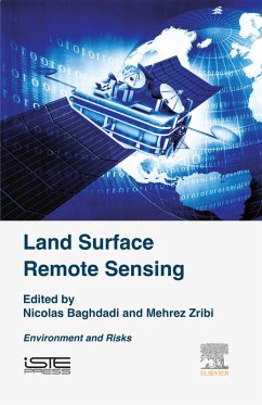
Land Surface Remote Sensing: Environment and Risks explores the use of remote sensing in applications concerning the environment, including desertification and monitoring deforestation and forest fires. The first chapter covers the characterization of aerosols and gases by passive remote sensing. The next chapter presents the correlation of optical images for quantifying the deformation of the Earth's surface and geomorphological processes. The third chapter is examines remote sensing applications in the mining environment. The fourth chapter depicts the strong potential of radar imagery for…mehr

Produktbeschreibung
Land Surface Remote Sensing: Environment and Risks explores the use of remote sensing in applications concerning the environment, including desertification and monitoring deforestation and forest fires. The first chapter covers the characterization of aerosols and gases by passive remote sensing. The next chapter presents the correlation of optical images for quantifying the deformation of the Earth's surface and geomorphological processes. The third chapter is examines remote sensing applications in the mining environment. The fourth chapter depicts the strong potential of radar imagery for volcanology and urban and mining subsidence studies. The next two chapters deal respectively with the use of remote sensing in locust control and the contribution of remote sensing to the epidemiology of infectious diseases.

In the last ten years, spatial observation of the Earth-particularly continental surfaces-has expanded considerably with the launch of increasing numbers of satellites covering various applications (hydrology, biosphere, flow of surface, snow, ice, landslide, floods). This has paved the way for an explosion in the use of remote sensing data.

This book offers essential coverage of space-based observation techniques for continental surfaces. The authors explore major applications and provide a corresponding detailed chapter for the physical principles, physics of measurement, and data processing requirements for each technique, bringing you up-to-date descriptions of techniques used by leading scientists in the field of remote sensing and Earth observation.

  • Provides clear and concise descriptions of modern remote sensing methods
  • Explores the most current remote sensing techniques with physical aspects of the measurement (theory) and their applications
  • Provides chapters on physical principles, measurement, and data processing for each technique described
  • Describes optical remote sensing technology, including a description of acquisition systems and measurement corrections to be made

Dieser Download kann aus rechtlichen Gründen nur mit Rechnungsadresse in A, B, BG, CY, CZ, D, DK, EW, E, FIN, F, GR, HR, H, IRL, I, LT, L, LR, M, NL, PL, P, R, S, SLO, SK ausgeliefert werden.

Autorenporträt
Mehrez Zribi is Director of Research at CNRS/France. He received Ph.D. degree in 1998 from the University of Toulouse, France. Since October 2008, he has been with the Centre d'Etudes Spatiales de la Biosphère, Toulouse. His research interests include land surface characterization for hydrology applications, remote sensing signal processing, and airborne microwave instrumentation. Mehrez Zribi has published 125 papers in peer-reviewed journals and has coordinated publication of 20 books about remote sensing for land surfaces. He serves as an editorial board member for several journals and coordinate several international and french research projects. He is deputy director of CESBIO laboratory.