149,79 €
inkl. MwSt.
Sofort per Download lieferbar
  • Format: PDF

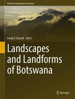
This volume contains 22 chapters introducing a wide range of semi-arid and geologic landscapes. Botswana, a thinly populated nation, the size of France, is a Southern African keystone country at the heart of the Kalahari, sharing some of the major sub-continental drainage basins such as the Limpopo, Zambezi, Orange, and Okavango with its neighbouring countries. The extensive Kalahari Sand surface has been sculptured by numerous past processes which have produced subtle but regional landforms consisting of extensive dunes and shorelines. Incipient rifting has created the dynamic Okavango and…mehr

Produktbeschreibung
This volume contains 22 chapters introducing a wide range of semi-arid and geologic landscapes. Botswana, a thinly populated nation, the size of France, is a Southern African keystone country at the heart of the Kalahari, sharing some of the major sub-continental drainage basins such as the Limpopo, Zambezi, Orange, and Okavango with its neighbouring countries. The extensive Kalahari Sand surface has been sculptured by numerous past processes which have produced subtle but regional landforms consisting of extensive dunes and shorelines. Incipient rifting has created the dynamic Okavango and Makgadikgadi fan-basin systems which produces iconic wetlands with a world heritage status. Geological outcrops in particular to the east expose highly denuded basement lithologies which produces numerous inselbergs that are home to a rich archaeological heritage. The book also examines the geomorphology of mineral and water resources which sustain the economy and population and also features dedicated chapters that cover diamondiferous kimberlites, caves, pans, dams, duricrusts and wildlife.

Chapter 6 is available open access under a Creative Commons Attribution 4.0 International License via link.springer.com.
Autorenporträt
Frank Eckardt is a geomorphologist who has been working at the University of Cape Town (UCT) since 2005. Originally from Germany, raised in various European countries and educated in the UK, Eckardt obtained a BSc in Geography at Kings College London, an MSc in applied remote sensing from Silsoe (Cranfield) and a DPhil from the School of Geography in Oxford.

After working as an undergraduate on glacial forelands in Norway and coastal marine habitats in Belize during his masters, he shifted to southern African drylands while conducting his PhD fieldwork in Namibia. Prior to coming to UCT, Frank Eckardt was teaching physical geography and remote sensing at the University of Botswana and acted as a remote sensing consulted on variety of projects. He currently teaches global physical geography to first years and focuses on earth observation as well as contemporary polar, tropical and arid land surface dynamics in the second year. In their final year, students are exposed to Southern Africa's Geomorphology, which among other things includes topics such as landscape evolution, weathering, soils, duricrusts, as well as contemporary mineral dust production. Frank Eckardt is currently president of the International Society for Aeolian Research (ISAR) and Head of Department at the Environmental and Geographical Sciences at UCT.