34,95 €
34,95 €
inkl. MwSt.
Sofort per Download lieferbar
payback
17 °P sammeln
34,95 €
34,95 €
inkl. MwSt.
Sofort per Download lieferbar

Alle Infos zum eBook verschenken
payback
17 °P sammeln
Als Download kaufen
34,95 €
inkl. MwSt.
Sofort per Download lieferbar
payback
17 °P sammeln
Jetzt verschenken
34,95 €
inkl. MwSt.
Sofort per Download lieferbar

Alle Infos zum eBook verschenken
payback
17 °P sammeln
  • Format: PDF

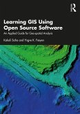
This book introduces the usage, functionality, and application of data in Geographic Information Systems (GIS) for geo-spatial analysis. It offers knowledge on GIS tools and techniques and explains how they can be applied in real-world project to architects and planners in the Indian, and the greater South Asian context.

Produktbeschreibung
This book introduces the usage, functionality, and application of data in Geographic Information Systems (GIS) for geo-spatial analysis. It offers knowledge on GIS tools and techniques and explains how they can be applied in real-world project to architects and planners in the Indian, and the greater South Asian context.


Dieser Download kann aus rechtlichen Gründen nur mit Rechnungsadresse in A, B, BG, CY, CZ, D, DK, EW, E, FIN, F, GR, HR, H, IRL, I, LT, L, LR, M, NL, PL, P, R, S, SLO, SK ausgeliefert werden.

Autorenporträt
Kakoli Saha is Assistant Professor, School of Planning and Architecture, Bhopal, India, and currently heads the Geoinformatics Centre there. She completed her PhD in Applied Remote Sensing in 2010 from Kent State University,Ohio, USA. Since then she has successfully completed many professional assignments. She was Coordinator for the Doctoral Programme and was Principal Investigator for DST project, under Young Scientist Scheme (2012- 2015). Her research interest span the application of GIS and remote sensing in physical planning and architecture. Author of several scholarly articles, she is a recipient of the prestigious Erasmus Scholarship under the framework of Erasmus Plus Global Mobility Programme, 2016.

Yngve Frøyen is Professor at the Department of Architecture and Planning, Faculty of Architecture and Design, Norwegian University of Science and Technology, Norway. He is a renowned expert in the field of GIS and information technology for land-use and transportation planning purposes. With a civil engineering background, he has worked on a wide field of planning-related disciplines, as researcher, university lecturer and as consulting adviser both in Norway and abroad. He is a member of the group responsible for the master program in physical planning at NTNU, where he has taught since 2010, and he supervises urban and regional planning topics such as integrated land-use and transportation planning, sustainable urban transport and urban network modelling. He is also teaches mapping and geographical information systems (GIS), and how GIS-methods and other computer-based tools can be utilized for planning purposes. His field of research includes the planning of sustainable urban transport solutions. In particular, he is concerned with environment friendly modes of transport-walking, bicycling and transit.