0,99 €
0,99 €
inkl. MwSt.
Sofort per Download lieferbar
payback
0 °P sammeln
0,99 €
0,99 €
inkl. MwSt.
Sofort per Download lieferbar

Alle Infos zum eBook verschenken
payback
0 °P sammeln
Als Download kaufen
0,99 €
inkl. MwSt.
Sofort per Download lieferbar
payback
0 °P sammeln
Jetzt verschenken
0,99 €
inkl. MwSt.
Sofort per Download lieferbar

Alle Infos zum eBook verschenken
payback
0 °P sammeln
  • Format: PDF

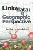
Linked Data opens up structured data from databases to be searched and queried via the web, and a geographic element is increasingly being used to link to those data. This book helps you understand how to organize and describe data that includes geographic content and how to publish it as Linked Data for the Semantic Web, as well as explaining the benefits of doing so. In easy-to-understand terms, it equips you with the knowledge you need to think about Geographic Information through the lens of the Semantic Web.

Produktbeschreibung
Linked Data opens up structured data from databases to be searched and queried via the web, and a geographic element is increasingly being used to link to those data. This book helps you understand how to organize and describe data that includes geographic content and how to publish it as Linked Data for the Semantic Web, as well as explaining the benefits of doing so. In easy-to-understand terms, it equips you with the knowledge you need to think about Geographic Information through the lens of the Semantic Web.

Dieser Download kann aus rechtlichen Gründen nur mit Rechnungsadresse in A, B, BG, CY, CZ, D, DK, EW, E, FIN, F, GR, HR, H, IRL, I, LT, L, LR, M, NL, PL, P, R, S, SLO, SK ausgeliefert werden.

Autorenporträt
Glen Hart currently leads the research group at Ordnance Survey, Great Britain's national mapping agency. Glen first began to investigate the Semantic Web in 2002, initially working to understand the relevance to data integration and then how to construct ontological descriptions of geographical objects. Mirroring his interest in vernacular geography (how people understand and refer to the landscape around them as opposed to official views), Glen was also determined to develop ways to make ontologies more accessible to domain experts, those people expert in a subject area but for whom ontologies expressed in formal logic were totally opaque. This resulted in the development of a syntax for the Web ontology language OWL called Rabbit that expresses OWL sentences using controlled natural language. More recently, Glen has been involved in the publication of Ordnance Survey's Geographic Information as Linked Data. Glen sees the publication of Linked Data as an enabler towards more efficient and accurate data integration, and his research continues along these lines.

Dr. Catherine Dolbear is currently a link data architect at Oxford University Press (OUP), working on strategies for linking content across online academic and journal products within OUP's discoverability program. Catherine is the author of several papers in areas of geographical ontology development, semantic data integration, and information filtering using structured data; a previous cochair of the OWL Experiences and Directions Workshop; and cofounder, along with Glen Hart, of the international workshop series "Terra Cognita" on geospatial semantics. While leading the geosemantics research team at Ordnance Survey, Catherine worked on the development of several ontologies in the geographic domain as well as the reuse of these in application areas such as flood defense and risk management. More recently, she has been interested in moving semantic technologies