Sie sind bereits eingeloggt. Klicken Sie auf 2. tolino select Abo, um fortzufahren.
Bitte loggen Sie sich zunächst in Ihr Kundenkonto ein oder registrieren Sie sich bei bücher.de, um das eBook-Abo tolino select nutzen zu können.
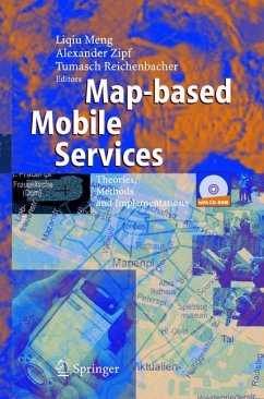
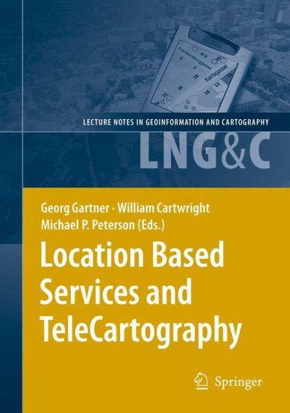
This book provides for the first time a general overview of research activities related to location and map-based services. These activities have emerged over the last years, especially around issues of positioning, spatial modelling, cartographic communication as well as in the fields of ubiquitious cartography, geo-pervasive services, user-centered modelling and geo-wiki activities. The innovative and contemporary character of these topics has lead to a great variety of interdisciplinary contributions, from academia to business, from computer science to geodesy. Topics cover an enormous…mehr
This book provides for the first time a general overview of research activities related to location and map-based services. These activities have emerged over the last years, especially around issues of positioning, spatial modelling, cartographic communication as well as in the fields of ubiquitious cartography, geo-pervasive services, user-centered modelling and geo-wiki activities. The innovative and contemporary character of these topics has lead to a great variety of interdisciplinary contributions, from academia to business, from computer science to geodesy. Topics cover an enormous range with heterogenous relationships to the main book issues. Whilst contemporary cartography aims at looking at new and efficient ways for communicating spatial information the development and availability of technologies like mobile networking, mobile devices or short-range sensors lead to interesting new possibilities for achieving this aim. By trying to make use of available technologies, cartography and a variety of related disciplines look specifically at user-centered and conte- aware system development, as well as new forms of supporting wayfinding and navigation systems. Contributions are provided in five main sections and they cover all of these aspects and give a picture of the new and expanding field of Location Based Services and TeleCartography. Georg Gartner, Vienna, Austria William Cartwright, Melbourne, Australia Michael Peterson, Omaha, USA Table of Contents Georg Gartner LBS and TeleCartography: About the book. . . . . . . . . . . . . . . . . . . . . . . . . . . . . . . . . . . . . . . . . . . 1 1 A series of Symposiums on LBS and TeleCartography. . . . . . . . . . . . . . . . . . . . . . 1 2 Progression of Research . . . . . . . . . . . . . . . . . . . . . . . . .. . . . . . . . . . . . . . . . . . . . . . . . . . . . . . . . . . . . . . . . . . . . . 3 2. 1 Terms. . . . . . . . . . . . . . . . . . . . . . . . . . . . . . . . . . . . . . . . . . . . . . . . . . . . . . . . . . . . . . . . . . . . . . . . . . . . . . . . . . . . . . . . . . . . 3 2. 2 Elements. . . . . . . . . . . . . . . . . . . . . . . . . . . . . . . . . . . . . . . . . . . . . . . . . . . . . . . . . . . . . . . . . . . . . . . . . . . . . . . . . . . . . . . 4 3 Structure of the book . . . . . . . . . . . . . . . . . . . . . . . . . . . . . . . . . . . . . . . . . . . . . . . . . . . . . . . . . . . . . . . . . . . . . . . . . . .
Georg Gartner, Vienna University of Technology, Vienna, Austria
Inhaltsangabe
LBS and TeleCartography: About the book.- LBS and TeleCartography: About the book.- General Aspects.- Design constraints on operational LBS.- Location Based Services and GIS in Perspective.- A Market and User View on LBS.- What makes Location-Based Services fail?.- The Transition from Internet to Mobile Mapping.- Theory and development of research in ubiquitous mapping.- Positioning.- Positioning LBS to the third dimension.- Altitude Determination of a Pedestrian in a Multistorey Building.- Terminal-Centric Location Services in the IP Multimedia Subsystem.- WiKaF - A Knowledge-based Kalman-Filter for Pedestrian Positioning.- Map-independent positioning of land vehicles with causative modified motion equations.- Modelling and Awareness.- Shortest Path Search in Multi-Representation Street Databases.- Region-Based Representation for Assistance with Spatio-Temporal Planning in Unfamiliar Environments.- A Logic-Based Foundation for Spatial Relationships in Mobile GIS Environment.- From Turn-By-Turn Directions to Overview Information on the Way to Take.- Geocoding Japanese Walking Directions using Sidewalk Network Databases.- The concept of relevance in mobile maps.- A Knowledge-Based Map Adaptation Approach for Mobile Map Services.- A visual editor for OGC SLD files for automating the configuration of WMS and mobile map applications.- Towards Orientation-Aware Location Based Mobile Services.- Geo-Services and Computer Vision for Object Awareness in Mobile System Applications.- Visualisation and Cartographic Communication.- How to design a pedestrian navigation system for indoor and outdoor environments.- Dancing_without_gravity: A story of interface design.- Landmarks and the perception of a space in web-delivered 3D-worlds.- Comparing the effects of different 3D representations on human wayfinding.- An Approach towards Semantics-Based Navigation in 3D City Models on Mobile Devices.- The World as a User Interface: Augmented Reality for Ubiquitous Computing.- “Anywhere Augmentation”: Towards Mobile Augmented Reality in Unprepared Environments.- Open Content Web Mapping Service: A Really Simple Syndication (RSS) Approach.- Applications.- Mobile Landscapes: Graz in Real Time.- The Spatial Accuracy of Mobile Positioning: Some experiences with Geographical Studies in Estonia.- A Framework for Decision-Centred Visualisation in Civil Crisis Management.- Providing an Information Infrastructure for Map Based LBS - The approach of the City of Vienna.- MoGeo: A location-based educational service.- Bata Positioning System - A real time tracking system for the world’s largest relay race.- Smartphone-based information and navigation aids for public transport travellers.- EASYGO — A public transport query and guiding LBS.- Mobile City Explorer: An innovative GPS and Camera Phone Based Travel Assistant for City Tourists.- Development of Cultural Inheritance Information System using LBS Technologies for Tourists.- LWD-Infosystem Tirol — visual information about the current avalanche situation via mobile devices.- Spatial tracking in sport.
LBS and TeleCartography: About the book.- LBS and TeleCartography: About the book.- General Aspects.- Design constraints on operational LBS.- Location Based Services and GIS in Perspective.- A Market and User View on LBS.- What makes Location-Based Services fail?.- The Transition from Internet to Mobile Mapping.- Theory and development of research in ubiquitous mapping.- Positioning.- Positioning LBS to the third dimension.- Altitude Determination of a Pedestrian in a Multistorey Building.- Terminal-Centric Location Services in the IP Multimedia Subsystem.- WiKaF - A Knowledge-based Kalman-Filter for Pedestrian Positioning.- Map-independent positioning of land vehicles with causative modified motion equations.- Modelling and Awareness.- Shortest Path Search in Multi-Representation Street Databases.- Region-Based Representation for Assistance with Spatio-Temporal Planning in Unfamiliar Environments.- A Logic-Based Foundation for Spatial Relationships in Mobile GIS Environment.- From Turn-By-Turn Directions to Overview Information on the Way to Take.- Geocoding Japanese Walking Directions using Sidewalk Network Databases.- The concept of relevance in mobile maps.- A Knowledge-Based Map Adaptation Approach for Mobile Map Services.- A visual editor for OGC SLD files for automating the configuration of WMS and mobile map applications.- Towards Orientation-Aware Location Based Mobile Services.- Geo-Services and Computer Vision for Object Awareness in Mobile System Applications.- Visualisation and Cartographic Communication.- How to design a pedestrian navigation system for indoor and outdoor environments.- Dancing_without_gravity: A story of interface design.- Landmarks and the perception of a space in web-delivered 3D-worlds.- Comparing the effects of different 3D representations on human wayfinding.- An Approach towards Semantics-Based Navigation in 3D City Models on Mobile Devices.- The World as a User Interface: Augmented Reality for Ubiquitous Computing.- "Anywhere Augmentation": Towards Mobile Augmented Reality in Unprepared Environments.- Open Content Web Mapping Service: A Really Simple Syndication (RSS) Approach.- Applications.- Mobile Landscapes: Graz in Real Time.- The Spatial Accuracy of Mobile Positioning: Some experiences with Geographical Studies in Estonia.- A Framework for Decision-Centred Visualisation in Civil Crisis Management.- Providing an Information Infrastructure for Map Based LBS - The approach of the City of Vienna.- MoGeo: A location-based educational service.- Bata Positioning System - A real time tracking system for the world's largest relay race.- Smartphone-based information and navigation aids for public transport travellers.- EASYGO - A public transport query and guiding LBS.- Mobile City Explorer: An innovative GPS and Camera Phone Based Travel Assistant for City Tourists.- Development of Cultural Inheritance Information System using LBS Technologies for Tourists.- LWD-Infosystem Tirol - visual information about the current avalanche situation via mobile devices.- Spatial tracking in sport.
Rezensionen
From the reviews:
"The book provides, in an easy and an accessible fashion, a general overview of the research activities in different LBS elements in addition to their applications. ... This is an ideal book for anyone who wants to learn about LBS, and for practitioners and researchers who are facing the numerous technological challenges raised by location-based services. ... this book provides an excellent state-of-the-art overview that will remain relevant for years to come." (Naser El-Sheimy, Geomatica, Vol. 61 (3), 2007)
Es gelten unsere Allgemeinen Geschäftsbedingungen: www.buecher.de/agb
Impressum
www.buecher.de ist ein Shop der buecher.de GmbH & Co. KG i.I. Bürgermeister-Wegele-Str. 12, 86167 Augsburg Amtsgericht Augsburg HRA 13309