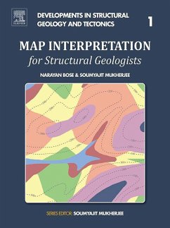
Map Interpretation for Structural Geologists covers various topics, from deciphering topography using contour patterns to interpreting folds, faults, unconformities and dykes. By interpreting several types of maps, this book gives readers the confidence to solve difficult geologic questions related to map interpretation in the classroom and in the field. Interpreting geological and structural maps is an inseparable part of learning structural geology in the undergraduate curriculum and postgraduate development.
- Features approximately 30 full-color geological or structural maps and their solutions, from basic to the most complex
- Includes content appropriate for undergraduate and graduate students and professional geoscientists alike
- Presents a self-learning guide and teaching manual with minimum instruction required
Dieser Download kann aus rechtlichen Gründen nur mit Rechnungsadresse in A, B, BG, CY, CZ, D, DK, EW, E, FIN, F, GR, HR, H, IRL, I, LT, L, LR, M, NL, PL, P, R, S, SLO, SK ausgeliefert werden.

