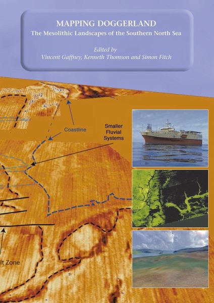
Mapping Doggerland: The Mesolithic Landscapes of the Southern North Sea (eBook, PDF)

PAYBACK Punkte
7 °P sammeln!
12,000 years ago the area that now forms the southern North Sea was dry land: a vast plain populated by Mesolithic hunter-gatherers. By 5,500 BC the entire area had disappeared beneath the sea as a consequence of rising sea levels. Until now, this unique landscape remained hidden from view and almost entirely unknown. The North Sea Palaeolandscape Project, funded by the Aggregates Levy Sustainability Fund, have mapped 23,000 km2 of this "lost world" using seismic data collected for mineral exploration. "Mapping Doggerland" demonstrates that the North Sea covers one of the largest and best pres...
12,000 years ago the area that now forms the southern North Sea was dry land: a vast plain populated by Mesolithic hunter-gatherers. By 5,500 BC the entire area had disappeared beneath the sea as a consequence of rising sea levels. Until now, this unique landscape remained hidden from view and almost entirely unknown. The North Sea Palaeolandscape Project, funded by the Aggregates Levy Sustainability Fund, have mapped 23,000 km2 of this "lost world" using seismic data collected for mineral exploration. "Mapping Doggerland" demonstrates that the North Sea covers one of the largest and best preserved prehistoric landscapes in Europe. In mapping this exceptional landscape the project has begun to provide an insight into the historic impact of the last great phase of global warming experienced by modern man and to assess the significance of the massive loss of European land that occurred as a consequence of climate change. Contents: 1) Mapping Doggerland Vincent Gaffney and Kenneth Thomson; 2) Coordinating Marine Survey Data Sources (Mark Bunch, Vincent Gaffney and Kenneth Thomson); 3) 3D Seismic Reflection Data, Associated Technologies and the Development of the Project Methodology (Kenneth Thomson and Vincent Gaffney); 4. Merging Technologies: The integration and visualisation of spatial data sets used in the project (Simon Fitch, Vincent Gaffney and Kenneth Thomson); 5) A Geomorphological Investigation of Submerged Depositional Features within the Outer Silver Pit, Southern North Sea (Simon Fitch, Vincent Gaffney and Kenneth Thomson; 6) Salt Tectonics in the Southern North Sea: Controls on Late Pleistocene-Holocene Geomorphology (Simon Holford, Kenneth Thomson and Vincent Gaffney); 7) An Atlas of the Palaeolandscapes of the Southern North Sea (Simon Fitch, Vincent Gaffney, Kenneth Thomson with Kate Briggs, Mark Bunch and Simon Holford); 8) The Potential of the Organic Archive for Environmental Reconstruction: An Assessment of Selected Borehole Sediments from the Southern North Sea (David Smith, Simon Fitch, Ben Gearey, Tom Hill, Simon Holford, Andy Howard and Christina Jolliffe); 9) Heritage Management and the North Sea Palaeolandscapes Project (Simon Fitch, Vincent Gaffney and Kenneth Thomson).See further information at Mapping Doggerland
Dieser Download kann aus rechtlichen Gründen nur mit Rechnungsadresse in A, B, BG, CY, CZ, D, DK, EW, E, FIN, F, GR, HR, H, IRL, I, LT, L, LR, M, NL, PL, P, R, S, SLO, SK ausgeliefert werden.


