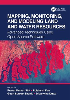
Mapping, Monitoring, and Modeling Land and Water Resources (eBook, ePUB)
Advanced Techniques Using Open Source Software
Redaktion: Shit, Pravat Kumar; Dutta, Dipanwita; Bhunia, Gouri Sankar; Das, Pulakesh
47,95 €
47,95 €
inkl. MwSt.
Sofort per Download lieferbar

24 °P sammeln
47,95 €
Als Download kaufen

47,95 €
inkl. MwSt.
Sofort per Download lieferbar

24 °P sammeln
Jetzt verschenken
Alle Infos zum eBook verschenken
47,95 €
inkl. MwSt.
Sofort per Download lieferbar
Alle Infos zum eBook verschenken

24 °P sammeln
Mapping, Monitoring, and Modeling Land and Water Resources (eBook, ePUB)
Advanced Techniques Using Open Source Software
Redaktion: Shit, Pravat Kumar; Dutta, Dipanwita; Bhunia, Gouri Sankar; Das, Pulakesh
- Format: ePub
- Merkliste
- Auf die Merkliste
- Bewerten Bewerten
- Teilen
- Produkt teilen
- Produkterinnerung
- Produkterinnerung

Bitte loggen Sie sich zunächst in Ihr Kundenkonto ein oder registrieren Sie sich bei
bücher.de, um das eBook-Abo tolino select nutzen zu können.
Hier können Sie sich einloggen
Hier können Sie sich einloggen
Sie sind bereits eingeloggt. Klicken Sie auf 2. tolino select Abo, um fortzufahren.

Bitte loggen Sie sich zunächst in Ihr Kundenkonto ein oder registrieren Sie sich bei bücher.de, um das eBook-Abo tolino select nutzen zu können.
This book brings together real-world case studies accurately surveyed and assessed through spatial modeling and focuses on the effectiveness of combining remote sensing, GIS, and R. The use of open source software, remote sensing, and GIS, help researchers and practitioners to better understand the phenomena and the prediction of future analyses.
- Geräte: eReader
- mit Kopierschutz
- eBook Hilfe
Andere Kunden interessierten sich auch für
![Mapping, Monitoring, and Modeling Land and Water Resources (eBook, PDF) Mapping, Monitoring, and Modeling Land and Water Resources (eBook, PDF)]() Mapping, Monitoring, and Modeling Land and Water Resources (eBook, PDF)47,95 €
Mapping, Monitoring, and Modeling Land and Water Resources (eBook, PDF)47,95 €![Artificial Intelligence and Modeling for Water Sustainability (eBook, ePUB) Artificial Intelligence and Modeling for Water Sustainability (eBook, ePUB)]() Artificial Intelligence and Modeling for Water Sustainability (eBook, ePUB)48,95 €
Artificial Intelligence and Modeling for Water Sustainability (eBook, ePUB)48,95 €![Wetland Indicators (eBook, ePUB) Wetland Indicators (eBook, ePUB)]() Ralph W. TinerWetland Indicators (eBook, ePUB)170,95 €
Ralph W. TinerWetland Indicators (eBook, ePUB)170,95 €![Blue Economy of the Indian Ocean (eBook, ePUB) Blue Economy of the Indian Ocean (eBook, ePUB)]() Ranadhir MukhopadhyayBlue Economy of the Indian Ocean (eBook, ePUB)47,95 €
Ranadhir MukhopadhyayBlue Economy of the Indian Ocean (eBook, ePUB)47,95 €![Urban Expansion, Land Cover and Soil Ecosystem Services (eBook, ePUB) Urban Expansion, Land Cover and Soil Ecosystem Services (eBook, ePUB)]() Urban Expansion, Land Cover and Soil Ecosystem Services (eBook, ePUB)47,95 €
Urban Expansion, Land Cover and Soil Ecosystem Services (eBook, ePUB)47,95 €![Vanadium in Soils and Plants (eBook, ePUB) Vanadium in Soils and Plants (eBook, ePUB)]() Vanadium in Soils and Plants (eBook, ePUB)47,95 €
Vanadium in Soils and Plants (eBook, ePUB)47,95 €![Water Tech (eBook, ePUB) Water Tech (eBook, ePUB)]() William SarniWater Tech (eBook, ePUB)34,95 €
William SarniWater Tech (eBook, ePUB)34,95 €-
-
-
This book brings together real-world case studies accurately surveyed and assessed through spatial modeling and focuses on the effectiveness of combining remote sensing, GIS, and R. The use of open source software, remote sensing, and GIS, help researchers and practitioners to better understand the phenomena and the prediction of future analyses.
Hinweis: Dieser Artikel kann nur an eine deutsche Lieferadresse ausgeliefert werden.
Dieser Download kann aus rechtlichen Gründen nur mit Rechnungsadresse in A, B, BG, CY, CZ, D, DK, EW, E, FIN, F, GR, HR, H, IRL, I, LT, L, LR, M, NL, PL, P, R, S, SLO, SK ausgeliefert werden.
Hinweis: Dieser Artikel kann nur an eine deutsche Lieferadresse ausgeliefert werden.
Produktdetails
- Produktdetails
- Verlag: Taylor & Francis eBooks
- Seitenzahl: 348
- Erscheinungstermin: 27. Juni 2021
- Englisch
- ISBN-13: 9781000401462
- Artikelnr.: 61810302
- Verlag: Taylor & Francis eBooks
- Seitenzahl: 348
- Erscheinungstermin: 27. Juni 2021
- Englisch
- ISBN-13: 9781000401462
- Artikelnr.: 61810302
- Herstellerkennzeichnung Die Herstellerinformationen sind derzeit nicht verfügbar.
Dr. Pravat Kumar Shit is an Assistant Professor at the P.G. Department of Geography, Raja N. L. Khan Women's College (Autonomous), West Bengal, India. He received his M.Sc & Ph.D. degrees in Geography from Vidyasagar University and PG Diploma in Remote Sensing & GIS from Sambalpur University. His research interests include applied geomorphology, soil erosion, groundwater, forest resources, wetland ecosystem, environmental contaminants & pollution, and natural resources mapping & modelling. He has published nine books (seven books in Springer) and more than 60 papers in peer-reviewed journals. He is currently the editor of the GIScience and Geo-environmental Modelling (GGM) Book Series, Springer-Nature. Dr. Pulakesh Das is currently work in World Resources Institute India (WRII), New Delhi India. Previously, he was teaching as an Assistant Professor in the Department of Remote Sensing & GIS, Vidyasagar University, Midnapore, West Bengal, India. He has received his Ph.D. degree from the Indian Institute of Technology (IIT) Kharagpur, India in July 2019. He completed his M.Sc (2012) in Remote Sensing & GIS and B.Sc (2010) in Physics from the Vidyasagar University, Midnapore, West Bengal, India. His primary research area includes Land Use Forest Cover (LUFC) modeling, Hydrological Modeling, Forest Cover Dynamics and Climate Change, Digital Image Processing, Microwave Remote Sensing for Soil Moisture and Forest Biomass Estimation, Plant Biophysical Characterization, etc. He has published more than 13 research articles in reputed peer-reviewed journals. Dr Gouri Sankar Bhunia received Ph.D. from the University of Calcutta, India in 2015. His Ph.D. dissertation work focused on environmental control measures of infectious disease using geospatial technology. His research interests include environmental modelling, risk assessment, natural resources mapping and modelling, data mining and information retrieval using Geospatial technology. Dr Bhunia is associate editor and on the editorial boards of three international journal in health GIS and Geosciences. Dr. Bhunia has published more than 60 articles in various scopus indexed journals. Dr. Dipanwita Dutta has been working as Assistant Professor in the Department of Remote Sensing and GIS, Vidyasagar University since October 2012. She completed her M. Sc. in Geography from the University of Calcutta in 2006 and obtained her second M. Sc. degree in Remote Sensing and GIS under a joint collaboration program of International Institute for Geo-information science and Earth Observation (ITC), University of Twente (The Netherlands) and Indian Institute of Remote Sensing, Dehradun (India) in the year 2010. She started her career as senior research fellow at the Indian Agricultural Research Institute, Pusa, New Delhi. She received her Ph. D. degree from Jamia Millia Islamia, New Delhi in collaboration with Indian Institute of Technology (IIT) Kharagpur, India in 2016. Her broad area of research includes agricultural drought, dryland issues, crop monitoring, land use dynamics, urban green space and her research projects have been funded by UGC, DST-SERB (Govt. of India). Dr. Dutta has published more than 31 articles, book chapters in reputed international journals and edited book volumes. She is reviewer of many national and international journals. Dr. Dutta has been awarded NUFFIC fellowship for three months staying at ITC, Netherlands as part of her M. Sc. course. She has been awarded International Travel Grant from Department of Science and Technology, Govt. of India for visiting the University of Salzburg, Austria. She has also been awarded WMO-ICTP fellowship for attending an international workshop at ICTP, Italy.
Chapter 1 Introduction to Part I: Mapping, Monitoring, and Modeling of Land
Resources
Chapter 2 Spatio-Temporal Investigation of Mining Activity and Its Effect
on Landscape Dynamics: A Geo-Spatial Study of Beejoliya Tehsil, Rajasthan
(India)
Chapter 3 Mapping Areas for Growing Pulses in Rice Fallows Using
Multi-Criteria Spatial Decisions
Chapter 4 Assessing Desertification Using Long-Term MODIS and Rainfall Data
in Himachal Pradesh (India)
Chapter 5 Land Use/Land Cover Characteristics of Odisha Coastal Zone: A
Retrospective Analysis during the Period between 1990 and 2017
Chapter 6 Evaluating Landscape Dynamics in Jamunia Watershed, Jharkhand
(India) Using Earth Observation Datasets
Chapter 7 Drought Frequency and Soil Erosion Problems in Puruliya District
of West Bengal, India: A Geo-Environmental Study
Chapter 8 Effects of Cyclone Fani on the Urban Landscape Characteristics of
Puri Town, India: A Geospatial Study Using Free and Open Source Software
Chapter 9 Land Resource Mapping and Monitoring: Advances of Open Source
Geospatial Data and Techniques
Chapter 10 Introduction to Part II: Mapping, Monitoring, and Modeling of
Water Resources
Chapter 11 Improving Wetland Mapping Techniques Using the Integration of
Image Fusion Techniques and Artificial Neural Network (ANN)
Chapter 12 Open Source Geospatial Technologies for Generation of Water
Resource Development Plan
Chapter 13 Geo-Spatial Enabled Water Resource Development Plan for
Decentralized Planning in India: Myths and Facts
Chapter 14 Automatic Extraction of Surface Waterbodies of Bilaspur
District, Chhattisgarh (India)
Chapter 15 Valuing Ecosystem Services for the Protection of Coastal
Wetlands Using Benefit Transfer Approach: Evidence from Bangladesh
Chapter 16 Identification of Groundwater Prospect of Bilaspur District: A
Multi-Criteria Decision Making Approach
Chapter 17 Long-Term Drought Assessment and Prediction Driven by
CORDEX-RCM: A Study on a Hydro-Meteorologically Significant Watershed of
West Bengal
Chapter 18 Use of Open Source Software to Assess Spatio-Temporal Variation
of Agricultural Drought at Regional Scale
Chapter 19 Snow Cover Monitoring Using Topographical Parameters for Beas
River Catchment Area
Chapter 20 Land Surface Water Resource Monitoring and Climate Change
Index
