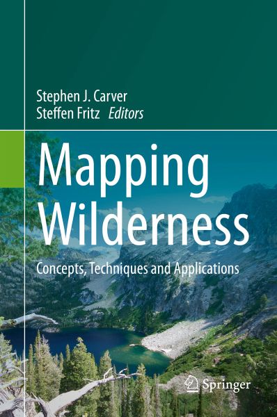
Mapping Wilderness (eBook, PDF)
Concepts, Techniques and Applications
139,09 €
inkl. MwSt.
Sofort per Download lieferbar
Mapping Wilderness (eBook, PDF)
Concepts, Techniques and Applications
- Format: PDF
- Merkliste
- Auf die Merkliste
- Bewerten Bewerten
- Teilen
- Produkt teilen
- Produkterinnerung
- Produkterinnerung
Bitte loggen Sie sich zunächst in Ihr Kundenkonto ein oder registrieren Sie sich bei
bücher.de, um das eBook-Abo tolino select nutzen zu können.
Hier können Sie sich einloggen
Sie sind bereits eingeloggt. Klicken Sie auf 2. tolino select Abo, um fortzufahren.
Bitte loggen Sie sich zunächst in Ihr Kundenkonto ein oder registrieren Sie sich bei bücher.de, um das eBook-Abo tolino select nutzen zu können.
Das E-Book Mapping Wilderness wird angeboten von Springer Netherlands und wurde mit folgenden Begriffen kategorisiert: Global Inaccessibilty;Spatial Technology;Mapping Human Impact;Wilderness;Conservation;Computational Approaches
- Geräte: PC
- ohne Kopierschutz
- eBook Hilfe
- Größe: 6.75MB
- Upload möglich
Andere Kunden interessierten sich auch für
- Vladimir KrapivinInformation Technologies for Remote Monitoring of the Environment (eBook, PDF)110,95 €
- Dewang ChenIntelligent Processing Algorithms and Applications for GPS Positioning Data of Qinghai-Tibet Railway (eBook, PDF)71,95 €
- Advances in Solid and Hazardous Waste Management (eBook, PDF)149,79 €
- Umweltinformationssysteme - Digitalisierung im Zeichen des Klimawandels und der Energiewende (eBook, PDF)109,99 €
- Gerold NoackGeodäsie für Bauingenieure und Architekten (eBook, PDF)29,99 €
- Umweltinformationssysteme - Wie trägt die Digitalisierung zur Nachhaltigkeit bei? (eBook, PDF)79,99 €
- Electric Vehicle Sharing Services for Smarter Cities (eBook, PDF)96,29 €
-
-
-
Das E-Book Mapping Wilderness wird angeboten von Springer Netherlands und wurde mit folgenden Begriffen kategorisiert:
Global Inaccessibilty;Spatial Technology;Mapping Human Impact;Wilderness;Conservation;Computational Approaches
Produktdetails
- Produktdetails
- Verlag: Springer Netherland
- Erscheinungstermin: 9. Februar 2016
- Englisch
- ISBN-13: 9789401773997
- Artikelnr.: 44598044
- Verlag: Springer Netherland
- Erscheinungstermin: 9. Februar 2016
- Englisch
- ISBN-13: 9789401773997
- Artikelnr.: 44598044
Steve Carver
Steve is a geographer with an interest in application of GIS to wilderness and wild landscapes. He is particularly interested in quality assessment, public participation and visibility analyses. He has worked widely on these topics in the UK, Europe and North America. He is Director of the Wildland Research Institute, and is based in the School of Geography, University of Leeds.
Steffen Fritz
Steffen is Head of the Earth Observation Systems group in the Ecosystems Services and Management Program at IIASA. Steffen is the main driver behind Geo-Wiki and is currently researching different incentive schemes for crowdsourcing of land cover in Kenya, Tanzania and Austria through the European Research Council funded project called CrowdLand. His PhD was on wilderness mapping under the supervision of Steve Carver.
Contents.-List of Contributors.-Preface.-Acknowledgments.-Dedication.-1. Introduction.-2. The wilderness continuum concept and its application in Australia: Lessons for modern conservation.-3. Connectivity, networks, cores and corridors.-4. The Use of Spatial Technology in USDA Forest Service Wilderness Recreation Site Surveys.-5. Wild Vistas : Progress in Computational Approaches to ‘Viewshed’ Analysis.-6. Mapping Human Impact using Crowdsourcing.-7. Visualising spaces of global inaccessibility.-8. Addressing Weak Legal Protection of Wilderness: Deliberate Choices and Drawing Lines on the Map.-9. Unraveling the Coil of the Wild: Geospatial Technology and Wilderness.-10. Wilderness areas in Romania, a case study on the South Western Carpathians.-11. Purism scale approach for wilderness mapping in Iceland.-12. Is there something wild in Austria?-13. Conclusions.-Author Index.-Subject Index
Contents.-List of Contributors.-Preface.-Acknowledgments.-Dedication.-1. Introduction.-2. The wilderness continuum concept and its application in Australia: Lessons for modern conservation.-3. Connectivity, networks, cores and corridors.-4. The Use of Spatial Technology in USDA Forest Service Wilderness Recreation Site Surveys.-5. Wild Vistas : Progress in Computational Approaches to 'Viewshed' Analysis.-6. Mapping Human Impact using Crowdsourcing.-7. Visualising spaces of global inaccessibility.-8. Addressing Weak Legal Protection of Wilderness: Deliberate Choices and Drawing Lines on the Map.-9. Unraveling the Coil of the Wild: Geospatial Technology and Wilderness.-10. Wilderness areas in Romania, a case study on the South Western Carpathians.-11. Purism scale approach for wilderness mapping in Iceland.-12. Is there something wild in Austria?-13. Conclusions.-Author Index.-Subject Index