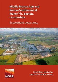
Between 2002 and 2014 MOLA Northampton carried out evaluation and excavation work over an area of approximately 49.65ha ahead of mineral extraction for the quarry at the Manor Pit, Baston, Lincolnshire. The earliest activity dated to the Neolithic with the first occupation dating to the early Bronze Age, but it was within the middle Bronze Age that significant occupation took place within the site. Part of a large co-axial field system was recorded over an area approximately c800m long and up to 310m wide. Cropmarks and the results from other archaeological excavations suggest the field system continued beyond Manor Pit for c4km and was up to 1km wide. The field system was a well-planned pastoral farming landscape at a scale suggesting that cattle and other animals were being farmed for mass trade. The site was reoccupied in the early 2nd century AD when two adjacent Roman settlements were established. One of the settlements was arranged along a routeway which led from the Car Dyke whilst the other settlement connected to this routeway by a long straight boundary. In both settlements there were a series of fields/enclosures situated in a largely open environment, with some evidence for cultivation, areas of wet ground and stands of trees. Well/watering holes lay within these enclosures and fields indicating that stock management was a key component of the local economy. In the later medieval period a trackway ran across the site, associated with which was a small enclosure, which perhaps contained fowl. During the early post-medieval period the land was subject to a final period of enclosure, with a series of small rectilinear fields established aligned with Baston Outgang Road, forming the basis of the current landscape.
Dieser Download kann aus rechtlichen Gründen nur mit Rechnungsadresse in A, B, BG, CY, CZ, D, DK, EW, E, FIN, F, GR, HR, H, IRL, I, LT, L, LR, M, NL, PL, P, R, S, SLO, SK ausgeliefert werden.

