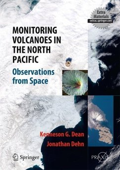
This book provides a unique visual experience, showing satellite images of volcanic eruptions worldwide and detailed observations from the North Pacific 'ring of fire'. Daily volcano monitoring and analysis from this region have resulted in one of the most detailed collections of satellite images in the world. An international team of experts has provided comprehensive coverage of the state-of-the-art techniques for real-time volcano monitoring and analysis using space-borne data, as well as satellite data acquisition and analysis, ash-dispersion models, wind field data, case studies, hazard mitigation, transmitting warnings and discussion of global impacts of eruptions.
Dieser Download kann aus rechtlichen Gründen nur mit Rechnungsadresse in A, B, BG, CY, CZ, D, DK, EW, E, FIN, F, GR, HR, H, IRL, I, LT, L, LR, M, NL, PL, P, R, S, SLO, SK ausgeliefert werden.

