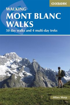
A guidebook to 50 day walks in the Mont Blanc region near Chamonix and Courmayeur, plus outlines of 4 multi-day treks around both sides of the Mont Blanc massif.
The day walks are 213 miles (320km) in length and range from high-level walks to easy summits, mountain huts, viewpoints and mountain lakes, as well as less strenuous valley walks. The multi-day treks range from 1433 miles (2252km) and include Vallorcine to Plaine Joux and Servoz, the Aiguilles Rouges and the Italian Val Ferret.
Hinweis: Dieser Artikel kann nur an eine deutsche Lieferadresse ausgeliefert werden.
The day walks are 213 miles (320km) in length and range from high-level walks to easy summits, mountain huts, viewpoints and mountain lakes, as well as less strenuous valley walks. The multi-day treks range from 1433 miles (2252km) and include Vallorcine to Plaine Joux and Servoz, the Aiguilles Rouges and the Italian Val Ferret.
- 1:100,000 sketch maps (1:200,000 scale for treks) included
- Bases include Les Houches, Chamonix, Argentiere and Courmayeur
- Information on access, accommodation and recommended mapping
- Walks are graded (1-3) according to difficulty
- Valley walks included for bad weather or rest days
Dieser Download kann aus rechtlichen Gründen nur mit Rechnungsadresse in A, D ausgeliefert werden.
Hinweis: Dieser Artikel kann nur an eine deutsche Lieferadresse ausgeliefert werden.


