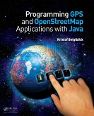
This book provides a concrete paradigm for object-oriented modeling and programming. It introduces the use of available global positioning data for the development of applications involving digital maps. The author describes the different formats of GPS data and digital maps and shows how to use recorded GPS traces to replay and display this data on a digital map. Then, he works through in detail the processing steps of obtaining dedicated data from OpenStreetMaps and how to extract a network for a simple navigation application. For each topic covered-GPS data, OpenStreetMaps, and navigation-Java code is developed that can be adapted to readers' needs and locality.
Dieser Download kann aus rechtlichen Gründen nur mit Rechnungsadresse in A, B, BG, CY, CZ, D, DK, EW, E, FIN, F, GR, HR, H, IRL, I, LT, L, LR, M, NL, PL, P, R, S, SLO, SK ausgeliefert werden.


