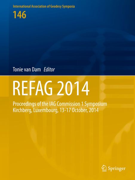
REFAG 2014 (eBook, PDF)
Proceedings of the IAG Commission 1 Symposium Kirchberg, Luxembourg, 13-17 October, 2014
Redaktion: Dam, Tonie van
113,95 €
113,95 €
inkl. MwSt.
Sofort per Download lieferbar
57 °P sammeln
113,95 €
Als Download kaufen
113,95 €
inkl. MwSt.
Sofort per Download lieferbar
57 °P sammeln
Jetzt verschenken
Alle Infos zum eBook verschenken
113,95 €
inkl. MwSt.
Sofort per Download lieferbar
Alle Infos zum eBook verschenken
57 °P sammeln
REFAG 2014 (eBook, PDF)
Proceedings of the IAG Commission 1 Symposium Kirchberg, Luxembourg, 13-17 October, 2014
Redaktion: Dam, Tonie van
- Format: PDF
- Merkliste
- Auf die Merkliste
- Bewerten Bewerten
- Teilen
- Produkt teilen
- Produkterinnerung
- Produkterinnerung
![](https://bilder.buecher.de/images/aktion/tolino/tolino-select-logo.png)
Bitte loggen Sie sich zunächst in Ihr Kundenkonto ein oder registrieren Sie sich bei
bücher.de, um das eBook-Abo tolino select nutzen zu können.
Hier können Sie sich einloggen
Sie sind bereits eingeloggt. Klicken Sie auf 2. tolino select Abo, um fortzufahren.
![](https://bilder.buecher.de/images/aktion/tolino/tolino-select-logo.png)
Bitte loggen Sie sich zunächst in Ihr Kundenkonto ein oder registrieren Sie sich bei bücher.de, um das eBook-Abo tolino select nutzen zu können.
This book series is composed of peer-reviewed proceedings of selected symposia organized by the International Association of Geodesy. It deals primarily with topics related to Geodesy as applied to the Earth Sciences : terrestrial reference frame, Earth gravity field, Geodynamics and Earth rotation, Positioning and engineering applications.
- Geräte: PC
- ohne Kopierschutz
- eBook Hilfe
- Größe: 17.66MB
Andere Kunden interessierten sich auch für
- Geodesy - the Challenge of the 3rd Millennium (eBook, PDF)233,95 €
- IGFS 2014 (eBook, PDF)113,95 €
- Sciences of Geodesy - II (eBook, PDF)113,95 €
- Geodesy for Planet Earth (eBook, PDF)435,95 €
- Earth on the Edge: Science for a Sustainable Planet (eBook, PDF)209,95 €
- Mechanics Problems in Geodynamics Part II (eBook, PDF)28,95 €
- Atmospheric Effects in Space Geodesy (eBook, PDF)53,95 €
-
-
-
This book series is composed of peer-reviewed proceedings of selected symposia organized by the International Association of Geodesy. It deals primarily with topics related to Geodesy as applied to the Earth Sciences : terrestrial reference frame, Earth gravity field, Geodynamics and Earth rotation, Positioning and engineering applications.
Dieser Download kann aus rechtlichen Gründen nur mit Rechnungsadresse in A, B, BG, CY, CZ, D, DK, EW, E, FIN, F, GR, HR, H, IRL, I, LT, L, LR, M, NL, PL, P, R, S, SLO, SK ausgeliefert werden.
Produktdetails
- Produktdetails
- Verlag: Springer International Publishing
- Seitenzahl: 246
- Erscheinungstermin: 11. April 2017
- Englisch
- ISBN-13: 9783319456294
- Artikelnr.: 53036387
- Verlag: Springer International Publishing
- Seitenzahl: 246
- Erscheinungstermin: 11. April 2017
- Englisch
- ISBN-13: 9783319456294
- Artikelnr.: 53036387
- Herstellerkennzeichnung Die Herstellerinformationen sind derzeit nicht verfügbar.
Part 1 - Theory and Concepts.- The Helmert transformation approach in network densification revisited.- A study of the role of the choice of reference system in the analysis of GNSS coordinate time series.- Validation of components of local ties.- Part 2 - Geodetic Measurement Techniques.- Combination of space-geodetic techniques on the observation level with c5++ - common nuisance parameters, data weighting and computational challenges.- The Processing of Single Differenced GNSS Data with VLBI Software.- IVS contribution to ITRF2014.- Antenna axis offsets and their impact on VLBI derived reference frames.- Scheduling VLBI observations to satellites with VieVS.- Refined Tropospheric Delay Models for CONT11.- Loading-induced deformation due to atmosphere, ocean and hydrology: Model comparisons and the impact on global SLR, VLBI and GNSS solutions.- The International Mass Loading Service.- Pre-combined GNSS-SLR Solutions: What could be the benefit for the ITRF?.- GGOS-SIM - Simulation of the Reference Frame for the Global Geodetic Observing System.- Overview of the ILRS contribution to the development of ITRF2013.- Part 3 - Regional Reference Frames.- A Spatial Analysis of Global Navigation Satellite Systems Stations within the context of the African Geodetic Reference Frame.- The development of a station coordinate prediction program to model time series from Continuous GPS stations in New Zealand.- Results from the regional AUSTRAL VLBI sessions for southern hemisphere reference frames.- Implementation of the ETRS89 in Europe: Current Status and Challenges.- Defining a Local Reference Frame using a Plate Motion Model and Deformation Model.- A Development of the Russian Geodetic Reference Network.- Weighted vs. unweighted MCs for the datum definition in regional networks.- Is Nubia plate rigid? A geodetic study of the relative motion of different cratonic areas within Africa.- Part 4 - Celestial to Terrestrial Frame Transformations.- How consistent are the current conventional celestial and terrestrial reference frames and the conventional Earth orientation parameters?.- Using quasar physics to improve the VLBI reference frame.- Towards Improved Lunar Reference Frames: LRO Orbit Determination.- Part 5 - Usage and applications of reference frames in Geosciences.- Terrestrial reference frame requirements for studies of geodynamics and climate change.- Advantage of the North America Land Data Assimilation System Phase 2 (NLDAS-2) products in modeling continental water storage driven surface displacement for the continuous Plate Boundary Observatory GPS stations.- Non-parametric estimation of seasonal variations in GPS-derived time series.- Spatial Truncation Errors in Continental Water Storage Variations Induced Displacements for Regional Study.- Part 6 - Georeferencing in Practice.- A Two-Frame National Geospatial Reference System Accounting for Geodynamics.