Sie sind bereits eingeloggt. Klicken Sie auf 2. tolino select Abo, um fortzufahren.
Bitte loggen Sie sich zunächst in Ihr Kundenkonto ein oder registrieren Sie sich bei bücher.de, um das eBook-Abo tolino select nutzen zu können.
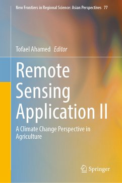
This book focuses solely on the issues of agricultural productivity analysis with advanced modeling approaches bringing solutions to food-insecure regions of the world, especially in south and southeast Asia and in Africa. Advanced modeling tools and their use in regional planning provide an outstanding opportunity to help face the challenges of climate change. The sudden effect of flash floods, drought, salinity, and sea water rises causing saltwater intrusions and its impact on agricultural production are some of the disastrous results of climate change. In this edited volume, information…mehr
This book focuses solely on the issues of agricultural productivity analysis with advanced modeling approaches bringing solutions to food-insecure regions of the world, especially in south and southeast Asia and in Africa. Advanced modeling tools and their use in regional planning provide an outstanding opportunity to help face the challenges of climate change. The sudden effect of flash floods, drought, salinity, and sea water rises causing saltwater intrusions and its impact on agricultural production are some of the disastrous results of climate change.
In this edited volume, information on climate-induced impacts for flooding, flash floods, and drought impact on agricultural crops is provided to address possible solutions for food security in south Asia, southeast Asia, and some regions of Africa. Leading-edge research methodology is presented as it relates to remote sensing applications for regional science and allied fields. In regional policy planning, agriculture andforestry play key roles in food security along with environmental conservation and depend on geo-spatial variability. Satellite remote sensing and geographical information systems have an immense potential to encompass all these factors and to catalogue the regional variability of climate change and climate economics. In the satellite remote sensing domain, advanced modeling tools, deep learning applications, and cloud-based earth engines significantly increase the flexibility of decision making and its application for regional perspectives. The result can increase agricultural and forest productivity and ensure its resilience and sustainability.
The book’s chapters introduce modeling techniques such as machine learning and fuzzy expert system using satellite remote sensing datasets based on cloud application. These methods assist regional planners to increase crop production, land use, and detection of changes in land cover in order to better understand their vulnerability toclimate-related disaster. Furthermore, remote sensing and in-depth GIS analysis are integrated with machine learning to address natural uncertainties such as flash floods, droughts, and cyclones so that emergency responses for agricultural production management can be adopted more effectively.
Tofael Ahamed is an Associate Professor from University of Tsukuba, Japan, performs research and supervises graduate students in the field of precision agriculture technology, agricultural robotics decision support systems and agricultural remote sensing. Tofael focuses on enabling smart application using Internet of Things and Artificial Intelligence in agriculture, where crop production varies spatially and temporally within the field boundaries depending on the soil, nutrient, and environmental conditions. He is also serving as one of the Associate Editors for the reputed journals of Computer and Electronics in Agriculture, Agricultural Information Research, Editorial Member for Asia-Pacific Journal of Regional Science. He is a Lead Author and Editor of number books, Guest Editor of Special Issues for Remote Sensing and Regional Application of Remote Sensing. Tofael has published in journals such as Computers and Electronics inAgriculture, BiosystemsEngineering, Transactions of ASABE, Sensors,Remote Sensing, and Journal of Japanese Society of Agricultural Machinery and Food Engineering. Tofael is recognized as one of the best faculty members for 2016 and 2022 at the University of Tsukuba, Japan for his outstanding contributions to research, education, university management and social contributions.
Inhaltsangabe
Chapter 1. Application of Remote Sensing in the Climate Change Perspectives.- Chapter 2. Land Suitability Analysis for Potential Vineyards Extension in Afghanistan at Regional Scale Using Remote Sensing Datasets.- Chapter 3. Assessment of Land Use Land Cover Changes for Predicting Vulnerable Agricultural Lands in River Basins of Bangladesh Using Remote Sensing and a Fuzzy Expert System.-Chapter 4. An Assessment of Drought Stress in Tea Estates Using Optical and Thermal Remote Sensing.- Chapter 5. A damage-based crop insurance system for flash flooding: a satellite remote sensing and econometric approach.- Chapter 6. Integrating an Expert System, GIS, and Satellite Remote Sensing to Evaluate Land Suitability for Sustainable Tea Production in Bangladesh.- Chapter 7. Shoreline Change Assessment in the Coastal Region of Bangladesh Using Tasseled Cap Transformation from Satellite Re-mote Sensing Dataset.- Chapter 8. Land Suitability and Insurance Premiums: A GIS-based Multicriteria Analysis Approach for Sustainable Rice Production.- Chapter 9. Transecting cyclones landfall on deltaic shorelines for landform alternation assessment using deep learning models.- Chapter 10. Vegetation Phenology Analysis for Drought Severity Classification in Myanmer Using Google Earth Engine and Satellite Remote Sensing.- Chapter 11. Conclusions: Concluding Remarks.
Es gelten unsere Allgemeinen Geschäftsbedingungen: www.buecher.de/agb
Impressum
www.buecher.de ist ein Internetauftritt der buecher.de internetstores GmbH
Geschäftsführung: Monica Sawhney | Roland Kölbl | Günter Hilger
Sitz der Gesellschaft: Batheyer Straße 115 - 117, 58099 Hagen
Postanschrift: Bürgermeister-Wegele-Str. 12, 86167 Augsburg
Amtsgericht Hagen HRB 13257
Steuernummer: 321/neu