65,95 €
65,95 €
inkl. MwSt.
Sofort per Download lieferbar
payback
33 °P sammeln
65,95 €
65,95 €
inkl. MwSt.
Sofort per Download lieferbar

Alle Infos zum eBook verschenken
payback
33 °P sammeln
Als Download kaufen
65,95 €
inkl. MwSt.
Sofort per Download lieferbar
payback
33 °P sammeln
Jetzt verschenken
65,95 €
inkl. MwSt.
Sofort per Download lieferbar

Alle Infos zum eBook verschenken
payback
33 °P sammeln
  • Format: PDF

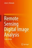
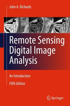
Remote Sensing Digital Image Analysis provides the non-specialist with a treatment of the quantitative analysis of satellite and aircraft derived remotely sensed data. Since the first edition of the book there have been significant developments in the algorithms used for the processing and analysis of remote sensing imagery; nevertheless many of the fundamentals have substantially remained the same. This new edition presents material that has retained value since those early days, along with new techniques that can be incorporated into an operational framework for the analysis of remote…mehr

  • Geräte: PC
  • ohne Kopierschutz
  • eBook Hilfe
  • Größe: 24.38MB
Produktbeschreibung
Remote Sensing Digital Image Analysis provides the non-specialist with a treatment of the quantitative analysis of satellite and aircraft derived remotely sensed data. Since the first edition of the book there have been significant developments in the algorithms used for the processing and analysis of remote sensing imagery; nevertheless many of the fundamentals have substantially remained the same. This new edition presents material that has retained value since those early days, along with new techniques that can be incorporated into an operational framework for the analysis of remote sensing data. The book is designed as a teaching text for the senior undergraduate and postgraduate student, and as a fundamental treatment for those engaged in research using digital image processing in remote sensing. The presentation level is for the mathematical non-specialist. Since the very great number of operational users of remote sensing come from the earth sciences communities, the text is pitched at a level commensurate with their background.

Each chapter covers a different aspect of the analysis of digital remotely sensed data, without an excessively detailed mathematical treatment of computer based algorithms, but in a manner conductive to an understanding of their capabilities and limitations. Problems conclude each chapter.


Dieser Download kann aus rechtlichen Gründen nur mit Rechnungsadresse in A, B, BG, CY, CZ, D, DK, EW, E, FIN, F, GR, HR, H, IRL, I, LT, L, LR, M, NL, PL, P, R, S, SLO, SK ausgeliefert werden.

Autorenporträt
John Richards has been active in remote sensing research for the past 30 years, mainly in image analysis and imaging radar and is the author of four books, all published by Springer. He is an electrical engineering graduate from the University of New South Wales, Australia, and a Life Fellow of the IEEE. John was foundation Director of the Centre for Remote Sensing at the University of New South Wales in the 1980s, and has had a career that has taken him through teaching and research in remote sensing and engineering. He has also served in senior academic administration including as Dean of the College of Engineering and Computer Science, and Vice-President of the Australian National University. John is an Emeritus Professor of both the Australian National University and the University of New South Wales.