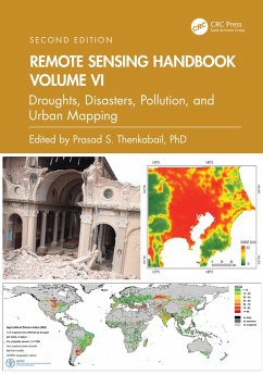
Remote Sensing Handbook, Volume VI (eBook, PDF)
Droughts, Disasters, Pollution, and Urban Mapping
Redaktion: Thenkabail, Prasad S.
52,95 €
52,95 €
inkl. MwSt.
Sofort per Download lieferbar
26 °P sammeln
52,95 €
Als Download kaufen
52,95 €
inkl. MwSt.
Sofort per Download lieferbar
26 °P sammeln
Jetzt verschenken
Alle Infos zum eBook verschenken
52,95 €
inkl. MwSt.
Sofort per Download lieferbar
Alle Infos zum eBook verschenken
26 °P sammeln
Remote Sensing Handbook, Volume VI (eBook, PDF)
Droughts, Disasters, Pollution, and Urban Mapping
Redaktion: Thenkabail, Prasad S.
- Format: PDF
- Merkliste
- Auf die Merkliste
- Bewerten Bewerten
- Teilen
- Produkt teilen
- Produkterinnerung
- Produkterinnerung
Bitte loggen Sie sich zunächst in Ihr Kundenkonto ein oder registrieren Sie sich bei
bücher.de, um das eBook-Abo tolino select nutzen zu können.
Hier können Sie sich einloggen
Sie sind bereits eingeloggt. Klicken Sie auf 2. tolino select Abo, um fortzufahren.
Bitte loggen Sie sich zunächst in Ihr Kundenkonto ein oder registrieren Sie sich bei bücher.de, um das eBook-Abo tolino select nutzen zu können.
Volume VI of the Remote Sensing Handbook , Second Edition, is focused on the use of remote sensing in the assessment and monitoring of droughts, dry lands, biomass burning, natural disasters, and urban studies and nightlights. This book is an essential resource for researchers at all levels interested in using remote sensing.
- Geräte: PC
- mit Kopierschutz
- eBook Hilfe
- Größe: 151.86MB
Andere Kunden interessierten sich auch für
- Remote Sensing Handbook, Volume VI (eBook, ePUB)52,95 €
- Remote Sensing Handbook, Volume IV (eBook, PDF)52,95 €
- Remote Sensing Handbook, Volume II (eBook, PDF)52,95 €
- Remote Sensing Handbook, Volume I (eBook, PDF)52,95 €
- Remote Sensing Handbook, Volume V (eBook, PDF)52,95 €
- Spaceborne Synthetic Aperture Radar Remote Sensing (eBook, PDF)60,95 €
- Maged MarghanyRemote Sensing and Image Processing in Mineralogy (eBook, PDF)68,95 €
-
-
-
Volume VI of the Remote Sensing Handbook, Second Edition, is focused on the use of remote sensing in the assessment and monitoring of droughts, dry lands, biomass burning, natural disasters, and urban studies and nightlights. This book is an essential resource for researchers at all levels interested in using remote sensing.
Dieser Download kann aus rechtlichen Gründen nur mit Rechnungsadresse in A, B, BG, CY, CZ, D, DK, EW, E, FIN, F, GR, HR, H, IRL, I, LT, L, LR, M, NL, PL, P, R, S, SLO, SK ausgeliefert werden.
Produktdetails
- Produktdetails
- Verlag: Taylor & Francis
- Seitenzahl: 510
- Erscheinungstermin: 29. November 2024
- Englisch
- ISBN-13: 9781040203453
- Artikelnr.: 72284587
- Verlag: Taylor & Francis
- Seitenzahl: 510
- Erscheinungstermin: 29. November 2024
- Englisch
- ISBN-13: 9781040203453
- Artikelnr.: 72284587
Dr. Prasad S. Thenkabail, Senior Scientist (ST), United States Geological Survey (USGS), is a world-recognized expert in remote sensing science with major contributions in the field for nearly 40 years. He has made the list of the world's top 1% of scientists across 22 scientific fields and 176 sub-fields. Dr. Thenkabail has conducted pioneering research in hyperspectral remote sensing of vegetation, global croplands, and their water use for food security. He obtained his PhD from the Ohio State University in 1992 and has 168 peer-reviewed publications including 15 books, including this six-volume set, and over 15 major data releases such as the Landsat-derived global cropland extent product @ 30m and Landsat-derived rainfed and irrigated cropland area product @ 30 m (LGRIP30). He was recognized as a Fellow of the American Society of Photogrammetry and Remote Sensing (ASPRS) in 2023. His scientific papers have won several awards for demonstrating world-class, highest-quality research. He was a Landsat Science Team Member (2007-2011).
Part I: Droughts and Drylands. 1. Drought Monitoring Using Vegetation
Health Indices. 2. Studies using Space-derived Vegetation and Biophysical
Products: A Global Perspective. 3. Remote Sensing of Drought:
Satellite-Based Monitoring Tools for the United States. 4. Regional Drought
Monitoring Based on Multi-Sensor Remote Sensing. 5. Land Degradation
Assessment and Monitoring of Drylands. Part II: Disasters. 6. Disasters:
Risk Assessment, Management and Post-Disaster Studies Using Remote Sensing.
7. Humanitarian Emergencies: Causes, Traits and Impacts as Observed by
Remote Sensing. Part III: Volcanoes. 8. Remote Sensing of Volcanoes. Part
IV: Fires. 9. Satellite-derived Nitrogen Dioxide Variations from Biomass
Burning in a Subtropical Evergreen Forest, Northeast India. 10. Remote
Sensing-Based Mapping and Monitoring of Coal Fires. Part V: Urban. 11.
Urban Growth and Climatic Mapping of Mega Cities: Multi-Sensor Approach.
12. High-Resolution Remote Sensing and Visibility Analysis Method for Smart
Environment Design. Part VI: Nightlights. 13. Nighttime Light Remote
Sensing -- Monitoring Human Societies from Outer Space. Part VII: Summary
and Synthesis for Volume VI. 14. Remote Sensing Handbook, Volume VI:
Droughts, Disasters, Pollution, and Urban Mapping.