Dr. Krishna Vadrevu is the Deputy Program Manager for the Land Cover/Land Use Change (LCLUC) Program at the Earth Science Division of NASA's Science Mission Directorate. He is also leading the South/Southeast Research Initiative (www.sari.umd.edu), a regional initiative of the NASA LCLUC program. He has more than 20 years of research experience in satellite remote sensing. Dr. Vadrevu gained his Ph.D. in 2000 while working at the Indian Space Research Organization (ISRO), India. He worked with the interdisciplinary team of agricultural scientists at the Ohio Agricultural Research and Development Center (OARDC), the Ohio State University, USA, on remote sensing of agroecosystems and organic farming field experiments (2001-2010). He then focused on various LCLUC projects, including vegetation fires in developing countries at the University of Maryland, College Park (2010-2016). He joined NASA in 2016. Dr. Vadrevu served as PI and Co-I on projects funded by NASA, USDA, and NSF on LCLUC, biomass burning/greenhouse gas emissions, land-atmospheric interactions, agricultural carbon cycling, and ecosystem sustainability. He has more than a hundred publications in peer-reviewed journals and books. Dr. Thuy Le Toan is the Head of the research team in Remote Sensing in the Center for the Study of the Biosphere from Space (CESBio), a joint research Centre of the University of Toulouse, the National Center of Scientific Research (CNRS), and the National Center of Spatial Studies (CNES), France. Her current interest is on the use of Radar Earth Observation data to monitor terrestrial ecosystems, focusing on their role in the carbon budget and climate change, particularly in the tropics. She is P.I. of the ESA Biomass mission and currently Co-chair of the Biomass Mission Advisory Group. Moreover, she has been co-lead of the Asia-Rice Initiative. Also, she is currently involved in projects on forest biomass and rice agriculture and the effects of climate change on these ecosystems. She has supervised numerous Ph.D. students and post-doc researchers at the University Paul Sabatier, Toulouse, France, and international collaboration in Europe, the U.S., and Asia. In addition, she has been lecturing and conducting training courses on SAR Remote Sensing at Universities and Research organizations in Europe, South America, and many countries in Asia. Dr. Shibendu Shankar Ray was the Director of the Mahalanobis National Crop Forecast Centre, Ministry of Agriculture & Farmers' Welfare, India. He worked for more than 20 years in the Space Applications Centre, Indian Space Research Organization (ISRO) on Remote Sensing Applications in Agriculture. He led a team of scientists and researchers on various national-level operational agricultural applications, including Crop Forecasting, Drought Assessment, Crop Insurance, Horticultural Assessment and Development, and Crop Intensification. His sudden demise on May 04th, 2021, extremely saddened us. Although he was a co-Editor in this book project, unfortunately, he couldn't see the project to fruition. Dr. Christopher Justice is a Professor at the Department of Geographical Sciences, University of Maryland, College Park, USA. He has 40 years of research experience in remote sensing. His current research is on land cover and land-use change and global agricultural monitoring using remote sensing. He is the Chief Scientist for NASA HARVEST, NASA's Applied Sciences program on agricultural monitoring. He serves as Project Scientist for the NASA LCLUC Program, the Land Discipline Lead for the NASA MODIS, and the Suomi-NPP VIIRS Science Team. In addition, he is the Co-Chair of the international GEO Global Agricultural Monitoring Initiative (GEOGLAM), and Chair of the international Global Observations of Forest and Land Use Dynamics (GOFC-GOLD) program.
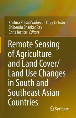
Chapter 1. Agricultural Information Needs and Research Priorities for Remote Sensing in South and Southeast Asian Countries (Krishna Vadrevu, Thuy Le Toan, Shibendu Ray and Chris Justice).- Part I: International, Regional and National Programs in Agriculture.- Chapter 2. South/Southeast Asia Research Initiative and Agricultural Research Projects (Krishna Vadrevu).- Chapter 3. The NASA Harvest program on Agriculture and Food Security (Inbal Becker-Reshef, Varaprasad Bandaru, Brian Barker,Sylvain Coutu, Jillian M Deines, Bradley Doorn, Gary Eilerts, Belen Franch, Antonio Sanchez Galvez, Mehdi Hosseini1, Michael Humber, Greg Husak, Kaiyu Guan, Christina Justice, John Keniston, Hannah Kerner, Mary Mitkish, Kara Mobley, Blake Munshell, Catherine Nakalembe, Estefania Puricelli, Ritvik Sahajpal, Sergii Skakun, Eric Vermote, Alyssa Whitcraft, Matthew Hansen, Bill Salas, and Christopher Justice).- Chapter 4. Asia-RiCE: Collaborative framework for Rice Crop Management in Asia (Shinichi Sobue, and Lal Samarakoon, Matthew Steventon, Kei Oyoshi, Thuy Le Toan).- Chapter 5. Rice Growth Outlook using Satellite-Based Information in Southeast Asia (Kei Oyoshi, Shinichi Sobue, and Shoji Kimura).- Chapter 6. RIICE - The service and its operational use (Francesco Holecz, Tri Setiyono, Massimo Barbieri, Francesco Collivignarelli, Luca Gatti, Michael Anthony, Renaud Mathieu, Emma Quicho, Aileen Maunahan, Sushree Satapathy, Deiveegan Murugesan, Ponnurangam Ganesan, Alice Laborte, Mary Rose Mabalay, Jovino de Dios, Eduardo Jimmy Quilang, Men Sothy, Pich Rothana, Vang Seng, Ngin Chhay, Chharom Chin, Phuong Do Minh, Hung Bui Vang, Vo Quoc Tuan, Tuong Chi Quang, Vo Quang Minh, Ninh Nguyen Hong, Sellaperumal Pazhanivela, Bernard Zaugg).- Chapter 7. The Philippine Rice Information System (PRiSM): An operational monitoring and information system on rice (Mary Rose Mabalay, Jeny Raviz, Elmer Alosnos, Massimo Barbieri, Emma Quicho, Jesiree Elena Ann Bibar, Mabel Barroga, Meriam Coñado, Pristine Mabalot, Jean Rochielle Mirandilla, Arturo Arocena, Juanito Maloom, Gerald Bello, Ederlina Cariño, Gina de Mesa, Norlyn Detoito, Harvey Gonzaga, Nonilon Martin, Mitzi Philline Tejada, Mary Jane Vives, Marjie Lastimoso, Darlynne Kaye Bumagat, Henry Cayaban, Michael Barroga, Ruvicyn Bayot, Abel Melquiades Callejo, Neale Marvin Paguirigan, Mary Anne Gutierrez, Gene Christhopher Romuga, Frances Grace Amanquiton, Janica Gan, Ethel Princess Banasihan, Creigton Czar Guevarra, Arnel Rala, Hilario Yonson, Michael Malonzo, Glorie Belle Berja, Consolacion Diaz, Luis Alejandre Tamani, Ronald Gregory Roces, Sonia Asilo, Jovino de Dios, Tri Deri Setiyono, Francesco Holecz, Eduardo Jimmy Quilang, and Alice Laborte).- Chapter 8. An Initiation of National Institute for Precision Agriculture Research Network: A case of Thailand Research Fund and Thailand Science Research and Innovation (Attachai Jintrawet, Prapaporn Khopaibool, Thongchai Suwansichon).- Part II: Crop Mapping, Monitoring, Yield and Water Resources.- Chapter 9. Varietal Discrimination, Acreage Estimation and Yield Prediction of Basmati Aromatic Rice in North-Western India Using Satellite Data (Dharmesh Verma, A. N. Singh, Manik H. Kalubarme, G.P. Saroha, Ritesh Sharma and Brajendra).- Chapter 10. Mapping Smallholder Yields Using Planet and Sentinel-2 Satellite Data (Meha Jain, Weiqi Zhou, Ambica Paliwal).- Chapter 11. A Data-analytical way of estimating Rice crop Yield: Economic and Water related causative factors (Nilabja Ghosh, M. Rajeshwor, Alka Singh, Satarupa Chakravarty).- Chapter 12. Rice Monitoring in Southeast Asia Using Earth Observation Satellite Data (Kei Oyoshi, Lal Samarakoon, Shin-chi Sobue, Sotheavy Meas, Men Sothy, Shoji Kimura, Rizatus Shofiyati, Tanita Suepa, Kanjana Koedkurang, Yootthapoom Potiracha6,, Sutinee Sihirunwong, Patiwet Chalearmpong, Panu Nuangjumnong, Damrongrit Niammuad, and Soravis Supavetch, Phung Hoang-Phi,Nguyen Lam-Dao,and Thuy Le Toan).- Chapter 13. Crop LAI and biomass estimation from different polarization modes of simulated NISAR data (Dipankar Mandal, Vineet Kumar, Avik Bhattacharya and Y. S. Rao).- Chapter 14. Pixel-based evaluation of rice production and related greenhouse gas emissions in the Mekong Delta integrating SAR data and ground observations (Hironori Arai, Wataru Takeuchi, Kei Oyoshi, Lam Dao Nguyen, Tamon Fumoto, Kazuyuki Inubushi and Thuy Le Toan).- Chapter 15. The utilization of satellite data to support wet season rice production policy in Thailand: A review of practices and opportunities (Chitnucha Buddhaboon, Panu Neungchumnong, Thewin Kaeomuangmoon and Attachai Jintrawet).- Chapter 16. Productivity, damages, and losses of rice in Cambodia: past, present and future trends in the Mekong and Tonle Sap regions (Serey Sok, Hoeurn Cheb, Nyda Chhinh and Pheakdey Nguonphan).- Chapter 17. Rice growth stage monitoring and yield estimation in the Vietnamese Mekong Delta using multi-temporal Sentinel-1 data (Phung Hoang-Phi, Nguyen Lam-Dao, VuNguyen-Van-Anh, Thanh Nguyen-Kim, Thuy Le Toan, and Tien Pham-Duy).- Chapter 18. Agricultural Drought Assessment using Remote Sensing, with special emphasis on India (S. S. Ray, Shalini Saxena, K. Choudhary, Preeti Tahlani and Krishna Vadrevu).- Chapter 19. Role of remote sensing in assessing total water storage and evapotranspiration for croplands in the Mekong river basin (Venkataramana Sridhar, Syed Azhar Ali).- Part III: Prediction and Modeling.- Chapter 20. Random forests for early rice yield prediction from time series of remote sensed data (Nguyen-Thanh Son, Chi-Farn Chen, Cheng-Cru Chen).- Chapter 21. Assessment of Climate Change Impact on Rice production over South and Southeast Asia under CMIP6 climate scenarios (Tzu-Shun Lin and Atul K Jain).- Chapter 22. Application of Geo-CropSim framework for Rainfed Sugarcane Yield Assessment in Thailand (Varaprasad Bandaru, Pallavi Cherumalli, Sergii Skakun, Kristofer Lasko, Sukunya Yampracha).- Chapter 23. Crop yield assessment of smallholder farms using remote sensing and simulation modeling (Vinay Kumar Sehgal, Debasish Chakraborty, Rajkumar Dhakar, Joydeep Mukherjee, Rabi Narayan Sahoo).- Part IV: Agricultural Land Cover/Land Use Changes.- Chapter 24. Agricultural intensity assessment in Punjab India using food security metrics and remote sensing data (Krishna Vadrevu, Emily Casadaban, Aditya Eaturu, Samuel Amborski and Sumalika Biswas).- Chapter 25. Agricultural intensity assessment in Punjab India using food security metrics and remote sensing data (Bhavani P, Ripan Das, Mariam Jamilah, Vijay P.Kanawade, Chandrashekhar Biradar and P.S. Roy).- Chapter 26. Nexus of Urbanization and Changes in Agricultural Land in Bangladesh (Mst. Ilme Faridatul, Md. Sarfaraz Gani Adnan and Ashraf Dewan).- Chapter 27. The Kandyan Home Garden - Sustainable Agricultural Ecosystem in Sri Lanka (A.R. Gunawardena and T.T. Fernando).- Chapter 28. Agricultural transformation, and deforestation in Shan State, Myanmar (Sumalika Biswas andKrishna Prasad Vadrevu).- Chapter 29. Agricultural fires in South Asian Countries and Implications (Krishna Vadrevu, Emily Casadaban, Aditya Eaturu and Sumalika Biswas).- Chapter 30. Agricultural Land-Use Trends in Vietnam 1990 - 2020 (Stephen J. Leisz, Nghiem Thi Tuyen, Ngo The An, Nong Duong, Nguyen Thi Bich Yen).- Chapter 31. Scenario-Based Land-Cover/Land-Use Change Modeling of Future Agricultural Land Conversion in Dong Thap, Vietnam (Keelin Haynes, Jessica L. McCarty, Stanley W. Toops, Bui Thi Minh Ha, Jarrod W. Brown, Peter Potapov, Svetlana Turubanova, Quyen Nguyen, Peou Touch, and Justin J. Fain).- Chapter 32. Extreme Development of Dragon Fruit Agriculture with Nighttime Lighting in Southern Vietnam (Shenyue Jia, Son V. Nghiem, Seung-Hee Kim, Laura Krauser, Andrea E. Gaughan, Forest R. Stevens, Menas Kafatos, and Khanh D. Ngo).- Chapter 33. Agricultural Land Use/Cover Changes in the Vientiane, Laos (Chittana Phompila, Vongphet Sihapanya, Bakham Chanthavong, Sithong Thongmanivong, Phung Van Khoa, Keigo Noda and Krishna Prasad Vadrevu).- Chapter 34. Color Features Based Model for Land Cover Identification and Agriculture Monitoring with Satellite Images (Shruti Gupta and Dharmendra Singh).- Index.


![Land Use and Land Cover Mapping in Europe (eBook, PDF) Land Use and Land Cover Mapping in Europe (eBook, PDF)]() Land Use and Land Cover Mapping in Europe (eBook, PDF)73,95 €
Land Use and Land Cover Mapping in Europe (eBook, PDF)73,95 €![Land Cover Classification of Remotely Sensed Images (eBook, PDF) Land Cover Classification of Remotely Sensed Images (eBook, PDF)]() S. JenickaLand Cover Classification of Remotely Sensed Images (eBook, PDF)97,95 €
S. JenickaLand Cover Classification of Remotely Sensed Images (eBook, PDF)97,95 €![Remote Sensing Land Surface Changes (eBook, PDF) Remote Sensing Land Surface Changes (eBook, PDF)]() Felix KoganRemote Sensing Land Surface Changes (eBook, PDF)113,95 €
Felix KoganRemote Sensing Land Surface Changes (eBook, PDF)113,95 €![Coral Reef Remote Sensing (eBook, PDF) Coral Reef Remote Sensing (eBook, PDF)]() Coral Reef Remote Sensing (eBook, PDF)113,95 €
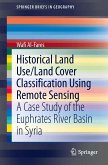
Coral Reef Remote Sensing (eBook, PDF)113,95 €![Historical Land Use/Land Cover Classification Using Remote Sensing (eBook, PDF) Historical Land Use/Land Cover Classification Using Remote Sensing (eBook, PDF)]() Wafi Al-FaresHistorical Land Use/Land Cover Classification Using Remote Sensing (eBook, PDF)40,95 €
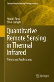
Wafi Al-FaresHistorical Land Use/Land Cover Classification Using Remote Sensing (eBook, PDF)40,95 €![Quantitative Remote Sensing in Thermal Infrared (eBook, PDF) Quantitative Remote Sensing in Thermal Infrared (eBook, PDF)]() Huajun TangQuantitative Remote Sensing in Thermal Infrared (eBook, PDF)89,95 €
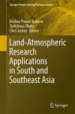
Huajun TangQuantitative Remote Sensing in Thermal Infrared (eBook, PDF)89,95 €![Land-Atmospheric Research Applications in South and Southeast Asia (eBook, PDF) Land-Atmospheric Research Applications in South and Southeast Asia (eBook, PDF)]() Land-Atmospheric Research Applications in South and Southeast Asia (eBook, PDF)161,95 €
Land-Atmospheric Research Applications in South and Southeast Asia (eBook, PDF)161,95 €