52,95 €
52,95 €
inkl. MwSt.
Sofort per Download lieferbar
payback
26 °P sammeln
52,95 €
52,95 €
inkl. MwSt.
Sofort per Download lieferbar

Alle Infos zum eBook verschenken
payback
26 °P sammeln
Als Download kaufen
52,95 €
inkl. MwSt.
Sofort per Download lieferbar
payback
26 °P sammeln
Jetzt verschenken
52,95 €
inkl. MwSt.
Sofort per Download lieferbar

Alle Infos zum eBook verschenken
payback
26 °P sammeln
  • Format: ePub

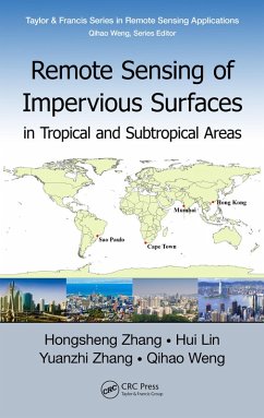
Urban impervious surfaces include any man-made surfaces such as roads, parking lots, and rooftops which prevent rainwater from infiltrating into the soil. This book investigates the state of the art of remote sensing of impervious surfaces by summarizing the environmental and socioeconomic impacts of impervious surfaces, the methods of impervious surface estimation using remote sensing technology, and challenges of remote sensing in tropical and subtropical regions. It pays special attention to the seasonal effects of impervious surface estimation in tropical and subtropical areas.

  • Geräte: eReader
  • mit Kopierschutz
  • eBook Hilfe
  • Größe: 3.39MB
Produktbeschreibung
Urban impervious surfaces include any man-made surfaces such as roads, parking lots, and rooftops which prevent rainwater from infiltrating into the soil. This book investigates the state of the art of remote sensing of impervious surfaces by summarizing the environmental and socioeconomic impacts of impervious surfaces, the methods of impervious surface estimation using remote sensing technology, and challenges of remote sensing in tropical and subtropical regions. It pays special attention to the seasonal effects of impervious surface estimation in tropical and subtropical areas.

Dieser Download kann aus rechtlichen Gründen nur mit Rechnungsadresse in A, B, BG, CY, CZ, D, DK, EW, E, FIN, F, GR, HR, H, IRL, I, LT, L, LR, M, NL, PL, P, R, S, SLO, SK ausgeliefert werden.

Autorenporträt
Hongsheng Zhang is currently a research assistant professor at the Institute of Space and Earth Information Science, The Chinese University of Hong Kong. He received a B.Eng in computer science and technology in 2007, and an M.Eng in computer applications technology in 2010 from South China Normal University, Guangzhou. In addition, he received a Ph.D in earth system and geoinformation science from The Chinese University of Hong Kong in 2013. Currently, his research interests are on remote sensing applications in tropical and subtropical areas, with a focus on urban environment and natural disasters monitoring, using multi-source remote sensing data fusion and image pattern recognition techniques.

Hui Lin is Chen Shupeng professor of geoinformation science and director of the Institute of Space and Earth Information Science of The Chinese University of Hong Kong. He is director of the Hong Kong Base of National Remote Sensing Center of China. He graduated from the Wuhan Technical University of Surveying and Mapping in 1980, and received his M.Sc from the Graduate School of Chinese Academy of Sciences in 1983, and his Ph.D. from the University at Buffalo in 1992. His research interests include microwave remote sensing image processing and analysis, virtual geographic environments (VGE), spatial database and data mining, spatially integrated humanities, and social science.

Yuanzhi Zhang is a professor of environmental remote sensing, remote sensing of lunar and planetary science at the Key Laboratory of Lunar and Deep-Space Exploration, Chinese Academy of Sciences. He is also a research fellow and adjunct professor at the Center for Housing Innovations, Chinese University of Hong Kong. He received his Ph.D. in Technology at Helsinki University of Technology (HUT) in Finland in 2005, a postgraduate diploma in remote sensing and geological survey at the International Institute for Geo-Informa