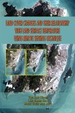
This book discusses the fundamentals of land-use and land-cover characterization, mapping, and monitoring using remote sensing technology. After covering the basic concepts and history, it presents state-of-the-art methods and techniques in data acquisition, preprocessing, classification, image interpretation, and accuracy assessment. It also includes examples of land-cover applications at global, continental, and national scales around the world. A synopsis of current knowledge and new frontiers in remote sensing of land use and land cover, this book highlights the need for better land-use and land-cover change information at multiple scales.
Dieser Download kann aus rechtlichen Gründen nur mit Rechnungsadresse in A, B, BG, CY, CZ, D, DK, EW, E, FIN, F, GR, HR, H, IRL, I, LT, L, LR, M, NL, PL, P, R, S, SLO, SK ausgeliefert werden.


