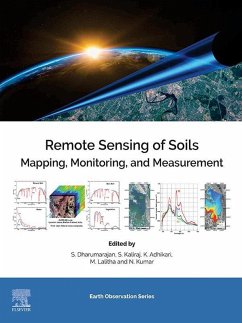
Site-specific research and case studies are described throughout with geographical and demographical data, current scientific issues, impacts, solutions and societal benefits, thus providing readers from multi-disciplinary backgrounds the tools they need to successful map, analyze and monitor soils.
- Covers multispectral, hyperspectral and SAR remote sensing analysis of soil properties, soil moisture, soil salinity, and soil organic matters, etc., in spatio-temporal scale
- Includes a section on digital soil mapping, including integrated RS, GIS and insitu surveyed data analysis for digital soil mapping using widely accepted models and approaches
- Ideal for readers in the soil sciences, remote sensing, geoinformatics, geomatics, civil and water resource engineering, geography, agriculture, disaster management, and earth and environmental sciences
Dieser Download kann aus rechtlichen Gründen nur mit Rechnungsadresse in A, B, BG, CY, CZ, D, DK, EW, E, FIN, F, GR, HR, H, IRL, I, LT, L, LR, M, NL, PL, P, R, S, SLO, SK ausgeliefert werden.

