46,95 €
46,95 €
inkl. MwSt.
Sofort per Download lieferbar
payback
23 °P sammeln
46,95 €
46,95 €
inkl. MwSt.
Sofort per Download lieferbar

Alle Infos zum eBook verschenken
payback
23 °P sammeln
Als Download kaufen
46,95 €
inkl. MwSt.
Sofort per Download lieferbar
payback
23 °P sammeln
Jetzt verschenken
46,95 €
inkl. MwSt.
Sofort per Download lieferbar

Alle Infos zum eBook verschenken
payback
23 °P sammeln
  • Format: ePub

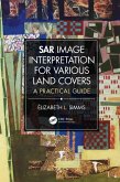
Written as an introduction to the visual interpretation of synthetic aperture radar (SAR) images for most types of land use and land cover (LULC), this book will help practitioners and students to familiarize themselves with, and to expand their knowledge of, geographic information data conveyed from radar images and unique context of terrains.

  • Geräte: eReader
  • ohne Kopierschutz
  • eBook Hilfe
  • Größe: 41.53MB
Produktbeschreibung
Written as an introduction to the visual interpretation of synthetic aperture radar (SAR) images for most types of land use and land cover (LULC), this book will help practitioners and students to familiarize themselves with, and to expand their knowledge of, geographic information data conveyed from radar images and unique context of terrains.

Dieser Download kann aus rechtlichen Gründen nur mit Rechnungsadresse in A, B, BG, CY, CZ, D, DK, EW, E, FIN, F, GR, HR, H, IRL, I, LT, L, LR, M, NL, PL, P, R, S, SLO, SK ausgeliefert werden.

Autorenporträt
Élizabeth L. Simms is Associate Professor in the Department of Geography at Memorial University. She received her MSc degree from the Université de Sherbrooke and completed her PhD from the Université de Montréal. She worked for the Application Division of the Canada Centre for Remote Sensing on research projects related to the ocean, coastal environment, agriculture, and natural resource monitoring. In 1990, she joined the Department of Geography, Memorial University. Her academic activities include teaching courses in remote sensing, introductory geography information sciences, field methods, research design, and quantitative methods. Dr. Simms is currently coordinator of the Diploma in Geographic Information Sciences. Dr. Simms supervised graduate students in research based on radar and multispectral images, applied to mapping of coastal ice, boundary environments such as the coastal zone, Arctic tree line and glacier ice margins. Her research interest include developing teaching material to assist with learning of land use and land cover interpretation from RADARSAT-2 and COSMO- SkyMed images, developed area intensity classification from synthetic aperture radar, and the evaluation of remote sensing classification schemes for the representation of landscape features described through Aboriginal language.