84,95 €
84,95 €
inkl. MwSt.
Sofort per Download lieferbar
payback
42 °P sammeln
84,95 €
84,95 €
inkl. MwSt.
Sofort per Download lieferbar

Alle Infos zum eBook verschenken
payback
42 °P sammeln
Als Download kaufen
84,95 €
inkl. MwSt.
Sofort per Download lieferbar
payback
42 °P sammeln
Jetzt verschenken
84,95 €
inkl. MwSt.
Sofort per Download lieferbar

Alle Infos zum eBook verschenken
payback
42 °P sammeln
  • Format: PDF

The Niger delta with its gentle slope and low elevation is extremely sensitive to effects of climate change. Its adaptive capacity is the second lowest in terms of socio-economic development in Nigeria. Quantitative studies on developing measures for coastal planning and management have been limited by data availability. The use of satellite data can help bridge the data gap by providing ancillary data that can be used to quantify the effects of SLR in the Niger delta. This thesis uses satellite data as the main source for hydrodynamic modelling and GIS analysis to assess the impact of SLR on…mehr

Produktbeschreibung
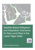
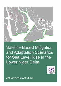
The Niger delta with its gentle slope and low elevation is extremely sensitive to effects of climate change. Its adaptive capacity is the second lowest in terms of socio-economic development in Nigeria. Quantitative studies on developing measures for coastal planning and management have been limited by data availability. The use of satellite data can help bridge the data gap by providing ancillary data that can be used to quantify the effects of SLR in the Niger delta. This thesis uses satellite data as the main source for hydrodynamic modelling and GIS analysis to assess the impact of SLR on the Niger delta in an integrated way that will lead to practical recommendations for adaptation.


Dieser Download kann aus rechtlichen Gründen nur mit Rechnungsadresse in A, B, BG, CY, CZ, D, DK, EW, E, FIN, F, GR, HR, H, IRL, I, LT, L, LR, M, NL, PL, P, R, S, SLO, SK ausgeliefert werden.

Autorenporträt
Zahrah N. Musa, graduated with a B.ENG in Electronics/Elecrotronics Engineering. An extensive curriculum in electromagnetic waves during the bachelors enabled her to pursue her interest in Remote Sensing/GIS as a PgD. As part of her work as a scientific officer with the National Space Research and Development Agency (NARSDA), she undertakes digital image processing of satellite imagery and has been involved in projects ranging from urban growth analysis to hazards and disaster analysis for environmental management. The interest in space sciences led to an MSc in Space Studies increasing her knowledge base in earth observation and satellite technology. As a MSc graduate of Hydro-informatics, she combined her fascination for space technology applications in earth observation with modelling and information technology to undertake this PhD research to enable 'Living with Sea level Rise on the subsiding Nigeria delta. Her interests included: hydrological/hydraulic modelling, geo-statistical analysis, spatio-temporal change analysis, programming for data analysis, and hazard mapping.