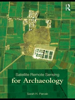
Satellite Remote Sensing for Archaeology (eBook, PDF)
Versandkostenfrei!
Sofort per Download lieferbar
48,95 €
inkl. MwSt.
Weitere Ausgaben:

PAYBACK Punkte
24 °P sammeln!
This handbook is the first comprehensive overview of the field of satellite remote sensing for archaeology and how it can be applied to ongoing archaeological fieldwork projects across the globe. It provides a survey of the history and development of the field, connecting satellite remote sensing in archaeology to broader developments in remote sensing, archaeological method and theory, cultural resource management, and environmental studies. With a focus on practical uses of satellite remote sensing, Sarah H. Parcak evaluates satellite imagery types and remote sensing analysis techniques spec...
This handbook is the first comprehensive overview of the field of satellite remote sensing for archaeology and how it can be applied to ongoing archaeological fieldwork projects across the globe. It provides a survey of the history and development of the field, connecting satellite remote sensing in archaeology to broader developments in remote sensing, archaeological method and theory, cultural resource management, and environmental studies. With a focus on practical uses of satellite remote sensing, Sarah H. Parcak evaluates satellite imagery types and remote sensing analysis techniques specific to the discovery, preservation, and management of archaeological sites.
Case studies from Asia, Central America, and the Middle East are explored, including Xi'an, China; Angkor Wat, Cambodia and Egypt's floodplains. In-field surveying techniques particular to satellite remote sensing are emphasized, providing strategies for recording ancient features on the ground observed from space. The book also discusses broader issues relating to archaeological remote sensing ethics, looting prevention, and archaeological site preservation. New sensing research is included and illustrated with the inclusion of over 160 satellite images of ancient sites.
With a companion website (www.routledge.com/textbooks/9780415448789) with further resources and colour images, Satellite Remote Sensing for Archaeology will provide anyone interested in scientific applications to uncovering past archaeological landscapes a foundation for future research and study.
Dieser Download kann aus rechtlichen Gründen nur mit Rechnungsadresse in A, B, BG, CY, CZ, D, DK, EW, E, FIN, F, GR, HR, H, IRL, I, LT, L, LR, M, NL, PL, P, R, S, SLO, SK ausgeliefert werden.


