80,95 €
80,95 €
inkl. MwSt.
Sofort per Download lieferbar
payback
40 °P sammeln
80,95 €
80,95 €
inkl. MwSt.
Sofort per Download lieferbar

Alle Infos zum eBook verschenken
payback
40 °P sammeln
Als Download kaufen
80,95 €
inkl. MwSt.
Sofort per Download lieferbar
payback
40 °P sammeln
Jetzt verschenken
80,95 €
inkl. MwSt.
Sofort per Download lieferbar

Alle Infos zum eBook verschenken
payback
40 °P sammeln
  • Format: ePub

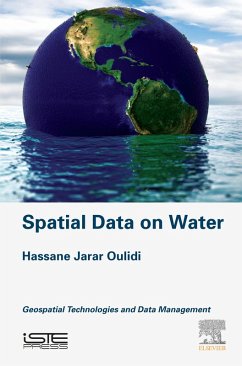
Spatial Data on Water: Geospatial Technologies and Data Management focuses on the worldwide corroborated difficulties in accessing data, a major hindrance in conducting water related studies in several domains.
Presents examples of research focused on water resource management | Includes a guide on how to manage water data using a geographic information system and a spatial data infrastructure | Provides several ideas and techniques to support integrated water data management

Produktbeschreibung
Spatial Data on Water: Geospatial Technologies and Data Management focuses on the worldwide corroborated difficulties in accessing data, a major hindrance in conducting water related studies in several domains.

  • Presents examples of research focused on water resource management
  • Includes a guide on how to manage water data using a geographic information system and a spatial data infrastructure
  • Provides several ideas and techniques to support integrated water data management

Dieser Download kann aus rechtlichen Gründen nur mit Rechnungsadresse in A, B, BG, CY, CZ, D, DK, EW, E, FIN, F, GR, HR, H, IRL, I, LT, L, LR, M, NL, PL, P, R, S, SLO, SK ausgeliefert werden.

Autorenporträt
Hassane Jarar Oulidi is professor of geoinformatics in the Department of Mathematics, informatics and geomatics at Hassania School for Public Works Engineering (EHTP). From 2006 and 2009, he had been a research scientist at German Research Center for Geosciences. His current research activities focus on the design, development of geospatial data infrastructure for groundwater resources management. His other research interests include geospatial sensor web, OGC standards and interoperability. He was established elearning program course for GIS and remote sensing in Morocco. He has led and participated in many research projects and has authored and co-authored numerous academic chapter's books and articles. He was member of the program committee of several conferences in the area of geomatics and geospatial technology. He works with many companies to help them manage and implement GIS project.