Statia & Saba: A Walking & Hiking Guide (eBook, ePUB)

PAYBACK Punkte
1 °P sammeln!
Thoughts of the Caribbean bring to mind images of lying on sun-drenched beaches with a gentle surf lapping at your feet or of dancing to the rhythms of a calypso band at a world-class resort. Yes, the islands of the Caribbean are this, but they are also so much more! Beyond the glitter of the casinos, the temptations of the duty-free shops, and the passive pursuit of a golden tan is a unique and fascinating world that is best discovered on foot. Nowhere else is it possible to experience, in such a small area, so many different cultures and social conditions, such diverse vegetation, and such v...
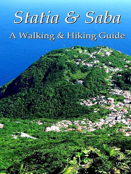
Thoughts of the Caribbean bring to mind images of lying on sun-drenched beaches with a gentle surf lapping at your feet or of dancing to the rhythms of a calypso band at a world-class resort. Yes, the islands of the Caribbean are this, but they are also so much more! Beyond the glitter of the casinos, the temptations of the duty-free shops, and the passive pursuit of a golden tan is a unique and fascinating world that is best discovered on foot. Nowhere else is it possible to experience, in such a small area, so many different cultures and social conditions, such diverse vegetation, and such varied landscape as in the Caribbean. Even the most casual walker can step out the door of a luxury hotel onto a palm-lined beach to search for conch shells and hermit crabs, pass through the center of a busy and historically-rich port town, then enter a cactus and boulder-strewn landscape. From there, you can walk among stalks of sugarcane, or up the slopes of a lush, rain forest-covered volcanic mountain to discover crashing waterfalls and thousands of multi-hued tropical flowers. All of these delights can be experienced in less than an hour's walk from major towns and tourist spots. Saba, "The Unspoiled Queen of the Caribbean," lives up to her tourist bureau-inspired name. Saba has escaped the commercialism and destruction of natural beauty that has accompanied the rise in tourism on many other islands of the Caribbean. This five-square-mile island has but one small, naturally occurring beach and just a handful of guest accommodations, the largest consisting of only about 10 rooms. Until recently all of Saba was a nation of walkers and hikers. Fifty years ago there were no cars or roads. Handcarved steps set in the mountainsides connected one village to another. Over 200 steps climbed the steep slope of the island from Fort Bay to The Bottom. Over 900 steps crossed the mountain to connect the capital city with the village of Windwardside, 1,100 feet higher in elevation. A total of 1,064 steps lead to the summit of Mt. Scenery, the highest point on the island at 2,854 feet. Other steps and mountain trails wound their way around the island. "The Road" on Saba was built in the same manner as the trails and steps. The mountainous terrain of Saba insures an abundant rainfall and the lush vegetation that accompanies it at the higher elevations. At a lower level, the rain forest gives way to scrub brush and below that are open fields and meadows. On your ramblings you may even encounter some of the hundreds of wild goats that still roam the island. Coconut trees, giant elephant ears, mango trees, cashews, mahogany, bananas, and a wide variety of orchids are just a part of the plant life to be seen. The 1,200 inhabitants of Saba are, undoubtedly, the friendliest people in the Caribbean. Almost everyone will know that you are a visitor, when and how you arrived, and where you are staying. It is next to impossible to walk the road without someone engaging you in conversation or a driver inquiring if you need a ride. They are genuinely interested in you and wish to share the pleasures of their island. Sint Eustatius, commonly called Statia, rises from the sea on volcanic peaks at its northern and southern points. A large, level plain, the Cultuurvlakte, extends between the two. The Quill is an extinct volcano on the southern end of the island and, at 1,965 feet, it dominates the scenery. From anywhere on the island it has the classic look of a volcanic cone. The sides of the mountain rise steeply, ending abruptly on the narrow, jagged rim, with just a hint of the crater inside visible through the low points around the rim. At one time, the Cultuurvlakte contained 38 sugar plantations. These are now gone and have been replaced by small family plots or open fields. The vegetation increases as the land gains elevation, turning to a rain forest in the mountains and into an elfin woodland on the summit of The Quill. Statia is only 11.8 square miles and, with such a low elevation, is drier than its neighbors of Saba and St. Kitts. Water shortages have occurred at various times. Statia has a strong historical foundation, tourism organization, and government. All have taken an active interest in walking and hiking. As a result, there are marked and maintained trails throughout the island. It is now possible to take hikes around the base of The Quill, along the rim and down into its crater, and along the crest of White Wall. These trails are lined with the luxuriant growth of a tropical forest - anthurium, heliconia, philodendron, elephant ear, and orchids. Trails on the northern end of Statia lead to sandy beaches and pass through areas of sea grapes, manchineel trees, cacti, and century plants. Statia is so far off the beaten tourist path that more than three people on the beach at one time would be considered a crowd. This is an island for those who are truly looking to get away from the masses of tourists found on so many other Caribbean islands. All of the trails and walking options for both islands are detailed here, along with the practical information you will need.
Dieser Download kann aus rechtlichen Gründen nur mit Rechnungsadresse in A, B, BG, CY, CZ, D, DK, EW, E, FIN, F, GR, HR, H, IRL, I, LT, L, LR, M, NL, PL, P, R, S, SLO, SK ausgeliefert werden.


