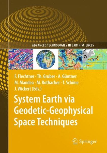
System Earth via Geodetic-Geophysical Space Techniques (eBook, PDF)
157,95 €
inkl. MwSt.
Sofort per Download lieferbar
System Earth via Geodetic-Geophysical Space Techniques (eBook, PDF)
- Format: PDF
- Merkliste
- Auf die Merkliste
- Bewerten Bewerten
- Teilen
- Produkt teilen
- Produkterinnerung
- Produkterinnerung
Bitte loggen Sie sich zunächst in Ihr Kundenkonto ein oder registrieren Sie sich bei
bücher.de, um das eBook-Abo tolino select nutzen zu können.
Hier können Sie sich einloggen
Sie sind bereits eingeloggt. Klicken Sie auf 2. tolino select Abo, um fortzufahren.
Bitte loggen Sie sich zunächst in Ihr Kundenkonto ein oder registrieren Sie sich bei bücher.de, um das eBook-Abo tolino select nutzen zu können.
Our planet is currently experiencing substantial changes due to natural phen- ena and direct or indirect human interactions. Observations from space are the only means to monitor and quantify these changes on a global and long-term p- spective. Continuous time series of a large set of Earth system parameters are needed in order to better understand the processes causing these changes, as well as their interactions. This knowledge is needed to build comprehensive Earth s- tem models used for analysis and prediction of the changing Earth. Geodesy and geophysics contribute to the understanding of…mehr
- Geräte: PC
- ohne Kopierschutz
- eBook Hilfe
- Größe: 23.4MB
- Upload möglich
Andere Kunden interessierten sich auch für
- Geodetic and Geophysical Observations in Antarctica (eBook, PDF)157,95 €
- Geodetic Deformation Monitoring: From Geophysical to Engineering Roles (eBook, PDF)157,95 €
- Sciences of Geodesy - I (eBook, PDF)157,95 €
- Earth Observation with CHAMP (eBook, PDF)157,95 €
- Global Geodetic Observing System (eBook, PDF)110,95 €
- Sciences of Geodesy - II (eBook, PDF)110,95 €
- Maarten HooijbergGeometrical Geodesy (eBook, PDF)126,95 €
-
-
-
Our planet is currently experiencing substantial changes due to natural phen- ena and direct or indirect human interactions. Observations from space are the only means to monitor and quantify these changes on a global and long-term p- spective. Continuous time series of a large set of Earth system parameters are needed in order to better understand the processes causing these changes, as well as their interactions. This knowledge is needed to build comprehensive Earth s- tem models used for analysis and prediction of the changing Earth. Geodesy and geophysics contribute to the understanding of system Earth through the observation of global parameter sets in space and time, such as tectonic motion, Earth surface deformation, sea level changes and gravity, magnetic and atmospheric elds. In the framework of the German geoscience research and development p- gramme GEOTECHNOLOGIEN, research projects related to the theme “Observing the Earth System from Space” have been funded within two consecutive phases since 2002, both covering 3 years. The projects address data analysis and model development using the satellite missions CHAMP, GRACE, GOCE and comp- mentary ground or airborne observations. The results of the rst phase projects have been published in the Springer book, titled “Observation of the Earth System from Space”, edited by Flury, Rummel, Reigber, Rothacher, Boedecker and Schreiber in 2006. The present book, titled “System Earth via Geodetic-Geophysical Space Techniques” summarizes in 40 scienti c papers the results of eight coordinated research projects funded in the second phase of this programme (2005–2008).
Produktdetails
- Produktdetails
- Verlag: Springer Berlin
- Erscheinungstermin: 10. Juli 2010
- Englisch
- ISBN-13: 9783642102288
- Artikelnr.: 37374899
- Verlag: Springer Berlin
- Erscheinungstermin: 10. Juli 2010
- Englisch
- ISBN-13: 9783642102288
- Artikelnr.: 37374899
CHAMP and GRACE.- More Accurate and Faster Available CHAMP and GRACE Gravity Fields for the User Community.- The CHAMP/GRACE User Portal ISDC.- Improvements for the CHAMP and GRACE Observation Model.- The Release 04 CHAMP and GRACE EIGEN Gravity Field Models.- Orbit Predictions for CHAMP and GRACE.- Rapid Science Orbits for CHAMP and GRACE Radio Occultation Data Analysis.- Parallelization and High Performance Computation for Accelerated CHAMP and GRACE Data Analysis.- GRACE.- Improved GRACE Level-1 and Level-2 Products and Their Validation by Ocean Bottom Pressure.- The GRACE Gravity Sensor System.- Numerical Simulations of Short-Term Non-tidal Ocean Mass Anomalies.- Improved Non-tidal Atmospheric and Oceanic De-aliasing for GRACE and SLR Satellites.- Global Gravity Fields from Simulated Level-1 GRACE Data.- ITG-GRACE: Global Static and Temporal Gravity Field Models from GRACE Data.- Validation of GRACE Gravity Fields by In-Situ Data of Ocean Bottom Pressure.- Antarctic Circumpolar Current Transport Variability in GRACE Gravity Solutions and Numerical Ocean Model Simulations.- GOCE.- Gravity and Steady-State Ocean Circulation Explorer GOCE.- GOCE Data Analysis: From Calibrated Measurements to the Global Earth Gravity Field.- GOCE and Its Use for a High-Resolution Global Gravity Combination Model.- Spectral Approaches to Solving the Polar Gap Problem.- Regionally Refined Gravity Field Models from In-Situ Satellite Data.- Quality Evaluation of GOCE Gradients.- Validation of Satellite Gravity Field Models by Regional Terrestrial Data Sets.- Comparison of GRACE and Model-Based Estimates of Bottom Pressure Variations Against In Situ Bottom Pressure Measurements.- SEAVAR.- Sea Level Variations – Prospects from the Past to the Present (SEAVAR).- Radar Altimetry Derived SeaLevel Anomalies – The Benefit of New Orbits and Harmonization.- Combining GEOSAT and TOPEX/Poseidon Data by Means of Data Assimilation.- Reanalysis of GPS Data at Tide Gauges and the Combination for the IGS TIGA Pilot Project.- Sea Level Rise in North Atlantic Derived from Gap Filled Tide Gauge Stations of the PSMSL Data Set.- Using ARGO, GRACE and Altimetry Data to Assess the Quasi Stationary North Atlantic Circulation.- A 15-Year Reconstruction of Sea Level Anomalies Using Radar Altimetry and GPS-Corrected Tide Gauge Data.- TIVAGAM.- Continental Water Storage Variations from GRACE Time-Variable Gravity Data.- Surface Mass VariabilitySurface mass variability from GRACE and Hydrological Models Hydrological model : Characteristic PeriodsPeriods characteristic and the Reconstruction of Significant SignalsReconstruction of significant signals .- Time-Space Multiscale AnalysisTime-Space Multiscale Analysis Multiscale analysis and Its Application to GRACE and Hydrology Data.- Mass Variation Signals in GRACE Products and in Crustal Deformations crustal deformation from GPS: A Comparison.- Monthly and Daily Variations of Continental Water Storage and Flows.- Calibration of a Global Hydrological Modelglobal hydrological model with GRACE Data.- NRT-RO.- Near-Real-Time Provision and Usage of Global Atmospheric Data from CHAMP and GRACE (NRT-RO): Motivation and Introduction.- Global Atmospheric Data from CHAMP and GRACE-A: Overview and Results.- Near-Real Time Satellite Orbit Determination for GPS Radio Occultation with CHAMP and GRACE.- The Operational Processing System for GPS Radio Occultation Data from CHAMP and GRACE.- Assimilation of CHAMP and GRACE-A Radio Occultation Data in the GME Global Meteorological Model of the German Weather Service.- MAGFIELD.- TheEarth’s Magnetic Field at the CHAMP Satellite Epoch.- GGOS-D.- Integration of Space Geodetic Techniques as the Basis for a Global Geodetic-Geophysical Observing System (GGOS-D): An Overview.- GGOS-D Data Management – From Data to Knowledge.- GGOS-D Consistent, High-Accuracy Technique-Specific Solutions.- GGOS-D Global Terrestrial Reference Frame.- GGOS-D Consistent and Combined Time Series of Geodetic/Geophyical Parameters.- GGOS-D Integration with Low Earth Orbiters.
CHAMP and GRACE.- More Accurate and Faster Available CHAMP and GRACE Gravity Fields for the User Community.- The CHAMP/GRACE User Portal ISDC.- Improvements for the CHAMP and GRACE Observation Model.- The Release 04 CHAMP and GRACE EIGEN Gravity Field Models.- Orbit Predictions for CHAMP and GRACE.- Rapid Science Orbits for CHAMP and GRACE Radio Occultation Data Analysis.- Parallelization and High Performance Computation for Accelerated CHAMP and GRACE Data Analysis.- GRACE.- Improved GRACE Level-1 and Level-2 Products and Their Validation by Ocean Bottom Pressure.- The GRACE Gravity Sensor System.- Numerical Simulations of Short-Term Non-tidal Ocean Mass Anomalies.- Improved Non-tidal Atmospheric and Oceanic De-aliasing for GRACE and SLR Satellites.- Global Gravity Fields from Simulated Level-1 GRACE Data.- ITG-GRACE: Global Static and Temporal Gravity Field Models from GRACE Data.- Validation of GRACE Gravity Fields by In-Situ Data of Ocean Bottom Pressure.- Antarctic Circumpolar Current Transport Variability in GRACE Gravity Solutions and Numerical Ocean Model Simulations.- GOCE.- Gravity and Steady-State Ocean Circulation Explorer GOCE.- GOCE Data Analysis: From Calibrated Measurements to the Global Earth Gravity Field.- GOCE and Its Use for a High-Resolution Global Gravity Combination Model.- Spectral Approaches to Solving the Polar Gap Problem.- Regionally Refined Gravity Field Models from In-Situ Satellite Data.- Quality Evaluation of GOCE Gradients.- Validation of Satellite Gravity Field Models by Regional Terrestrial Data Sets.- Comparison of GRACE and Model-Based Estimates of Bottom Pressure Variations Against In Situ Bottom Pressure Measurements.- SEAVAR.- Sea Level Variations - Prospects from the Past to the Present (SEAVAR).- Radar Altimetry Derived SeaLevel Anomalies - The Benefit of New Orbits and Harmonization.- Combining GEOSAT and TOPEX/Poseidon Data by Means of Data Assimilation.- Reanalysis of GPS Data at Tide Gauges and the Combination for the IGS TIGA Pilot Project.- Sea Level Rise in North Atlantic Derived from Gap Filled Tide Gauge Stations of the PSMSL Data Set.- Using ARGO, GRACE and Altimetry Data to Assess the Quasi Stationary North Atlantic Circulation.- A 15-Year Reconstruction of Sea Level Anomalies Using Radar Altimetry and GPS-Corrected Tide Gauge Data.- TIVAGAM.- Continental Water Storage Variations from GRACE Time-Variable Gravity Data.- Surface Mass VariabilitySurface mass variability from GRACE and Hydrological Models Hydrological model : Characteristic PeriodsPeriods characteristic and the Reconstruction of Significant SignalsReconstruction of significant signals .- Time-Space Multiscale AnalysisTime-Space Multiscale Analysis Multiscale analysis and Its Application to GRACE and Hydrology Data.- Mass Variation Signals in GRACE Products and in Crustal Deformations crustal deformation from GPS: A Comparison.- Monthly and Daily Variations of Continental Water Storage and Flows.- Calibration of a Global Hydrological Modelglobal hydrological model with GRACE Data.- NRT-RO.- Near-Real-Time Provision and Usage of Global Atmospheric Data from CHAMP and GRACE (NRT-RO): Motivation and Introduction.- Global Atmospheric Data from CHAMP and GRACE-A: Overview and Results.- Near-Real Time Satellite Orbit Determination for GPS Radio Occultation with CHAMP and GRACE.- The Operational Processing System for GPS Radio Occultation Data from CHAMP and GRACE.- Assimilation of CHAMP and GRACE-A Radio Occultation Data in the GME Global Meteorological Model of the German Weather Service.- MAGFIELD.- TheEarth's Magnetic Field at the CHAMP Satellite Epoch.- GGOS-D.- Integration of Space Geodetic Techniques as the Basis for a Global Geodetic-Geophysical Observing System (GGOS-D): An Overview.- GGOS-D Data Management - From Data to Knowledge.- GGOS-D Consistent, High-Accuracy Technique-Specific Solutions.- GGOS-D Global Terrestrial Reference Frame.- GGOS-D Consistent and Combined Time Series of Geodetic/Geophyical Parameters.- GGOS-D Integration with Low Earth Orbiters.