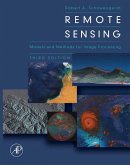
Techniques for Image Processing and Classifications in Remote Sensing provides an introduction to the fundamentals of computer image processing and classification (commonly called ""pattern recognition"" in other applications). The book begins with a discussion of digital scanners and imagery, and two key mathematical concepts for image processing and classification-spatial filtering and statistical pattern recognition. This is followed by separate chapters on image processing and classification techniques that are widely used in the remote sensing community. The emphasis throughout is on techniques that assist in the analysis of images, not particular applications of these techniques. The book also has four appendixes, featuring a bibliography; an introduction to computer binary data representation and image data formats; a discussion of interactive image processing; and a selection of exam questions from the Image Processing Laboratory course at the University of Arizona.
This book is intended for use as either a primary source in an introductory image processing course or as a supplementary text in an intermediate-level remote sensing course. The academic level addressed is upper-division undergraduate or beginning graduate, and familiarity with calculus and basic vector and matrix concepts is assumed.
Dieser Download kann aus rechtlichen Gründen nur mit Rechnungsadresse in A, B, BG, CY, CZ, D, DK, EW, E, FIN, F, GR, HR, H, IRL, I, LT, L, LR, M, NL, PL, P, R, S, SLO, SK ausgeliefert werden.


