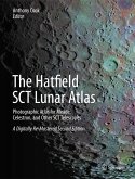
A major update of the atlas was made in 1998, using the same wonderful photographs that Commander Henry Hatfield made with his purpose-built 12-inch (300 mm) telescope, but bringing the lunar nomenclature up to date and changing the units from Imperial to S.I. metric.
However, with modern telescope optics, digital imaging equipment and computer enhancement new pictures can easily surpass what was achieved with Henry Hatfield's 12-inch telescope and a film camera. This limits the usefulness of the original atlas to visual observing or imaging with rather small amateur telescopes.
The new, digitally re-mastered edition vastly improves the clarity and definition of the original photographs - significantly beyond the resolution limits of the photographic grains present in earlier atlas versions - while preserving the layout and style of the original publications. This has been achieved by merging computer-visualized Earth-based views of the lunar surface, derived from NASA's Lunar Reconnaissance Orbiter data, with scanned copies of Commander Hatfield's photographic plates, using the author's own software.
The result is a The Hatfield Lunar Atlas for twenty-first century amateur telescopes.
Dieser Download kann aus rechtlichen Gründen nur mit Rechnungsadresse in A, B, BG, CY, CZ, D, DK, EW, E, FIN, F, GR, HR, H, IRL, I, LT, L, LR, M, NL, PL, P, R, S, SLO, SK ausgeliefert werden.
"The Hatfield Lunar Atlas is a classic atlas ... . you can also get some more ideas as to what one might do when observing the Moon and how can amateur astronomers contribute to Lunar Science. ... The line-drawn maps are clear and helpful, as well as photographs of the same areas of the Moon at different phases. ... you can use the atlas to find an interesting area of the Moon to photograph, or observe or look at different features like rilles and domes." (Kadri Tinn, AstroMadness.com, February, 2014)

