'A magnificent achievement. A who's who of contemporary remote sensing have produced an engaging, wide-ranging and scholarly review of the field in just one volume' - Professor Paul Curran, Vice-Chancellor, Bournemouth University
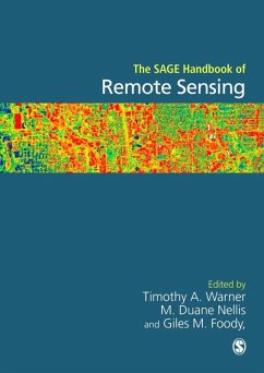
Remote Sensing acquires and interprets small or large-scale data about the Earth from a distance. Using a wide range of spatial, spectral, temporal, and radiometric scales Remote Sensing is a large and diverse field for which this Handbook will be the key research reference.
Organized in four key sections:
. Interactions of Electromagnetic Radiation with the Terrestrial Environment: chapters on Visible, Near-IR and Shortwave IR; Middle IR (3-5 micrometers); Thermal IR ; Microwave
. Digital sensors and Image Characteristics: chapters on Sensor Technology; Coarse Spatial Resolution Optical Sensors ; Medium Spatial Resolution Optical Sensors; Fine Spatial Resolution Optical Sensors; Video Imaging and Multispectral Digital Photography; Hyperspectral Sensors; Radar and Passive Microwave Sensors; Lidar
. Remote Sensing Analysis - Design and Implementation: chapters on Image Pre-Processing; Ground Data Collection; Integration with GIS; Quantitative Models in Remote Sensing; Validation and accuracy assessment;
. Remote Sensing Analysis - Applications: LITHOSPHERIC SCIENCES: chapters on Topography; Geology; Soils; PLANT SCIENCES: Vegetation; Agriculture; HYDROSPHERIC and CRYSOPHERIC SCIENCES: Hydrosphere: Fresh and Ocean Water; Cryosphere; GLOBAL CHANGE AND HUMAN ENVIRONMENTS: Earth Systems; Human Environments & Links to the Social Sciences; Real Time Monitoring Systems and Disaster Management; Land Cover Change
Illustrated throughout, an essential resource for the analysis of remotely sensed data, the SAGE Handbook of Remote Sensing provides researchers with a definitive statement of the core concepts and methodologies in the discipline.
Dieser Download kann aus rechtlichen Gründen nur mit Rechnungsadresse in A, D ausgeliefert werden.
A magnificent achievement. A who's who of contemporary remote sensing have produced an engaging, wide-ranging and scholarly review of the field in just one volume
Professor Paul Curran
Vice-Chancellor, Bournemouth University
This volume covers all the main fields of remote sensing in a very comprehendible
manner. Most of the chapters are presented in a semi-historic account that
shows the development of the field or in methods of data processing. The discussion
is accompanied by high-quality color images and graphs in order to provide as
full coverage of the topics as possible. The structure of the book is organized very
systematically into sections, sub-sections and chapters. It may thus be used as a text
book in various courses of remote sensing or as a book for independent learning in
advanced studies. The target audiences are students and researchers from different
fields such as geography, geology, and the natural and engineering science.
Yitzhak August
Geography Research Forum
Professor Paul Curran
Professor Paul Curran
Vice-Chancellor, Bournemouth University
This volume covers all the main fields of remote sensing in a very comprehendible
manner. Most of the chapters are presented in a semi-historic account that
shows the development of the field or in methods of data processing. The discussion
is accompanied by high-quality color images and graphs in order to provide as
full coverage of the topics as possible. The structure of the book is organized very
systematically into sections, sub-sections and chapters. It may thus be used as a text
book in various courses of remote sensing or as a book for independent learning in
advanced studies. The target audiences are students and researchers from different
fields such as geography, geology, and the natural and engineering science.
Yitzhak August
Geography Research Forum
Professor Paul Curran

