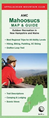
Located to the northeast of the White Mountain National Forest, straddling the border of New Hampshire and Maine, the Mahoosucs region offers a wide variety of four-season recreation opportunities for hikers, paddlers, bikers, and cross-country skiers alike. The Mahoosucs Map and Guide features descriptions of the best trips in the region for all ability levels from short day hikes and paddling trips that are perfect for families, to the new 21.1 mile Grafton Loop Trail, to treks along the famous "toughest mile" of the Appalachian Trail through Mahoosuc Notch.Special Features Include: Full color, GPS-rendered paper map. Hiking, biking, and paddling trips for all levels. Information on camping and lodging. Geological and historical information. Includes information about shuttles, guides, rentals, and outfitters.
Hinweis: Dieser Artikel kann nur an eine deutsche Lieferadresse ausgeliefert werden.
Hinweis: Dieser Artikel kann nur an eine deutsche Lieferadresse ausgeliefert werden.

