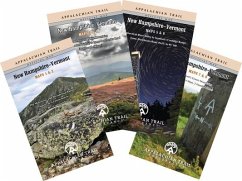
The official Appalachian Trail maps are essential hiking materials for both thru and section hikers. Each map is focused on the Appalachian Trail and overlaps with the neighboring maps, ideal for long-distance hikes and planning. The surrounding area and additional side trails are also included. An easy-to-use elevation profile shows the distance to the next campsite or shelter, side trails, and water sources. For added interest, maps indicate road crossings, waterfalls, and scenic areas. Maps are both water- and tear-resistant. The New Hampshire-Vermont maps cover 329 miles from Grafton Notch, Maine, to North Adams, Massachusetts, along with area side trails, in eight maps on four sheets. * Maps 1 & 2: The Mahoosuc and Presidential Ranges; Maine 26 (Grafton Notch) to U.S. 302 (Crawford Notch) Seven-color, 1:63,360-scale topographic maps with 100 foot contour intervals. 1 inch = 1 mile. Revised in 2012. * Maps 3 & 4: Southwestern White Mountains; U.S. 302 (Crawford Notch) to Lyme-Dorchester Road (Dartmouth Skiway) Seven-color, 1:63,360-scale topographic maps with 100 foot contour intervals. 1 inch = 1 mile. Revised in 2012. * Map 5 & 6: Connecticut River Valley to Vermont's Coolidge Range; Lyme-Dorchester Road (N.H.) to Vt. 140 Seven-color, 1:63,360-scale topographic maps with 100 foot contour intervals. 1 inch = 1 mile. Revised in 2012. * Map 7 & 8: Vermont's Green Mountains; Vt. 140 to Mass. 2 (North Adams) Seven-color, 1:63,360-scale topographic maps with 100 foot contour intervals. 1 inch = 1 mile. Revised in 2012.
Hinweis: Dieser Artikel kann nur an eine deutsche Lieferadresse ausgeliefert werden.
Hinweis: Dieser Artikel kann nur an eine deutsche Lieferadresse ausgeliefert werden.

