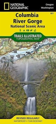
Considered one of the best year-round outdoor recreation areas in the country, the Columbia River Gorge contains countless opportunities for hikers, climbers, kayakers, cyclists, windsurfers, and winter sports enthusiasts alike. The 80 mile long gorge contains diverse ecosystems ranging from the lush Oneonta Gorge Rain Forest to the arid Celilo Grasslands. Our detailed Trails Illustrated recreation map of the Columbia River Gorge contains carefully researched trails, campsites, forest service roads, and points-of-interests and adjoins our Mt. Hood map. Backcountry users will find the UTM and Latitude/Longitude grids as well as other accurate navigation features perfect for exploring the region confidently and safely. Areas included on the map: - Mark O. Hatfield Wilderness Area - White Salmon, Klickitat, Sandy, and Lower Deschutes Wild and Scenic Rivers - Pacific Crest and Oregon Trails - Mount Hood, Columbia River Gorge, Historic Columbia River Highway, and Yakima Scenic Byways - Hood River County Northwest OHV Area - National Wildlife Refuges - Washington and Oregon State and County Parks, Forests and Recreation Areas - Popular Waterfall Locations - Recreation, Safety, Contact and Wilderness Permit Information - Overlap with the portions of the Gifford-Pinchot and Mount Hood National Forests
Hinweis: Dieser Artikel kann nur an eine deutsche Lieferadresse ausgeliefert werden.
Hinweis: Dieser Artikel kann nur an eine deutsche Lieferadresse ausgeliefert werden.


