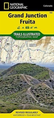
Jam packed with over 500 miles of single-track and multi-use trails, our new National Geographic Trails Illustrated map for the mountain biking mecca of Grand Junction & Fruita, Colorado is ideal for anyone hitting the trails. Like all Trails Illustrated maps, Grand Junction / Fruita blends detailed topography with carefully researched trail information. Rated mountain biking trails with mileages, recommended rides, and difficulty rating charts make this an ideal planning tool for novice and expert alike. An enhanced scale of 1:35,000 (1 = 0.55 Miles) makes it easy to read elevations and identify the numerous trails throughout the area. Grand Junction / Fruita Trails Illustrated is printed on environmentally friendly waterproof/tear-resistant material with low VOC inks at our green-certified printer in Ft. Collins, CO. National Geographic Trails Illustrated maps are developed in conjunction with local land managers and regional experts throughout all phases of the production process. This hands-on approach ensures that our maps have the most accurate and detailed information available. Proceeds from the sale of Grand Junction / Fruita go to support the National Geographic Societys non-profit mission to increase global understanding and promote conservation of our planet through exploration, research, and education. Coverage Highlights - Westwater Mesa & Rabbit Valley - Mack Ridge and Kokopelli Loops - Lunch Loops and Bangs Canyon - North Fruita & 18 Road - McInnis Canyons National Conservation Area - Black Ridge Wilderness - Westwater Canyon - Colorado National Monument - Colorado Riverway - Kokopelli and Tabugache Trails - The towns of Grand Junction and Fruita
Bitte wählen Sie Ihr Anliegen aus.
Rechnungen
Retourenschein anfordern
Bestellstatus
Storno


![Apache Creek, Juniper Mesa Map [Prescott and Kaibab National Forests] Apache Creek, Juniper Mesa Map [Prescott and Kaibab National Forests]](https://bilder.buecher.de/produkte/32/32038/32038604m.jpg)