13,99 €
inkl. MwSt.

Versandfertig in über 4 Wochen
  • Landkarte

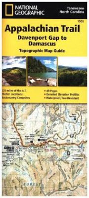
Waterproof, tear-resistant topographic map guide. The Davenport Gap to Damascus Topographic Map Guide makes a perfect traveling companion when traversing the north-eastern Tennessee and western North Carolina section of the Appalachian Trail. Each A.T. Topographic Map Guide includes detailed topographic maps at a detail of 1 inch equals 1 mile. Each page is centred on the A.T. and overlaps with the adjacent pages so there is little chance of getting lost. Along the bottom of each page is a trail profile that showing distance between shelters, camping areas and access points.

Produktbeschreibung
Waterproof, tear-resistant topographic map guide. The Davenport Gap to Damascus Topographic Map Guide makes a perfect traveling companion when traversing the north-eastern Tennessee and western North Carolina section of the Appalachian Trail. Each A.T. Topographic Map Guide includes detailed topographic maps at a detail of 1 inch equals 1 mile. Each page is centred on the A.T. and overlaps with the adjacent pages so there is little chance of getting lost. Along the bottom of each page is a trail profile that showing distance between shelters, camping areas and access points.
Autorenporträt
Founded in 1915 as the Cartographic Group, the first division of National Geographic, National Geographic Maps has been responsible for illustrating the world around us through the art and science of mapmaking.Today, National Geographic Maps continues this mission by creating the world's best wall maps, recreation maps, atlases, and globes which inspire people to care about and explore their world.